Where to stay in Sulkava
The right area depends on your trip. Here's who each one suits — pick the place, then the hotel.
Sulkava keeps a modest stock of beds for a lakeside municipality of Southern Savonia, the kind of Saimaa place where a small hotel, a guesthouse or a lakeshore cottage is the usual room. The village centre at Sulkavan kirkonkylä, around the Sulkavan kirkko, suits visitors who want the shops, the harbour and the parish church within an easy walk of the water. It is the simplest base.
Out along the shores and islands of Saimaa, cottages and cabins stand by the lake, near the ramparts of the Pisamalahden linnavuori and the waters of the Saimaa Geopark, a good base for touring the eastern Finnish lakeland by boat or car. Stock is thin once you leave the village. Visitors drawn to the old defences often base near the wartime line of the Salpalinja or the old Suvorovin sotakanavat, while many travellers instead sleep in the larger towns of Southern Savonia and drive in for the day.
Book ahead in summer, when the lakeside cottages around Sulkava fill and the few village rooms go early.
About Sulkava
What is Sulkava known for?
Sulkava is known for its place on the lake of Saimaa, a municipality of Southern Savonia in the eastern Finnish lakeland. The prehistoric hillfort of the Pisamalahden linnavuori rises above the water as the oldest landmark, its ramparts looking out over Saimaa. Stone and lake hold the story.
The parish church of Sulkavan kirkko keeps the village centre at Sulkavan kirkonkylä, and the wider waters fall within the Saimaa Geopark, the geological park spread across this part of eastern Finland.
What are the main landmarks in Sulkava?
The Pisamalahden linnavuori is the landmark that reaches deepest into Sulkava's past, a prehistoric hillfort whose ramparts crown a height above the lake of Saimaa. Older marks survive in the rock. The painted cliffs of the Kivikirkon kalliomaalaus and the Viidanmäen kalliomaalaus carry prehistoric rock art, the parish church of Sulkavan kirkko stands at Sulkavan kirkonkylä, and the wartime defences of the Salpalinja and the old Suvorovin sotakanavat trace the long line of fortification across this corner of eastern Finland.
What is the history of Sulkava?
Sulkava's history reaches back to the people who painted the cliffs and raised the hillfort above Saimaa. Long before any parish stood, the prehistoric ramparts of the Pisamalahden linnavuori and the painted rock of the Kivikirkon kalliomaalaus and Viidanmäen kalliomaalaus marked a settled lake country, the waters of the eastern Finnish lakeland feeding the early people of the shore. Lake and stone came first.
The parish itself was chartered in 1630, the church village of Sulkavan kirkonkylä gathering around the Sulkavan kirkko on the water of Southern Savonia. War later cut its lines across the land. The old Suvorovin sotakanavat were dug in the 18th century to move boats behind the frontier, and the wartime Salpalinja, the great defensive line of fortifications, runs through the district near the eastern border.
The canal of the Telataipaleen kanava joined the waters of Saimaa. Sulkava settled into its modern role as a lakeside municipality of eastern Finland, its waters now gathered within the Saimaa Geopark and its rowing on the lake known across the country.
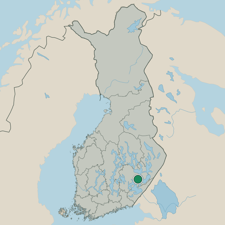
Where is Sulkava?
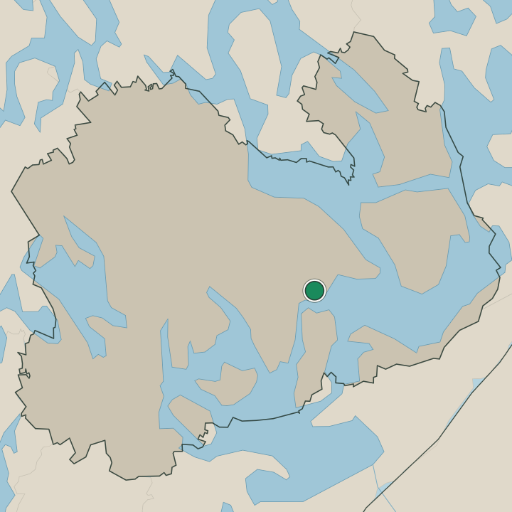
Sulkava lies on the southern reaches of the lake of Saimaa, in Southern Savonia, eastern Finland. Water, islands and forest fill the municipality, much of it lake, the village centre of Sulkavan kirkonkylä gathered on the shore while the channels of Saimaa wind between the wooded skerries. The lakeland runs deep here.
The hillfort of the Pisamalahden linnavuori rises above the water, the canal of the Telataipaleen kanava cuts between two basins, and the wider waters fall within the Saimaa Geopark across this part of eastern Finland.
What is the climate of Sulkava?
Sulkava has a cold inland climate, its seasons set by the great lake of Saimaa and the forests of Southern Savonia. Winters are long and snowy, the ice locking the channels and islands of the lake around Sulkava from early in the season until the late spring thaw. Summers are warm and bright.
The long northern daylight warms the water and the wooded shores of the eastern Finnish lakeland through the short growing season, the season of rowing and lakeside life before the ice returns to Saimaa.
How do you get to Sulkava?
Sulkava is reached by road through the lake country of Southern Savonia, and in summer by water across Saimaa. The main road brings most traffic to the village centre at Sulkavan kirkonkylä, and visitors come by car or bus through the eastern Finnish lakeland. There is no station in the town.
Buses link Sulkava to the larger towns of Southern Savonia, and travellers from farther afield reach eastern Finland through the regional cities before the last stretch to the lakeshore.
Where Sulkava sits
Boundaries © geoBoundaries (CC BY) & Wikidata (CC0); water & neighbours: Natural Earth.