Where to stay in Virolahti
The right area depends on your trip. Here's who each one suits — pick the place, then the hotel.
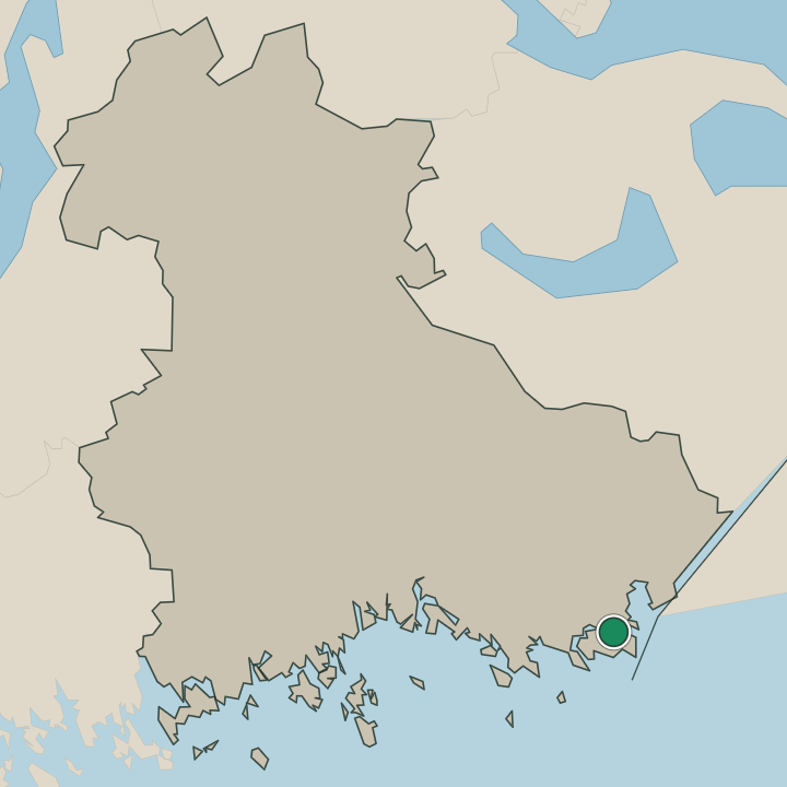
Virolahti gathers most of its beds in the church village. The core around Virolahden kirkko holds the main lodging in south-eastern Finland, within reach of the church, its old stone Virolahden sakaristo, and the everyday streets of this corner of Kymenlaakso. Stay there to be central.
The municipality suits you if the war history is your draw, with the Salpa Line bunkers and the Virolahden bunkkerimuseo a short way out along the eastern border, near the manor school of Harjun oppimiskeskus. Quarry and coast lie beyond. The granite ground of Pyterlahden louhos sits among the rock to one side, while the fishing village around Klamilan kirkko keeps its own small core, more homes than hotels, near where the Lapurin hylky was raised from the water.
Beds thin across the outer parishes. Most travellers reserve in the centre of Virolahti and drive out to the bunkers, the quarry and the boundary stones across this part of Kymenlaakso.
Things to do in Virolahti
Ranked by global recognition; descriptions from Wikidata (CC0).
Museums & Galleries
2- Virolahden bunkkerimuseo
- Virolahden kotiseutumuseo
Churches & Religious Sites
3- Virolahden kirkko Heritage
- Virolahden sakaristo
- Klamilan kirkko
worth knowingacross 2 categories in Virolahti
About Virolahti
Defences made its name.
What is Virolahti known for?
Defences made its name. Virolahti carries the Salpa Line, the bunker chain dug along the eastern border, and the Virolahden bunkkerimuseo keeps its concrete and tank traps open to visitors in this corner of Kymenlaakso. Stone and the sea add older layers.
The granite quarry of Pyterlahden louhos cut rock for grand building, the Viking-age Lapurin hylky was found in its waters, and Virolahden kirkko with its old stone Virolahden sakaristo anchors the parish of this part of south-eastern Finland.
What are the main landmarks in Virolahti?
War and stone dominate. The Salpa Line runs its bunkers and tank traps along the eastern border, kept open at the Virolahden bunkkerimuseo, while the granite quarry of Pyterlahden louhos cut rock that was shipped far beyond Kymenlaakso. Older marks ring the parish.
Virolahden kirkko and its stone Virolahden sakaristo hold the church village, Klamilan kirkko stands in its own community, and the Uudenkaupungin rauhan rajakivet, the boundary stones of an old peace, mark the historic frontier where the Viking-age Lapurin hylky was raised from the water.
What is the history of Virolahti?
Virolahti has long sat on a frontier. A parish of south-eastern Finland on the eastern border, it grew around Virolahden kirkko and its old stone Virolahden sakaristo, and its ground has been marked by shifting borders since the boundary stones of the Uudenkaupungin rauhan rajakivet set out an early peace line. The water held older traces still.
The Viking-age Lapurin hylky, a ship raised from the parish, points back to centuries when the coast carried trade through this corner of Kymenlaakso. Stone built its later trade. The granite quarry of Pyterlahden louhos cut hard rock that was shipped out for grand building far beyond the district.
War returned to the border. The Salpa Line was dug across the country here as a defensive chain, its bunkers and tank traps now kept at the Virolahden bunkkerimuseo, and the manor estate of Harjun oppimiskeskus turned to schooling on the same border ground where the Klamilan kirkko served its fishing village.
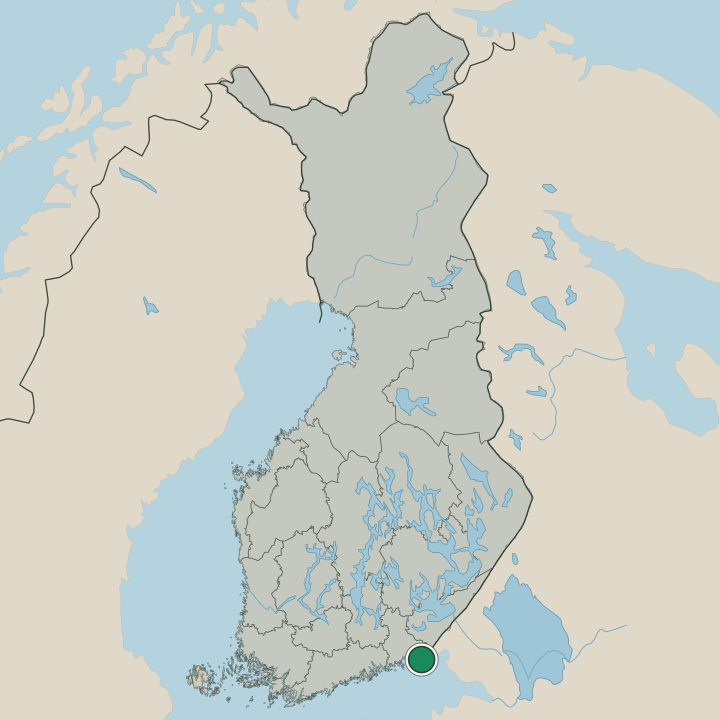
Where is Virolahti?
Virolahti lies in south-eastern Finland, in the Kymenlaakso region on the eastern border. The land is low and rocky here, granite breaking through the woods at the quarry of Pyterlahden louhos and along the bunker ground of the Salpa Line. Settlement gathers in villages.
Virolahden kirkko marks the main parish core while Klamilan kirkko stands in its own community to the side, and the boundary stones of the Uudenkaupungin rauhan rajakivet trace the historic frontier across this corner of Kymenlaakso.
What is the climate of Virolahti?
Eastern weather runs the year. Virolahti lies on the border ground of south-eastern Finland, so its winters are cold and snowy and its summers short and warm over the rock and woods of Kymenlaakso. Snow covers the bunkers for months.
The brief summer opens the Salpa Line trails and the Virolahden bunkkerimuseo to visitors and greens the land around Virolahden kirkko, before autumn closes in and the dim, frozen days settle over this corner of south-eastern Finland.
How do you get to Virolahti?
Road runs to the border. Virolahti lies on the main route east through Kymenlaakso toward the frontier, reached by car from the towns of south-eastern Finland, the drive ending near the church village around Virolahden kirkko. Buses follow the same road.
They link the centre to the wider region and the fishing village of Klamilan kirkko, and the Salpa Line bunkers and the Virolahden bunkkerimuseo draw their own visitors out along the eastern border of Kymenlaakso.
Where Virolahti sits
Boundaries © geoBoundaries (CC BY) & Wikidata (CC0); water & neighbours: Natural Earth.