Where to stay in Kotka
The right area depends on your trip. Here's who each one suits — pick the place, then the hotel.
Halla
Halla is a waterfront district on the eastern side of Kotka, in south-eastern Finland.Karhuvuori
Karhuvuori is a residential district on the western side of Kotka, a port city in south-eastern Finland.Korela
Korela is a district in north-western Kotka, holding the Langinkoski fishing lodge, in south-eastern Finland.Kotkansaari
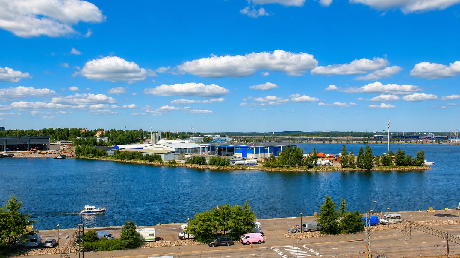
Kotkansaari is the central island district of Kotka, a port city on the Gulf of Finland in south-eastern Finland.Kyminlinna
Kyminlinna is a district in north-western Kotka, named for the old fortress at its heart, in south-eastern Finland.Mussalo
Mussalo is a district on the western side of Kotka, a port city on the Gulf of Finland in south-eastern Finland.Things to do in Kotka
Ranked by global recognition; descriptions from Wikidata (CC0).
Museums & Galleries
4- Jäänmurtaja Tarmo Finnish icebreaker and museum ship launched in 1907
- Merikeskus Vellamo Maritime museum
- Suomen merimuseo maritime museum
- Kymenlaakson museo
Churches & Religious Sites
3- Pyhän Nikolaoksen kirkko Heritage Eastern Orthodox church
- Kotkan kirkko Heritage
- Langinkosken kirkko
worth knowingacross 2 categories in Kotka
About Kotka
What is Kotka known for?
Kotka is known as the seaport of Kymenlaakso, an island city at the mouth of the great waterway in south-eastern Finland and the seat of the region. The sea is its story. The Merikeskus Vellamo holds the Suomen merimuseo and the museum ships beside it, among them the old icebreaker Jäänmurtaja Tarmo and the lightship Majakkalaiva Kemi.
Water and fish draw visitors to the Maretarium aquarium, the Orthodox Pyhän Nikolaoksen kirkko keeps the memory of the old naval town, and the Kotkan veistospromenadi lines the harbour walk of this corner of south-eastern Finland.
What are the main landmarks in Kotka?
Kotka's landmarks gather at the sea. The Merikeskus Vellamo holds the Suomen merimuseo and a fleet of museum ships, the icebreaker Jäänmurtaja Tarmo, the lightship Majakkalaiva Kemi and the pilot cutter Luotsikutteri Pitkäpaasi among them. Ships line the quays.
The Maretarium shows the fish of the Baltic, the Haukkavuoren näkötorni rises for the view over the islands, and the Orthodox Pyhän Nikolaoksen kirkko, the Kotkan kirkko and the regional Kymenlaakson museo keep the older life of this corner of south-eastern Finland.
What is the history of Kotka?
Kotka's history is bound to the sea and to war. The islands at the mouth of the waterway guarded a naval frontier long before any city, and the Orthodox Pyhän Nikolaoksen kirkko still stands from the old garrison town that once held the sound in south-eastern Finland. The sea drew the soldiers first.
When the naval age there had passed, a port and sawmill town rose on the same islands, chartered in 1879 as Kotka took its place as the seaport of Kymenlaakso. Timber, ships and trade built the settled city. The harbour shipped the forests of the river country to the Baltic, and the town grew around its quays, its Lutheran Kotkan kirkko and the riverside Langinkosken kirkko rising for the new population.
The maritime life of the port is gathered now in the Merikeskus Vellamo and the Suomen merimuseo, their museum ships the icebreaker Jäänmurtaja Tarmo and the lightship Majakkalaiva Kemi drawn up at the quay. Kotka settled into its long role as the island seaport and regional seat of south-eastern Finland.
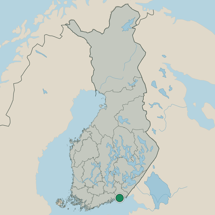
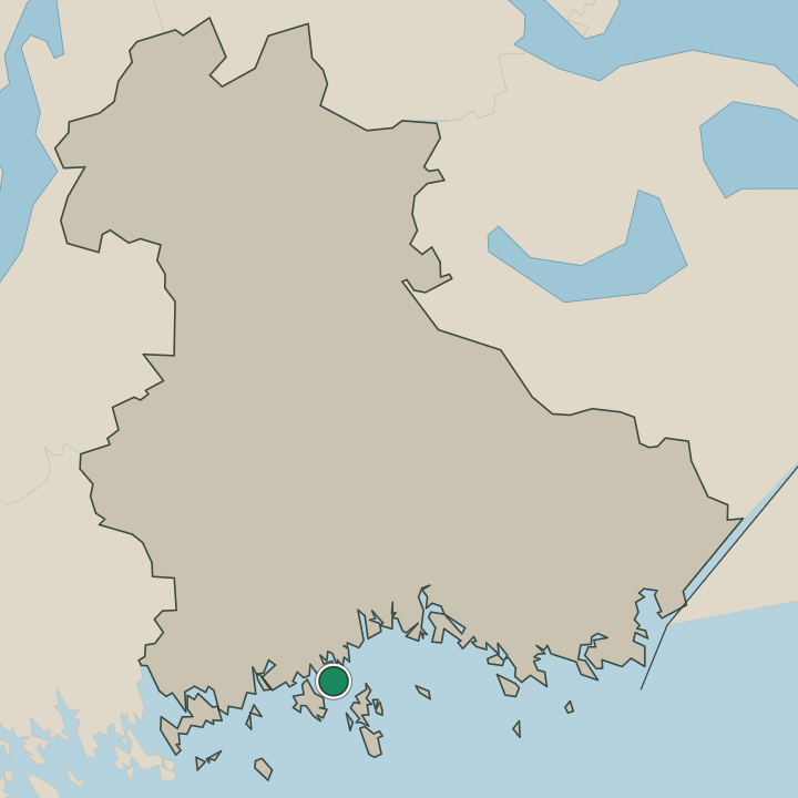
Where is Kotka?
Kotka stands on islands at the mouth of the great waterway, where the river country of Kymenlaakso meets the Baltic in south-eastern Finland. Bridges link the city's islands across the sounds, the centre gathered on the main island around the Kotkan kirkko while the open sea spreads to the south. Water rings the place.
The harbour and the museum quay of the Merikeskus Vellamo face the sound, the Haukkavuoren näkötorni rises over the rocky shore, and the outer islands and skerries scatter seaward from this corner of south-eastern Finland.
What is the climate of Kotka?
Kotka carries a cool maritime climate, its seasons tempered by the open Baltic around the islands. Winters are cold and snowy, drift ice closing the sounds and frost gripping the harbour and the rocky shores from early in the season until the late spring thaw. Summers are mild and bright.
The long northern daylight warms the quays, the skerries and the sea around Kotka through the short season, when the harbour of this corner of south-eastern Finland comes alive before the ice returns.
How do you get to Kotka?
Kotka sits on the coast at the mouth of the waterway, and road and rail both reach the islands. Trains and buses run to the centre near the Kotkan kirkko, linking Kotka to the cities of Kymenlaakso and the wider south-eastern Finland. The bridges carry you in.
Visitors from farther off come down through the river country before the last stretch onto the islands, where the harbour, the museum ships of the Merikeskus Vellamo and the open Baltic wait at the end of the road.
Where Kotka sits
Boundaries © geoBoundaries (CC BY) & Wikidata (CC0); water & neighbours: Natural Earth.