Sweden · Kalmar County
Where to Stay in Mörbylånga, Kalmar County


Mörbylånga is a town on the island of Öland in the south-eastern part of Kalmar County, in southern Sweden.
Find your area →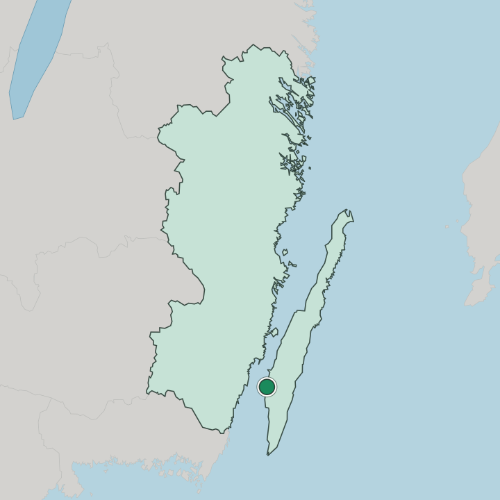
Where to stay in Mörbylånga
Where you base yourself shapes the visit — here's the character of each area.
Most visitors stay in the town centre, the small grid of streets near the church and the harbour that keeps the shops, a few cafes, and the bus stops within an easy walk. It works for those arriving without a car. Rooms here lean toward small hotels and guesthouses rather than resort lodging, and the central streets make a calm base for exploring southern Öland and the long limestone plain inland.
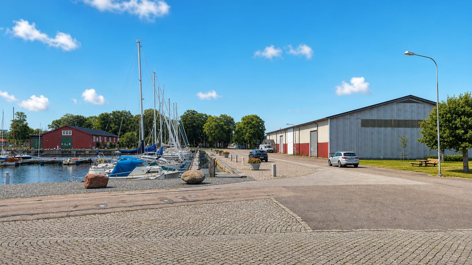
Down by the harbour the waterfront setting draws summer visitors and boaters, with cabins and small lodgings looking out over the Kalmarsund and the mainland beyond. This works best for those who came for the water and the sunsets. Cabins fill it in summer.
Out across the alvar and down the southern coast, a scatter of campsites, farm stays, and holiday cottages gives drivers a rural base among the windmills, stone walls, and open grassland of the island, and rates there often run lower than in town. Let your plans decide. The harbour or the alvar decides it.
About Mörbylånga
The alvar defines it.
What is Mörbylånga known for?
Mörbylånga is known as the chief town of southern Öland, set on the west coast of the island beside the great limestone plain of the Stora Alvaret, and it pairs that open, treeless landscape with old farmland, windmills, and a sheltered harbour on the sound. Mörbylånga kyrka stands in the centre. An old sugar mill marks the past.
Most visitors come for the wide skies, the bird life, and the island light.
What are the main landmarks in Mörbylånga?
Mörbylånga kyrka is the town's chief landmark, a stone church standing at the centre near the harbour. East and south of the town spreads the Stora Alvaret, the vast limestone plain that covers much of southern Öland and forms part of a World Heritage farming landscape. Old windmills dot the fields.
Stone walls run for miles. Together these places tie the town to its parish past, its island farming, and the rare open country that makes this end of Öland unlike anywhere else in Sweden.
What is the history of Mörbylånga?
Mörbylånga is old island country. People have farmed this end of Öland since prehistoric times, leaving burial grounds and ancient field walls across the limestone plain, and for generations the islanders worked the thin soil, grazed the alvar, and fished the sound much as their forebears had. The parish church marks that long settlement.
The harbour drew trade by sea. A small port town grew around the church and the quay, shipping the island's grain and limestone across the Kalmarsund to the mainland and beyond. In the modern era a sugar refinery rose by the harbour and gave the town an industry that ran for decades, drawing workers and shaping its growth, before that mill too closed and left its buildings behind.
Farming endured through it all. Mörbylånga became the seat of the municipality covering southern Öland, and while the old industry has gone, the church, the harbour, and the great alvar inland still anchor a town shaped by the sea, the soil, and the wide island sky.
Where is Mörbylånga?
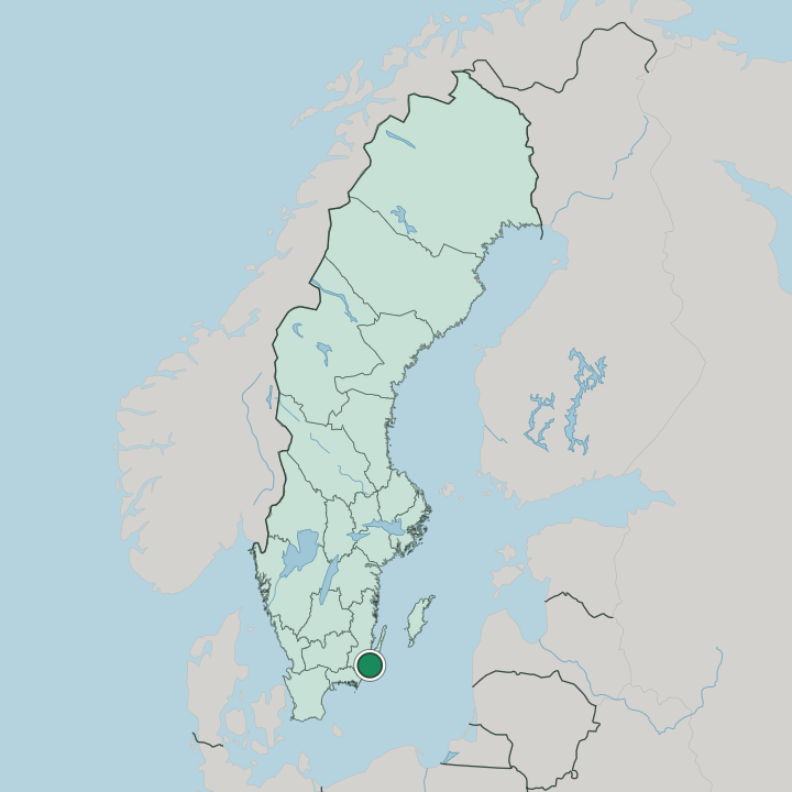
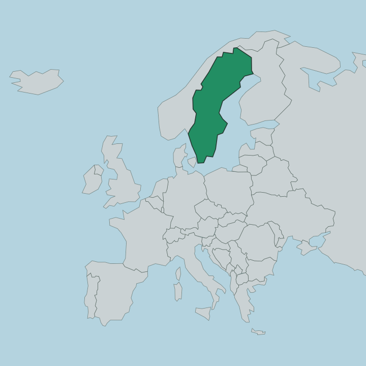
Mörbylånga lies on the island of Öland, in the south-eastern part of Kalmar County, in southern Sweden. The town sits on the west coast of the island, facing the Kalmarsund and the mainland, with the flat limestone plain of the Stora Alvaret stretching across the interior just to the east. The land is low and open.
North the island narrows toward the bridge and the city of Kalmar, while south it tapers to the long point and lighthouse at Öland's southern tip.
What is the climate of Mörbylånga?
Mörbylånga has a mild, dry coastal climate. Surrounded by the Baltic, the island sees cool grey winters that rarely turn harsh, and the open alvar lies exposed to steady winds off the sea. Summers are warm and sunny.
The long bright days then draw walkers, cyclists, and birdwatchers out across the plain and along the shore before the cooler season returns. This counts among the driest and sunniest spots in Sweden.
How do you get to Mörbylånga?
Mörbylånga is reached by road across the Öland bridge. The long span carries traffic from Kalmar onto the island, and the main island road then runs south down the west coast to the town, with regional buses serving the route, though the island has no railway of its own. The nearest airport is at Kalmar on the mainland.
Buses link the island villages. Drivers cross the bridge and follow the shore south to reach the town.
Good for
More cities in Kalmar County
Updated July 2026