DoaluKnow the place before you book.
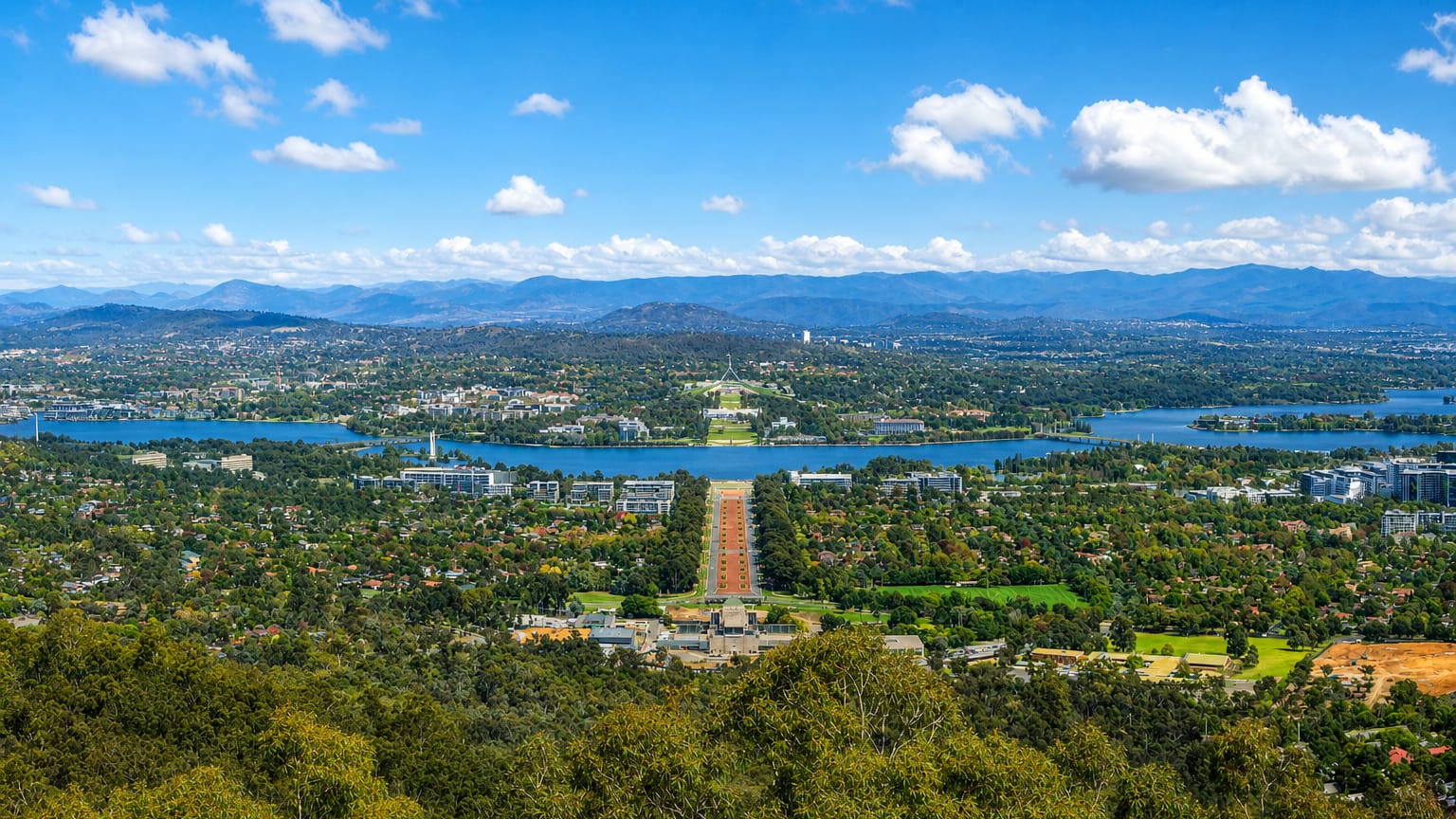
Canberra's land axis from Mount Ainslie down ANZAC Parade to Lake Burley Griffin and the Parliamentary triangle

Australia · Australian Capital Territory

Where to Stay in Canberra, Australian Capital Territory

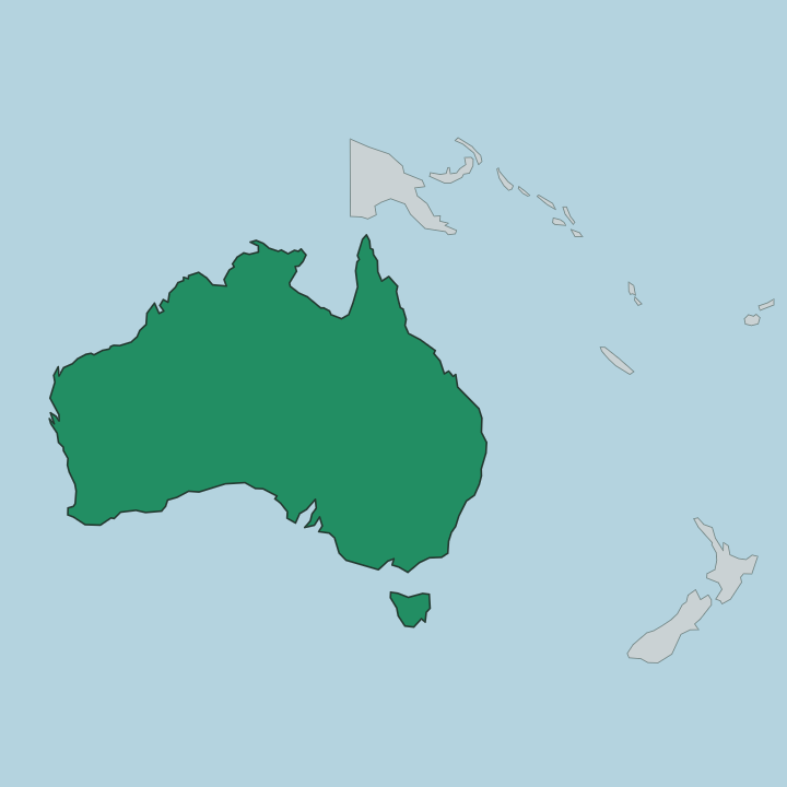
Canberra stands on the inland plain below the Brindabellas, the capital of Australia in the Australian Capital Territory, known for Parliament House.

Find your area →
Where to stay in Canberra

Each area has its own feel; here's who each one suits.

Aerial view of Kambah's tree-covered suburban streets in Canberra's Tuggeranong valley below dry hills.CanberraAustralia

Kambah

Kambah is a suburb of Canberra dating to 1973, one of the residential districts of the Australian Capital Territory.Where to stay →
Canberra's land axis from Mount Ainslie down ANZAC Parade to Lake Burley Griffin and the Parliamentary triangleCanberraAustralia

Ngunnawal

Ngunnawal is a Canberra suburb in the Australian Capital Territory, dating from 1992 and adjoining Amaroo.Where to stay →
New five-storey apartment block behind roadworks barriers at a wide intersection in Harrison, Canberra.CanberraAustralia

Harrison

Harrison sits in Canberra's Gungahlin district, named for the planner Peter Harrison and ringed by Franklin, Throsby, Kenny and the Mitchell estate.Where to stay →
Canberra's land axis from Mount Ainslie down ANZAC Parade to Lake Burley Griffin and the Parliamentary triangleCanberraAustralia

Gordon

Gordon is a suburb of Tuggeranong in Canberra, Australia, named after the poet Adam Lindsay Gordon and laid out with streets that honour sportspeople.Where to stay →
Aerial over Bruce in Canberra, its campus and stadium set in bushland below Black Mountain's Telstra Tower.CanberraAustralia

Bruce

Bruce is a district of Canberra laid out from 1968, and the AIS Arena is the landmark its record carries.Where to stay →
View from a grassy, rock-strewn hilltop over the suburban streets of Wanniassa, Canberra, to distant ranges.CanberraAustralia

Wanniassa

Wanniassa is a suburb of Canberra dating from 1975, with Viking Park the one feature listed inside its boundary in the Australian Capital Territory.Where to stay →
Aerial view over the suburb of Kaleen, Canberra, with a lake and open grassland beyond.CanberraAustralia

Kaleen

Kaleen is a suburb of Belconnen in Canberra, a Wiradjuri word for water attached to streets named after Australian rivers.Where to stay →
Canberra's land axis from Mount Ainslie down ANZAC Parade to Lake Burley Griffin and the Parliamentary triangleCanberraAustralia

Dunlop

Dunlop stands at the far north-west edge of Canberra, a Belconnen suburb whose grasslands and ponds run out towards the New South Wales border.Where to stay →
Aerial view of Nicholls, Canberra, with tiled-roof houses around a lake and open grassland hills beyond.CanberraAustralia

Nicholls

Nicholls is a Gungahlin suburb of Canberra, named for Sir Douglas Nicholls and wrapped around the shallow water of Gungahlin Pond.Where to stay →
All neighbourhoods (30)
Canberra's land axis from Mount Ainslie down ANZAC Parade to Lake Burley Griffin and the Parliamentary triangleCanberraAustralia

Macgregor

Macgregor is a residential suburb on the western side of Belconnen, ringed by Ginninderra Drive, Florey Drive and Southern Cross Drive in Canberra.Where to stay →
Canberra's land axis from Mount Ainslie down ANZAC Parade to Lake Burley Griffin and the Parliamentary triangleCanberraAustralia

Bonner

Bonner is a suburb of Canberra established in 2010, one of the addresses making up the Gungahlin district of the Australian Capital Territory.Where to stay →
Belconnen, Canberra, from the air: Lake Ginninderra with the town centre, suburbs and distant ranges beyond.CanberraAustralia

Belconnen

Belconnen is the inner suburb of Canberra's wider Belconnen district, holding the Belconnen Town Centre and the shore of Lake Ginninderra.Where to stay →
Canberra's land axis from Mount Ainslie down ANZAC Parade to Lake Burley Griffin and the Parliamentary triangleCanberraAustralia

Franklin

Franklin is a suburb of Canberra in the Gungahlin district, named for the novelist Miles Franklin and edged by Flemington Road.Where to stay →
Contemporary mixed-use building with ground-floor shops on a tree-lined street in Braddon, Canberra.CanberraAustralia

Braddon

Braddon is an inner north suburb of Canberra, pressed against the central business district and holding the Canberra Museum and Gallery.Where to stay →
Aerial over the leafy suburb of Narrabundah toward Lake Burley Griffin and Black Mountain Tower, Canberra.CanberraAustralia

Narrabundah

Narrabundah is a medium-density suburb in the inner south of Canberra, in the Australian Capital Territory, with streets dating to 1947.Where to stay →
Aerial view of Gungahlin town centre, Canberra, with a light rail tram at its terminus and hills beyond.CanberraAustralia

Gungahlin

Gungahlin is a suburb of Canberra holding the town centre for the wider district that shares its name, in the Australian Capital Territory.Where to stay →
A quiet tree-lined residential street in Watson, Canberra, with brick townhouses.CanberraAustralia

Watson

Watson takes its name from John Christian Watson, third Prime Minister of Australia, and sits in the North Canberra district of Canberra.Where to stay →
New houses and young native plantings in Casey, Canberra, with distant blue ranges beyond.CanberraAustralia

Casey

Casey is a Gungahlin suburb of Canberra named after Richard Casey, bounded by Horse Park Drive and Clarrie Hermes Drive.Where to stay →
Aerial view of Amaroo's tiled-roof homes beside a Canberra lake, with open grassland in the foreground.CanberraAustralia

Amaroo

Amaroo is a suburb in the Gungahlin district of Canberra, gazetted in 1991, its name meaning 'a beautiful place' in Nyoongar.Where to stay →
Canberra's land axis from Mount Ainslie down ANZAC Parade to Lake Burley Griffin and the Parliamentary triangleCanberraAustralia

Calwell

Calwell is a suburb of Tuggeranong in Canberra, Australia, with Tuggeranong Hill on its southern border and the Monaro Highway running close by.Where to stay →
Blossoming street trees lining a quiet residential road in O'Connor, inner-north Canberra.CanberraAustralia

O'Connor

Two churches mark O'Connor, a Canberra suburb in the Australian Capital Territory whose street plan dates from 1928.Where to stay →
Aerial view of Palmerston, Canberra, showing tiled-roof suburban streets beside a lake and open grassland.CanberraAustralia

Palmerston

Palmerston is a suburb in the Gungahlin district of Canberra, its streets named after Australian mountains and led by Kosciuszko Avenue.Where to stay →
Canberra City from above, with Civic office towers, Lake Burley Griffin and the Brindabella ranges beyond.CanberraAustralia

Canberra City

Canberra City is the district better known as Civic, Canberra's central business district and one of its oldest centres.Where to stay →
CanberraAustralia

Monash

Monash is a suburb in the Tuggeranong district of Canberra, named for General Sir John Monash, its streets named for engineers.Where to stay →
Aerial view of Evatt in Canberra, with tree-lined suburban streets stretching to Lake Ginninderra.CanberraAustralia

Evatt

Evatt is a suburb of the Belconnen district in Canberra, lying between McKellar, Florey, Melba and Spence in the Australian Capital Territory.Where to stay →
Shared cycle path crossing open parkland with tall trees in the Canberra suburb of Curtin.CanberraAustralia

Curtin

Curtin is a suburb of Canberra in the Woden Valley district, an Australian Capital Territory name that dates from 1962.Where to stay →
Leafy suburban street with brick houses and a wide driveway in Lyneham, inner north Canberra.CanberraAustralia

Lyneham

Lyneham is a Canberra suburb named for Sir William Lyne, with streets honouring artists and the figures behind early Canberra.Where to stay →
Cypress-lined suburban street with clipped hedges and lawns in Ainslie, an inner-north Canberra suburb.CanberraAustralia

Ainslie

Ainslie is a suburb of Canberra, Australia, laid out from 1928 and known for All Saints Anglican Church.Where to stay →
Panorama from Mount Ainslie over Campbell, Anzac Parade and Lake Burley Griffin toward Canberra's hillsCanberraAustralia

Campbell

Campbell is a suburb of Canberra at the base of Mount Ainslie, holding the Australian War Memorial at the head of ANZAC Parade.Where to stay →
Canberra's land axis from Mount Ainslie down ANZAC Parade to Lake Burley Griffin and the Parliamentary triangleCanberraAustralia

Chisholm

Chisholm is a suburb of Canberra, Australia, in the district of Tuggeranong, and takes its name from Caroline Chisholm.Where to stay →

About Canberra

What is Canberra known for?

Canberra is known as the planned national capital, laid out around a broad axis of parliamentary and cultural buildings. Parliament House sits at the centre, with the Australian War Memorial closing the vista along ANZAC Parade. The city gathers the nation's institutions.

The National Gallery of Australia, the National Library of Australia, and the National Museum of Australia line the lake shore, and Questacon draws families to the parliamentary side of the inland city.

What are the main landmarks in Canberra?

Canberra sets its landmarks along a single ceremonial axis. Parliament House crowns the southern rise, and the vista runs across the water to the Australian War Memorial at the foot of the northern hills along ANZAC Parade. The national collections cluster nearby.

The National Gallery of Australia, the National Library of Australia, the National Portrait Gallery, and the National Museum of Australia line the basin, with Questacon and the Captain James Cook Memorial close by in the heart of the capital.

What is the history of Canberra?

Canberra was founded in 1913 as a purpose-built capital on the inland plain, chosen as a compromise site between the two large coastal cities of the young Australian federation. The city was planned from open sheep country, its axes and radiating avenues drawn before the first buildings rose. The design came first.

A basin was created at the centre and the parliamentary and ceremonial buildings were set along a deliberate line, giving the Australian Capital Territory a capital laid out as a single composition rather than grown from a town. The national institutions filled that plan across the following century. The Australian War Memorial rose at the head of ANZAC Parade, and the National Library of Australia and the National Gallery of Australia followed on the shore of the basin.

Parliament House came to crown the southern hill. Canberra grew from a drawn plan into the working seat of government, ringed by the suburbs and the bushland that run out toward the Brindabellas.

Where is Canberra?

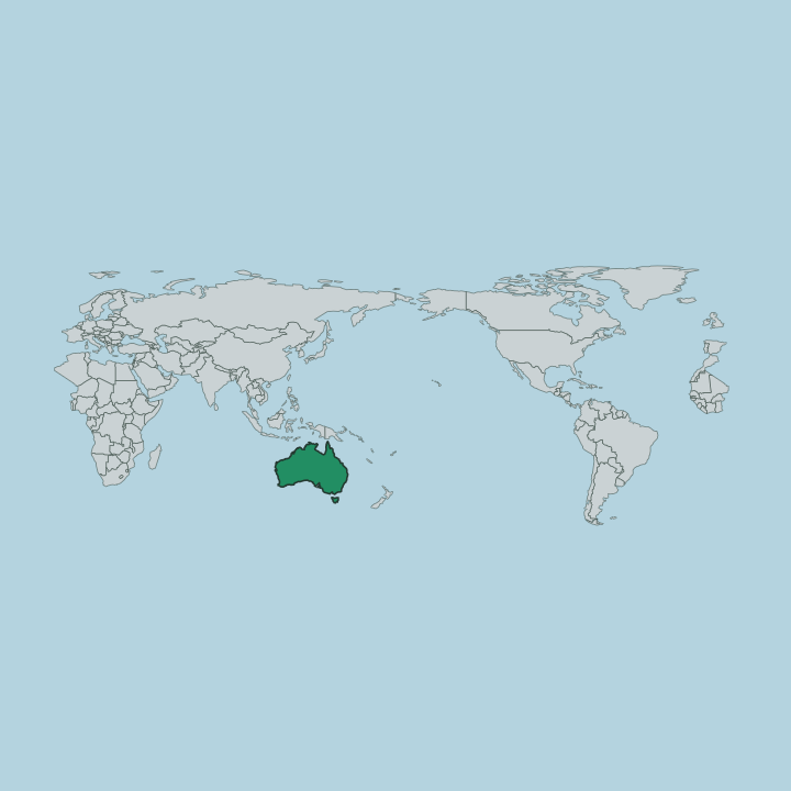
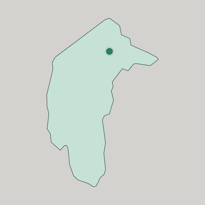
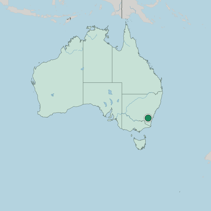
Canberra lies inland in the Australian Capital Territory, on a plain ringed by hills and surrounded by New South Wales. The city occupies the northern part of the territory, and its suburbs sprawl toward the state border on three sides. Mountains close the horizon.

The Brindabellas rise to the south and west as the northern reach of the Australian Alps, making Canberra the country's largest inland city, set well back from the coast.

What is the climate of Canberra?

Canberra has a temperate inland climate shaped by its height and its distance from the sea. Summers are warm and dry, with hot spells broken by cool nights on the plain below the Brindabellas. Winters are cold and frosty.

Clear, sharp mornings and frequent frosts mark the cold months, when the Australian Alps to the south hold snow and the inland air settles cold over the capital.

How do you get to Canberra?

Canberra sits inland in the Australian Capital Territory, reached across the surrounding country of New South Wales. As the national capital, the city draws highways in from the coastal cities and the interior alike, crossing the ranges to the planned basin at its heart. Roads climb in from every side.

A single line of highway and rail links the capital to the larger cities beyond the territory, and the routes wind down from the hills around the Brindabellas to reach the inland city.

Good for

Updated August 2026