Where to stay in Eura
The right area depends on your trip. Here's who each one suits — pick the place, then the hotel.
Eura keeps a modest stock of beds for a rural municipality of Satakunta, the kind of place where a small hotel or a guesthouse near the church village is the usual room. The centre around Euran kirkko suits visitors who want the parish church, the shops and the old ironworks ground of the Kauttuan ruukki- ja paperitehdasyhdyskunta within easy reach. It is the simplest base.
Out across the farmland and forest of the wider parish, cottages and cabins stand near the villages, close to the cairn of Kuninkaanhauta at Panelia and the grave field of Luistari, a good base for touring the Iron Age country of south-western Finland by car. Stock is thin once you leave the centre. Visitors drawn to the old dead often stay within reach of the hillfort of Kauttuan linnavuori and the river valleys of the Köyliönjokilaakso and the Lapinjokilaakso, while many travellers instead sleep in the larger towns of Satakunta and drive in for the day.
Book ahead in summer, when the rooms by the church village and the cottages around Eura go early.
Things to do in Eura
Ranked by global recognition; descriptions from Wikidata (CC0).
Churches & Religious Sites
6- Euran kirkko Heritage
- Kiukaisten kirkko Heritage
- Hinnerjoen kirkko Heritage
- Honkilahden kirkko Heritage
- Panelian kirkko
Show 1 more →
- Euran helluntaiseurakunta
Castles & Historic Sites
1- Kuninkaanhauta Heritage cairn
worth knowingacross 2 categories in Eura
About Eura
What is Eura known for?
Eura is known for its Iron Age past, a farming parish of Satakunta whose ground in south-western Finland holds some of the richest early graves in the country. The grave field of Luistari is the heart of that fame, and the great cairn of Kuninkaanhauta stands at Panelia as a marker of the same old dead. Old bones made the place.
Around the church village the parish church of Euran kirkko keeps the later story, while scattered villages and the river valleys carry the farms that have worked this soil for a very long time.
What are the main landmarks in Eura?
The grave field of Luistari is the landmark that tells Eura's story, one of the great Iron Age burial grounds of Satakunta dug out of the soil of south-western Finland. The cairn of Kuninkaanhauta rises at Panelia, a stone heap raised over the early dead. Old graves crowd this ground.
The parish church of Euran kirkko and the village churches of Panelian kirkko, Hinnerjoen kirkko, Kiukaisten kirkko and Honkilahden kirkko mark the later parishes, while the hillfort of Kauttuan linnavuori and the old ironworks ground of the Kauttuan ruukki- ja paperitehdasyhdyskunta carry the work of more recent centuries.
What is the history of Eura?
Eura's history reaches back to the Iron Age and runs forward through the farming parishes of Satakunta. The grave field of Luistari and the great cairn of Kuninkaanhauta at Panelia show a people settled on this soil of south-western Finland long before any record was kept, their dead buried in the river country with weapons and ornaments. The dead came first.
Across the long centuries between, the farms spread along the valleys of the Köyliönjokilaakso and the Lapinjokilaakso, the hamlets gathering by the water and the work of clearing the land going slowly on through the generations who knew nothing of charters or maps. The parishes grew around their churches. Euran kirkko, Panelian kirkko, Hinnerjoen kirkko, Kiukaisten kirkko and Honkilahden kirkko mark the village centres that the farming people raised over the long span of settlement, while the hillfort of Kauttuan linnavuori speaks of older defence.
The municipality of Eura was chartered in the 19th century, in 1866, drawing the old parishes into one administration, and the ironworks and paper community of the Kauttuan ruukki- ja paperitehdasyhdyskunta brought industry to the river. Old soil, new order.
Where is Eura?
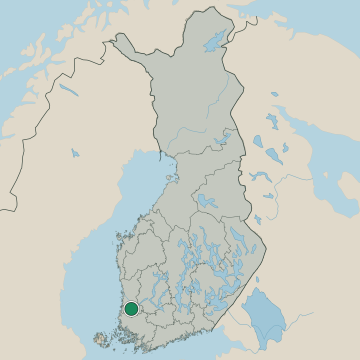
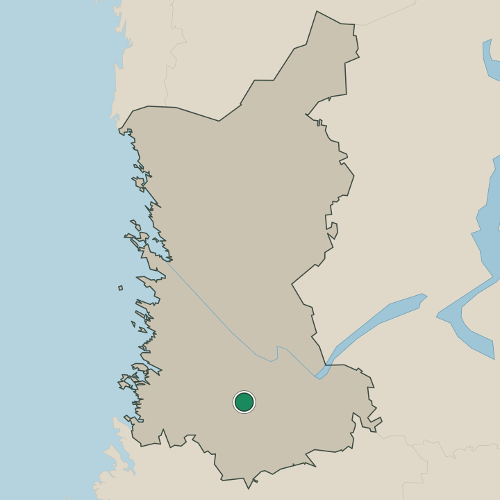
Eura lies in the farming country of Satakunta, in south-western Finland, where field and forest meet along the river valleys. The wide municipality spreads across the lowland, the church village gathered near Euran kirkko while the farms run out along the Köyliönjokilaakso and the Lapinjokilaakso. River country shapes the parish.
The village of Panelia stands to the north with its cairn of Kuninkaanhauta, the grave field of Luistari lies near the centre, and the hillfort of Kauttuan linnavuori rises over the old ironworks ground that worked the water of this corner of Satakunta.
What is the climate of Eura?
Eura keeps the cool, moist weather of the Satakunta lowland, its seasons turned by the farms and river valleys of south-western Finland. Winters bring frost and snow, the white lying long over the fields and the forests around the church village before the late thaw frees the soil. Summers are kindly here.
The long northern light warms the farmland and the valleys of the Köyliönjokilaakso and the Lapinjokilaakso through a short growing season, the weather milder on this western ground than in the cold interior, and the autumn comes in early and grey over the parish.
How do you get to Eura?
Eura is reached by road, the car the usual way into this rural municipality of Satakunta. Highways cross the farming country of south-western Finland to the church village by Euran kirkko, linking Eura to the larger towns of the region and to the coast beyond. The road carries the traveller in.
Buses also serve the parish, while visitors bound for the cairn of Kuninkaanhauta at Panelia, the grave field of Luistari and the old ironworks ground of the Kauttuan ruukki- ja paperitehdasyhdyskunta drive out to the scattered villages from the centre.
Where Eura sits
Boundaries © geoBoundaries (CC BY) & Wikidata (CC0); water & neighbours: Natural Earth.