
 In Republic of Finland
Where to stay in Satakunta
The right area depends on your trip. Here's who each one suits — pick the place, then the hotel.
Pori
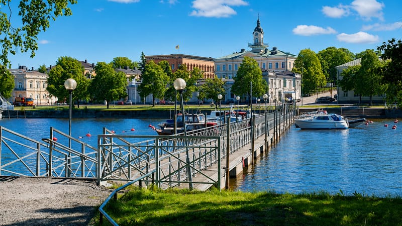
Pori is the regional capital of Satakunta, a port and industrial city in south-western Finland.Rauma
Rauma is a wooden old town on the south-western Finland coast, the seat of the Rauma sub-region in Satakunta.Kankaanpää
Kankaanpää is an inland town of Satakunta in south-western Finland, set where the Hämeenkangas and Pohjankangas ridges meet.Ulvila
Ulvila is a medieval town in south-western Finland's Satakunta, one of the country's oldest, set above the Kokemäenjoki.Eura
Eura is a municipality in Satakunta, south-western Finland, an old farming parish rich in Iron Age graves.Huittinen
Huittinen is an old market town of south-western Finland in Satakunta, gathered around a medieval stone church.Eurajoki
Eurajoki is a coastal municipality of Satakunta in south-western Finland, on the Eurajoki river.Kokemäki
Kokemäki is an old river town in Satakunta, south-western Finland, with a medieval castle and church at its heart.All towns & cities (20)
Harjavalta
Harjavalta is a riverside town of Satakunta, in south-western Finland, with a sculptor's museum at its heart.Säkylä
Säkylä is a lakeside municipality in Satakunta, south-western Finland, known for its garrison and its medieval church country.Nakkila
Nakkila is a riverside parish town in Satakunta, south-western Finland, gathered around the Nakkilan kirkko.Kiukainen
Kiukainen is a former parish in Satakunta, south-western Finland, now part of Eura around the village of Panelia.Lappi
Lappi is a former parish in Satakunta, south-western Finland, now part of Rauma and home to Sammallahdenmäki.Merikarvia
Merikarvia is a fishing municipality on the Gulf of Bothnia in Satakunta, south-western Finland.Karvia
Karvia is a forest-and-mire municipality in Satakunta, south-western Finland, known for the wild bogs of its national park.Pomarkku
Pomarkku is a rural municipality in Satakunta, south-western Finland, gathered around its stone church inland from the coast.Vampula
Vampula is a rural locality in south-western Finland, in Satakunta, gathered around the wooden Vampulan kirkko.Jämijärvi
Jämijärvi is a small municipality in Satakunta, south-western Finland, gathered around its 19th-century parish church.Honkajoki
Honkajoki is an inland municipality of Satakunta in south-western Finland, a farming and forest parish near Kankaanpää.Siikainen
Siikainen is a rural municipality in Satakunta, in south-western Finland, gathered around its old parish church.About Satakunta
Satakunta is known for its towns.
What is Satakunta known for?
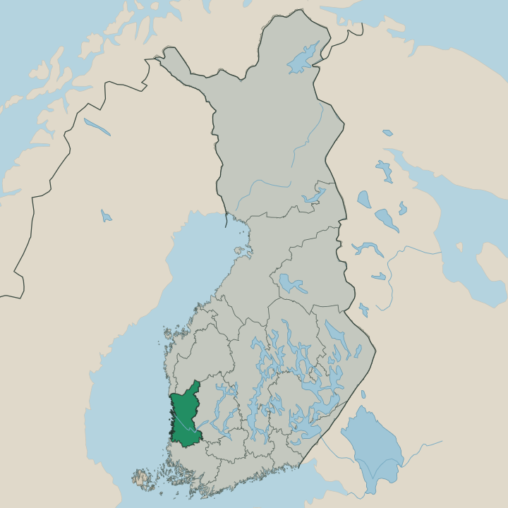
Satakunta is known for its towns. The region carries an old name and a string of working settlements, from Pori, its largest city, to the timber-built streets of Rauma and the inland market town of Kankaanpää, all set among the farms and forests of south-western Finland. Industry runs deep here.
Pori grew on trade and manufacturing, while smaller places like Ulvila and Harjavalta kept their mills and works through the long industrial age. People know the region for its rivers, its towns, and its quiet country between them.
Where is Satakunta?
Satakunta lies in south-western Finland, a region of low river valleys, farmland, and forest spread across the country's western flank. The land is gentle and open near the towns, where fields run between stands of pine and spruce, and grows wilder and more thinly settled toward the inland edges where the forests close in around the smaller villages and the country roads that thread between them. Pori anchors the region.
The largest city sits toward the western side, the hub around which the smaller towns of the region turn for trade, work, and services. The towns of Satakunta string out across this country. Rauma keeps its old wooden quarter to the south-west, while Ulvila and Harjavalta sit near Pori in the more thickly settled western belt, and Kankaanpää holds the inland north.
Kokemäki and Huittinen lie among the farms of the south-eastern part of the region, market towns of the cultivated valley country. Eura and Eurajoki fill out the settled south. Together these places make Satakunta a region defined less by a single centre than by its scatter of working towns across the south-western Finnish land.
What is Satakunta like?
Culture in Satakunta grows from its towns. Each settlement carries its own grain, from the trading life of Pori to the craft tradition of Rauma, whose old wooden streets keep a way of building and living that sets the town apart from its neighbours in south-western Finland. The towns hold the region's life.
Markets, churches, and the small institutions of working communities give the towns their character, and the local language of the region is Finnish, spoken across the towns and the country between them. The region has a strong sense of place. People here identify with Satakunta as much as with the wider country, and the towns keep their fairs, their parishes, and their local pride through the generations.
Rauma guards its old town. Inland places such as Kankaanpää, Kokemäki, and Huittinen hold to the rhythms of farm and forest country, where the year still turns on the land, and the smaller towns of Ulvila, Harjavalta, and Eura carry the everyday culture of work, parish, and neighbourhood that binds the region together across its scattered settlements.
What is the history of Satakunta?
The name is ancient. Satakunta carries one of the oldest regional names in the country, and the land was long a settled province of farms and market towns in south-western Finland, with Pori growing into the trading centre of the western valleys and smaller places like Ulvila and Kokemäki holding their parishes and mills through the centuries. The modern region took its present shape in 1994.
That reform drew the administrative bounds of Satakunta as it stands, gathering Pori, Rauma, and the inland towns of Kankaanpää and Harjavalta under one regional name.
What is the climate of Satakunta?
Satakunta has a cool, moist climate typical of south-western Finland. Winters are long and snowy, with frost and lying snow across the river valleys and forests for months as the days shorten and the light fails early through the depth of the cold season. Summers are short and green.
The warm months bring mild days and long light to the farms and towns of the region, from Pori in the west to the inland country around Kankaanpää, before the cold returns. Spring and autumn are brief turns between the two.
How do you get to Satakunta?
Satakunta is reached by road, rail, and air. Pori, the regional hub, sits on the main routes from the south and has its own airport and rail link, the quickest way into the western side of the region for most travellers. Roads thread inland to the smaller towns.
Highways run east and south through Harjavalta, Kokemäki, and Huittinen toward the rest of the country, while the coastal road carries traffic south to Rauma. Buses tie the towns of the region together along these same routes.
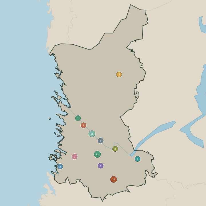
Towns & cities in Satakunta
Boundaries © geoBoundaries (CC BY) & Wikidata (CC0); water & neighbours: Natural Earth.
Common questions
What is the best area to stay in Satakunta?
Pori: first-time visitors and city services. Rauma: old-town wanderers.