Finland · South Karelia Region · Lappeenranta
Leiri, Lappeenranta — Area Guide & Where to Stay
Leiri is the fifth district of Lappeenranta, set between the city centre and the airport and reaching the shore of Saimaa. Military camps gave it the name.
About Leiri


Where to stay in Leiri
Not every neighbourhood fits every trip — here's what each one is good for.
Leiri is central without being the core, which makes it a practical base: Valtakatu runs through it, and the neighbouring districts of Keskus and Pallo-Tyysterniemi are a walk away. Fazer's confectionery factory, once Chymos, and a Prisma hypermarket sit inside the district. Lappeenranta airport lies at its western edge.
About Leiri
What are the main landmarks in Leiri?
Leirikirkko is the district's set piece, consecrated on 17 June 1904 to a design by the military engineer M. Redjko, with gilded onion domes paid for by the Lappeenranta merchant Ivan Wolkoff. It replaced a small wooden church of 1901 after the Governor-General Nikolai Bobrikov ordered something grander. The Rakuunamäki barracks fill the northern end, their red-brick blocks drawn by Sebastian Gripenberg and Johan Jacob Ahrenberg from 1889.
Saint Nicholas is its patron.
What is the history of Leiri?
Soldiers used this ground from 1788, and the Russian Saimaa flotilla worked the shore between Tyysterniemi and the site of the later confectionery factory. The flat ground suited it. Camp activity began under Alexander I, on a field called Joutsenkenttä that was first enlarged in 1821.
The Hämeenlinna railway of 1862 drew the camps away to Parola, and in 1880 the council offered the ground to the army of the Grand Duchy. Leiri itself, once part of the Puhakka farm, was joined to the city in 1892 with the consent of Alexander III. Oskar Hannikainen's plan gave the fifth district fourteen blocks and fifty-three plots.
Where is Leiri?
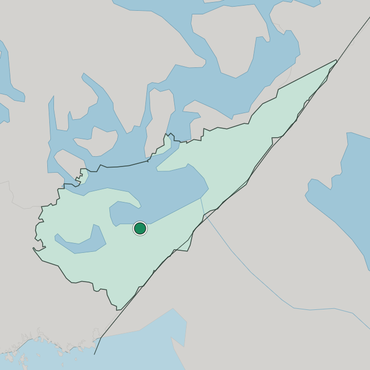
Taipalsaarentie, Kutojankatu, Liisankatu and Mannerheiminkatu bound Leiri to the north, the old Simola-Lappeenranta railway to the east, Simolantie and Opintie to the south, and Lavolankatu, the airport and Saimaa to the west. The district runs north to south, roughly a kilometre across and two long. Pallo-Tyysterniemi, Keskus, Tykki-Kiviharju, Kesämäki, Lentokenttä and Kuusimäki adjoin it.
More areas in Lappeenranta
Updated September 2026