
 In Republic of Finland
Where to stay in South Karelia Region
The right area depends on your trip. Here's who each one suits — pick the place, then the hotel.
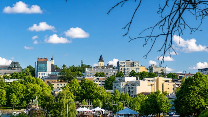
Lappeenranta
6 areasLappeenranta is a garrison city in South Karelia, south-eastern Finland, chartered in 1649 above the lake shore.Imatra
Imatra is an industrial town in South Karelia Region, south-eastern Finland, built around its harnessed rapids.Ruokolahti
Ruokolahti is a lakeland municipality in South Karelia, south-eastern Finland, on Saimaa by the eastern border.Taipalsaari
Taipalsaari is a lakeside municipality in South Karelia, in south-eastern Finland, set among the waters of Lake Saimaa.Luumäki
Luumäki is a municipality in South Karelia, south-eastern Finland, known for the Salpa Line and Taavetti Fortress.Parikkala
Parikkala is a parish town in South Karelia, south-eastern Finland, its three old churches set among the eastern lakes.Savitaipale
Savitaipale is a rural municipality in South Karelia, south-eastern Finland, set among the lakes near Saimaa.Lemi
Lemi is a small municipality in South Karelia, south-eastern Finland, on lake-cut land near the old Salpa Line.All towns & cities (11)
Ylämaa
Ylämaa is a former municipality in south-eastern Finland, now part of Lappeenranta and known across South Karelia for its gemstones.Simpele
Simpele is an urban area in south-eastern Finland's South Karelia region, the administrative centre of the Rautjärvi municipality.Taavetti
Taavetti is the administrative centre of Luumäki, in South Karelia, in south-eastern Finland, on Highway 6.About South Karelia Region
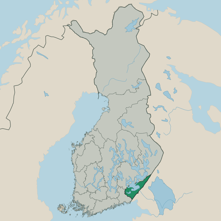
Big water and a long eastern border mark this region.
What is South Karelia Region known for?
Big water and a long eastern border mark this region. Lappeenranta, its hub city, rises on a lakeshore as the seat and largest town of the south-eastern lakes, the harbour where the routes of the corner gather. Imatra grew around a great rapids on the river toward Russia.
Smaller parishes like Ruokolahti and Taipalsaari spread along the open lakes, while Parikkala reaches to the far border. Lake, border, and a Karelian temper shape it.
Where is South Karelia Region?
Etelä-Karjala lies in south-eastern Finland, where great lakes meet the long border with Russia. The region spreads along the southern shores of the eastern lake systems, a country of open water, wooded peninsulas, and the low ridges that the ice left behind, with farmland and forest between the bays. Lappeenranta sits on a lakeshore near the western side of the region, the harbour town where its routes gather.
The great waters of the south-east frame the region, draining toward the river that carries them on past Imatra and across the frontier. Long peninsulas and islands break the lakes into countless bays, and the towns hold the shores and the narrows where the land reaches between the waters. Imatra grew on a famous rapids in that outflowing river in the east.
Etelä-Karjala borders the lake regions to the north and west, while its long eastern edge runs against Russia. Lake, peninsula, and forest repeat without end, and the border is never far away. Water and frontier shape the region.
What is South Karelia Region like?
The region is the part of Karelia that stayed inside Finland's south-eastern corner after the wars redrew the border. Its people carry a Karelian warmth and openness set apart from the rest of the country, along with the foodways of Karelia, the rye pasties, and a tradition of trade across the eastern frontier. The lake and the border together shape the local identity more than anything else.
Lappeenranta gives the region its urban face as a lakeshore garrison and trading town with a long military past on the eastern edge of the realm. Imatra carries the memory of an industrial age, where the power of a great rapids drew works and visitors to the river toward Russia. Cross-border trade and travel marked the local life for generations, and the harbour, the markets, and a busy summer season fill the warm months along the water.
The east leaves its mark on everything. A Karelian openness, a lakeside-and-border setting, and a tradition of trade and crossing together give Etelä-Karjala its lively, outward-looking character.
What is the history of South Karelia Region?
This corner of Karelia changed hands for centuries. Lappeenranta grew as a fortified lakeshore garrison and market town on the contested south-eastern frontier between the realms of Sweden and Russia. Imatra rose later around the power of its great rapids, drawing industry and travellers to the river in the east.
Then the border moved. The wars of the twentieth century redrew the frontier and left this the part of Karelia that stayed in Finland. The region is young.
It took its present administrative form in 1994, gathering the south-eastern lakes under one council around the hub at Lappeenranta.
What is the climate of South Karelia Region?
The region has a cold, continental climate moderated by the great lakes along its shores. Winters run long and snowy, and the lakes around Lappeenranta freeze hard enough to carry ice roads and skiers across the bays for months at a time. Summers stay warm.
They bring long northern light and the harbour life, the boating, and the lakeshore season that fill the south-eastern towns through the warm weeks. The large lakes hold their heat into autumn and soften the first frosts along the shores. The eastern position brings hard frosts, and the forests turn to colour when the year closes.
How do you get to South Karelia Region?
Lappeenranta sits on the main railway from Helsinki toward the east, with direct trains that run down to the lakeshore city. The line is the chief approach. Lappeenranta Airport handles light traffic west of the town, and drivers come on the highways that run east from the capital toward the border crossings near Imatra.
Regional buses link Lappeenranta with Imatra, Luumäki, and Parikkala across the lake country. Rail from Helsinki is simplest.
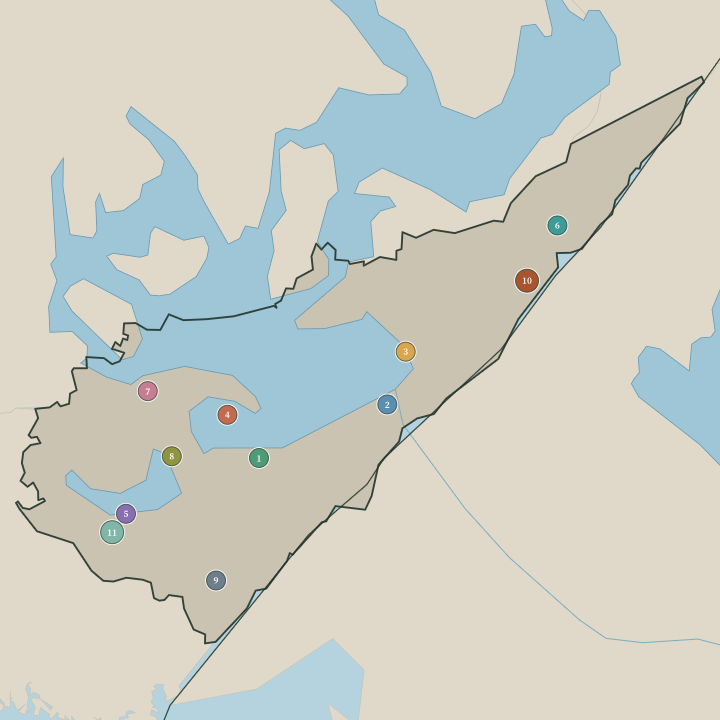
Towns & cities in South Karelia Region
Boundaries © geoBoundaries (CC BY) & Wikidata (CC0); water & neighbours: Natural Earth.
Common questions
What is the best area to stay in South Karelia Region?
Lappeenranta: first-time visitors and lakeshore harbour stays. Imatra: spa visitors and travellers near the eastern border.