Iceland
Austurland, Iceland — Towns & Travel Guide


Austurland is Iceland's eastern region, a jagged run of the Eastfjords reaching inland to Egilsstaðir and the Lagarfljót.
Find your area →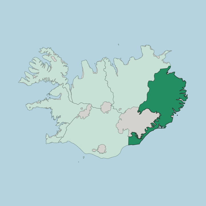
Towns & cities in Austurland
Pick a town or city — each links to where to stay.
 Iceland
Egilsstaðir
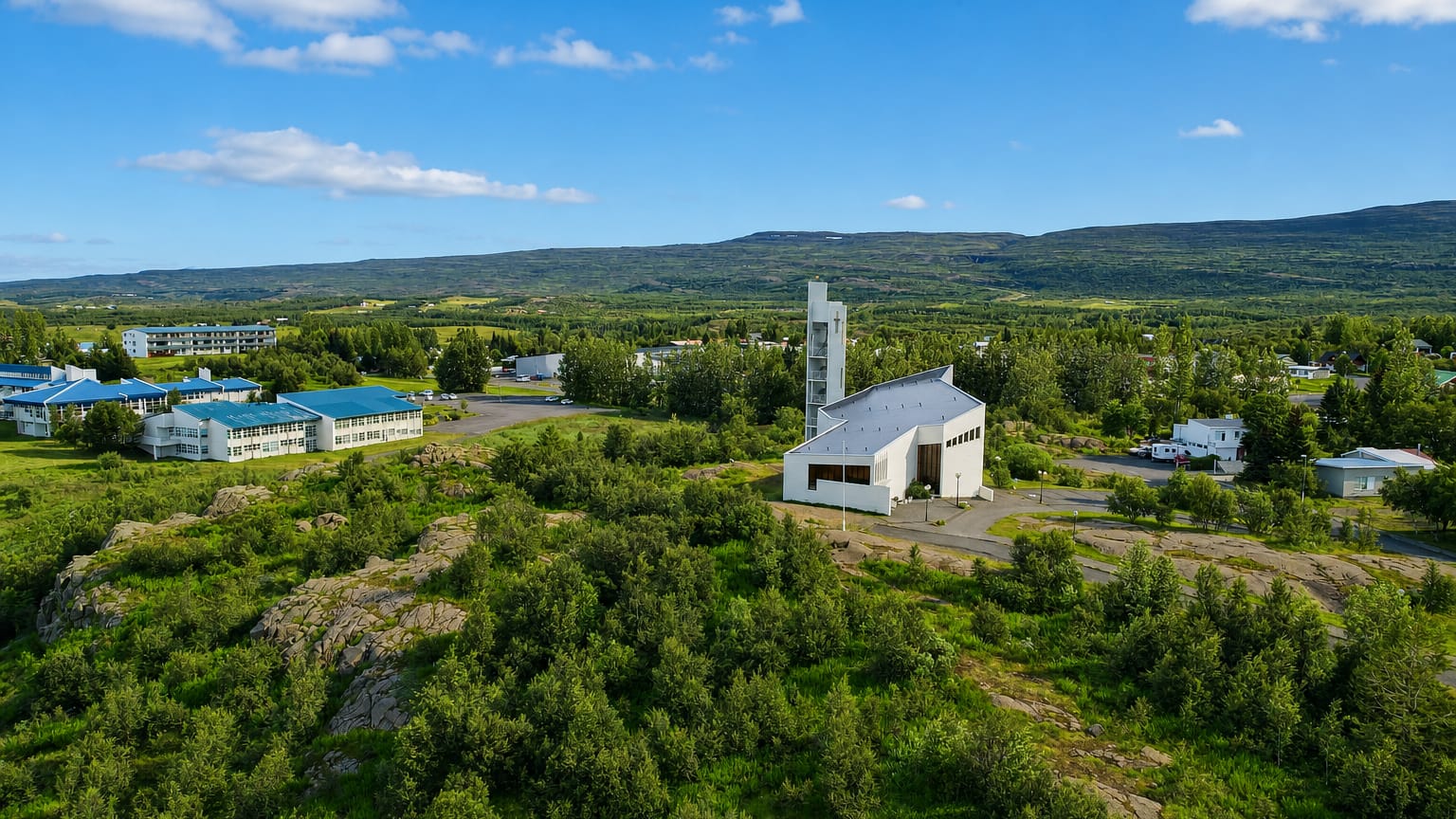
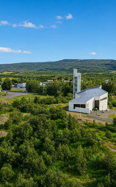
Egilsstaðir is the main town of eastern Iceland, set on the banks of the Lagarfljót river in Austurland.Where to stay →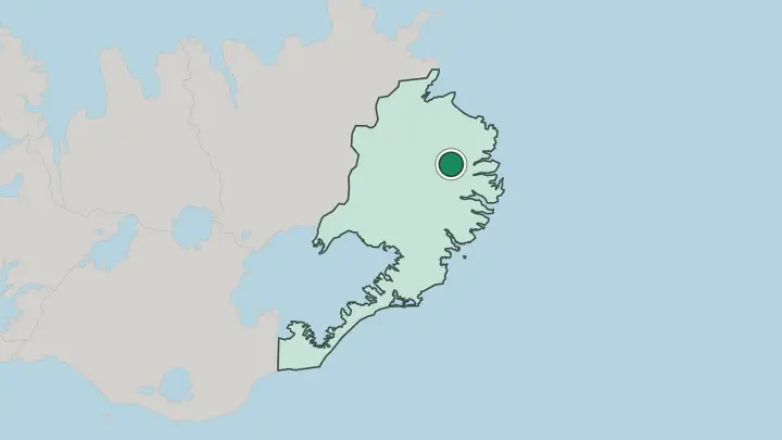
About Austurland
The Eastfjords define Austurland.
What is Austurland known for?
A jagged coastline of narrow fjords, called Austfirðir, threads between steep headlands while the inland valleys widen toward Egilsstaðir, the regional hub on the banks of the Lagarfljót. Stuðlagil draws climbers and photographers to its basalt columns, the Kárahnjúkar plant harnesses the glacial Jökla, and Seyðisfjörður anchors the ferry link to continental Europe. Birdwatchers reach Borgarfjörður eystri for its puffins.
Few corners of the country feel so remote.
Where is Austurland?
Austurland occupies the eastern part of Iceland, and its shape is written by the sea. The defining feature is the Eastfjords, the long line of narrow fjords the Icelanders call Austfirðir, where steep basalt headlands drop straight into deep, sheltered water and the road clings to each shore in turn. Behind that coast the land lifts inland.
Valleys open out. The broadest of them, Fljótsdalur, carries the Lagarfljót, a deep glacial trough of a lake that runs past the regional hub at Egilsstaðir and along the wooded slopes of Hallormsstaður. Further up the highland rim stands Snæfell, the tallest freestanding mountain in the country, marking the eastern edge of the Vatnajökull ice cap and its surrounding park.
Glacial rivers cut hard through the plateau. One of them, the Jökla, was dammed at Kárahnjúkar, and the dropping water revealed the basalt columns of Stuðlagil downstream. The whole region spreads thin across a vast area, one of the emptiest stretches of an already empty island.
What is Austurland like?
Life in Austurland clusters in small harbours strung along the fjords. Each village grew up around the same trades, fishing and trading, and the distance between them bred a stubborn local independence that still marks the region's character. Djúpivogur holds the oldest trading licence of the lot, granted in 1589, and its slow-living ethos has since shaped how the whole coast presents itself to visitors.
The towns are tiny. Art and the outdoors run together here. Seyðisfjörður keeps a studio scene inside its painted timber houses and hosts summer concerts in the blue church at the foot of the street, while Borgarfjörður eystri builds its calendar around the puffins at Hafnarhólmi and the elf folklore of the surrounding peaks.
Hallormsstaður adds a quieter strand, the country's first protected forest, where generations of Icelanders learned that trees could in fact grow on the island. The food leans on the sea and on reindeer that roam the eastern highlands. Music festivals fill the brief, bright summers, and the long dark winters keep the communities turned inward and close.
What is the history of Austurland?
Settlement reached these fjords in the saga age, and farms took the valley floors while the coast lived from the sea. Djúpivogur was granted its trading licence in 1589, making it the oldest of the eastern trading places, and the herring and fishing booms later swelled villages such as Seyðisfjörður. The modern turning point came with the Kárahnjúkar dam, which flooded the highland reservoir of Hálslón to power an aluminium smelter near Reyðarfjörður.
The fjords reshaped the economy. That single project changed the region for good.
What is the climate of Austurland?
The Eastfjords sit drier and clearer than much of the island. Sheltered behind the bulk of the Vatnajökull ice cap, the inland valley around Egilsstaðir often records some of the warmest summer days in the country, while the open fjord mouths stay cooler and breezier where the sea reaches in. Winters are dark and snowy, and the high passes between fjords, such as Fjarðarheiði above Seyðisfjörður, close hard in storms.
Light defines the seasons. Bright nights give way to long polar dark.
How do you get to Austurland?
Most visitors arrive at Egilsstaðir. The town has the region's airport with flights from Reykjavík, and it sits on the Ring Road that carries traffic the long way round the island to and from the south coast and the capital. By sea, the only car and passenger ferry between Iceland and continental Europe calls weekly at Seyðisfjörður over the steep Fjarðarheiði pass.
Roads wind tightly between the fjords. Distances are real out here.
Common questions
What is the best area to stay in Austurland?
Egilsstaðir: Drivers circling the Eastfjords who want one fixed base beside the Lagarfljót crossing..
Good for
Updated July 2026