
 In Republic of Finland
Where to stay in Kanta-Häme
The right area depends on your trip. Here's who each one suits — pick the place, then the hotel.
Hämeenlinna
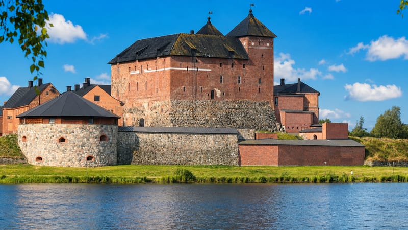
1 areaHämeenlinna is the capital of Kanta-Häme in southern Finland, an old castle town on the shore of Lake Vanajavesi.Riihimäki
Riihimäki is a railway-junction town in Kanta-Häme, southern Finland, on the lines north from Helsinki.Forssa
Forssa is a former textile town of Kanta-Häme in southern Finland, set where the Loimijoki begins.Janakkala
Janakkala is a municipality in Kanta-Häme, southern Finland, known for the Hakoisten linnavuori hill fort.Hausjärvi
Hausjärvi is a rural municipality of Kanta-Häme, in southern Finland, with its seat at the village of Oitti.Loppi
Loppi is a rural municipality in Kanta-Häme, southern Finland, strung along the old Hämeen Härkätie.Tammela
Tammela is a rural municipality in Kanta-Häme, in southern Finland, known for the bogs of Torronsuon kansallispuisto.Lammi
Lammi is an old parish village in Kanta-Häme, southern Finland, now a part of Hämeenlinna.All towns & cities (17)
Jokioinen
Jokioinen is a farm municipality of Kanta-Häme, its parish built around a great manor in the Loimijoki valley.Hauho
Hauho is a lakeside parish of Kanta-Häme, in southern Finland, gathered around its medieval stone church.Renko
Renko is a small parish in Kanta-Häme, southern Finland, on the old Oxen Road inland from the coast.Ypäjä
Ypäjä is a small municipality in southern Finland's Kanta-Häme region, a farming town known above all for its horses.Humppila
Humppila is a small farming municipality of southern Finland in Kanta-Häme, known for its heritage railway.Oitti
Oitti is the centre of Hausjärvi municipality, a railway village on the plain of southern Finland's Kanta-Häme.Tuulos
Tuulos is a rural municipality in southern Finland, a small Kanta-Häme parish of farmland, lakes, and a heritage church.Parola
Parola is a village in Hattula, Kanta-Häme, in southern Finland, known for the Panssarimuseo and the Parolan leijona.Turenki
Turenki is a village centre in southern Finland, the main settlement of Janakkala in Kanta-Häme, near a heritage church and an amusement park.About Kanta-Häme
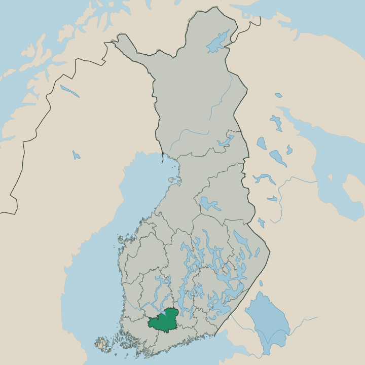
Kanta-Häme is inland Häme country.
What is Kanta-Häme known for?
Kanta-Häme is inland Häme country. The region, Hämeen maakunta in Finnish, lies in southern Finland between the lakes of Pirkanmaa to the north-west and the coast of Uusimaa to the south, a span of forest, ridge, and water away from the sea. It is the old heart of the Häme province.
People know Kanta-Häme for its lake landscape, its ridges, and its place at the inland crossing of southern Finland between Pirkanmaa, Uusimaa, and neighbouring Päijät-Häme.
Where is Kanta-Häme?
Kanta-Häme lies in southern Finland, an inland region of lake, ridge, and forest set away from the sea. Long eskers run across the land, gravel ridges left by old ice that thread between the lakes and break the forest into a landscape of water and wood, with farmland filling the gentler valleys and the towns gathered along the lakeshores and the routes that cross the interior of the country. The region sits at an inland crossing.
Pirkanmaa and its lakes lie to the north-west, the coast of Uusimaa to the south, and Päijät-Häme to the east, so Kanta-Häme forms the wooded centre between them in southern Finland. Forest covers the higher ground. Lakes fill the hollows between the ridges.
What is Kanta-Häme like?
Kanta-Häme is the old heart of Häme. The region carries the name and identity of the historic Häme province, an inland country of forest, lake, and farm whose people kept their own dialect and traditions away from the coast of southern Finland. The lakes set the rhythm.
Boats, summer cottages, and the ridge country mark the warm season between Pirkanmaa and Uusimaa. The land holds a long rural and provincial identity, set at the inland crossing where routes between the lake country of Pirkanmaa and the capital coast have long passed through. Festivals and lakeside gatherings fill the summers, and the eskers and forests draw walkers through the bright months toward neighbouring Päijät-Häme.
Kanta-Häme anchors the wooded centre. Its towns keep their own fairs and traditions through the year.
What is the history of Kanta-Häme?
Kanta-Häme is old Häme country. The inland province of Häme was settled and farmed for centuries along its lakes and eskers, set at the crossing where routes between the interior and the southern coast passed through. Long it kept its own provincial identity.
The present maakunta of Kanta-Häme, Hämeen maakunta in Finnish, was drawn in 1994, binding the lake and ridge country of southern Finland between Pirkanmaa and Uusimaa into one administrative whole.
What is the climate of Kanta-Häme?
Kanta-Häme has a cool inland climate. Winters bring snow and ice across the lakes and ridges of southern Finland, freezing the water and holding the forests white through the dark months of the year. Summers turn warm and bright.
The long days warm the lakes for swimmers and boats across the inland country between Pirkanmaa and the coast of Uusimaa.
How do you get to Kanta-Häme?
Kanta-Häme lies on the road north. The region sits on the main lines and roads that run inland from the capital region of Uusimaa toward the lakes of Pirkanmaa, so trains and traffic pass through its ridge country on the way between the coast and the north. The lakes are easy to reach.
Roads thread east toward neighbouring Päijät-Häme and out across the forest country of southern Finland.
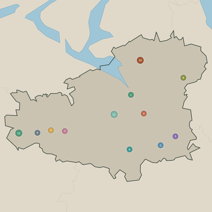
Towns & cities in Kanta-Häme
Boundaries © geoBoundaries (CC BY) & Wikidata (CC0); water & neighbours: Natural Earth.