India · Uttar Pradesh
Where to Stay in Najībābād, Uttar Pradesh
Najībābād is a Rohilla town in Bijnor district, Uttar Pradesh, India, founded by Nawab Najib-ud-Daula below the Garhwal hills and still holding his fort.
Hotel links are affiliate links: booking through them may earn us a commission, at no extra cost to you. It never affects how places are ranked. How this works


Where to stay in Najībābād
Where visitors usually base themselves, and why.
Najībābād divides between its past and its traffic. The fort quarter is the reason to come, with Najibabad Fort, the tomb, and the cemetery within reach of each other. The station and highway side is where most people actually stay, because the town is a junction as much as a destination.
North of both lies the terai. That road runs up towards the Malan River and the Garhwal foothills beyond.
Find hotels in Najībābād
Direct booking searches for these neighbourhoods.
Around Najibabad Fort
The historic quarter of Najībābād, holding the fort Najib-ud-Daula raised and the tomb and cemetery that the Archaeological Survey of India protects.Find hotels in Around Najibabad FortArrivals by rail, and drivers on the national highwaysThe station and highway side
The transport end of town, where the railway station and the highway traffic meet, and the practical base for anyone treating Najībābād as a stop.Find hotels in The station and highway sideThe Garhwal foothills and the country north of townTowards the Malan and the terai
The northern approach, running towards the Malan River and the terai below Garhwal, which is the direction the hill trade always came from.Find hotels in Towards the Malan and the teraiHotel links are affiliate links: booking through them may earn us a commission, at no extra cost to you. It never affects how places are ranked. How this works
About Najībābād
One man built this town and it still shows.
What is Najībābād known for?
Nawab Najib-ud-Daula founded Najībābād in the middle of the eighteenth century, and the fort, the tomb, and the cemetery he left are all protected by the Archaeological Survey of India. Industry carries it now. The town is a working manufacturing centre with rail and national highway links, which is a different life from the Kashmir trade it was founded to catch.
What are the main landmarks in Najībābād?
Four sites here are protected by the Archaeological Survey of India. Najibabad Fort, also called the Pathargarh Fort and known locally as Sultana Daku Ka Qila, is the largest of them and was built by Najib-ud-Daula himself. His tomb and the cemetery beside it are the other two.
The fourth is a surviving portion of the works from the same Rohilla period, and together they are why an industrial town still reads as an eighteenth-century foundation.
What is the history of Najībābād?
Najib Khan Yousafzai was a Rohilla soldier who served both the Mughal Empire and the Durrani Empire, and the title Najib-ud-Daula came to him from the Mughal emperor. He founded Najībābād in 1751, at the height of a career that took him to Grand Wazir in succession to Safdarjung, and he governed Saharanpur and Dehradun from 1757 to 1770. The site was chosen for trade.
George Foster, writing in 1790, judged the ground low and swampy and unsuited to a capital, but well placed to catch the Kashmir commerce that had shifted away from Lahore and Delhi and now came through the mountains by the Lall Dong Pass. In 1857 his successor Nawab Dundu Khan rose against the British, and the estate was confiscated with a part of it given to Rampur.
Where is Najībābād?
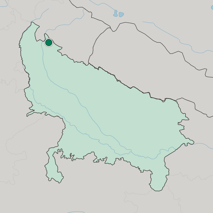
Najībābād sits in the terai below Garhwal, a short way off the Malan River, in the northern part of Bijnor district. Bijnor itself lies south. The ground is low and was described as swampy when the town was new, which is the same flatness that now carries the rail line and the national highways through it towards the hills and back down into the Uttar Pradesh plain.
What is the climate of Najībābād?
Sitting in the terai gives Najībābād a wetter year than the plain further south, with the monsoon banking against the Garhwal hills and falling heavily here. Winters turn foggy and cold. The low ground that George Foster called swampy still holds water after the rains, and the season shapes both the farming and the road traffic through the town.
How do you get to Najībābād?
Najībābād is a junction town and easy to reach. It has its own railway station and sits on national highways running between the Uttar Pradesh plain and the hills, which is what makes it an industrial centre rather than a backwater. Bijnor lies south and is the district town.
The roads north lead into Garhwal.
Common questions
What is the best area to stay in Najībābād?
Around Najibabad Fort: The Pathargarh Fort and the Rohilla remains. The station and highway side: Arrivals by rail, and drivers on the national highways. Towards the Malan and the terai: The Garhwal foothills and the country north of town.
More cities in Uttar Pradesh
Updated September 2026