Where to stay in Geta
The right area depends on your trip. Here's who each one suits — pick the place, then the hotel.
Geta keeps lodging simple. As a thinly populated rural municipality in the Åland Islands, it offers cottages and a guesthouse or two rather than hotels, mostly near the church village and the shore. Travellers who want a full range of rooms base in Mariehamn, the regional centre, and drive north to Geta for the day.
Staying here means staying quiet. Self-catering cabins sit within reach of Geta kyrka, the Geta Motormuseum, and the back roads toward Dånö. Come for the calm.
The Baltic Sea is never far, the nights in summer run long, and the appeal is precisely that nothing here resembles a resort.
About Geta
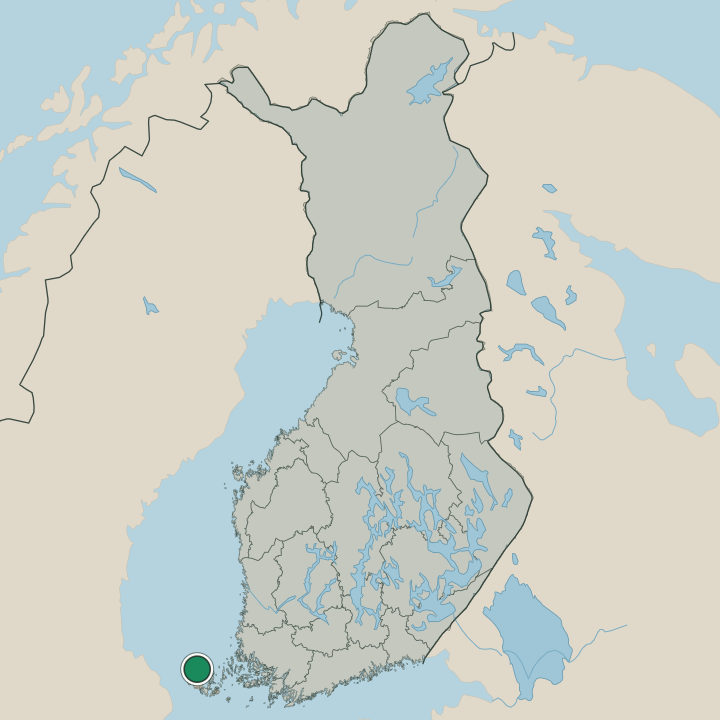
Geta sits at the top of the map.
What is Geta known for?
Geta sits at the top of the map. It is one of the northernmost parishes of the Åland Islands, a rural municipality of farms and shoreline rather than any town. Geta kyrka is its anchor, and visitors with time also find the Geta Motormuseum and, on the island of Dånö, a local heritage museum.
Around it all lies the Baltic Sea.
What are the main landmarks in Geta?
Three small sights repay a visit. Geta kyrka, the medieval stone church, stands with its separate bell tower as the parish landmark, a fixed point above the fields that islanders have gathered toward for centuries. The Geta Motormuseum gathers old vehicles and machinery.
Out on Dånö, a homestead museum preserves rural island life. None is grand. Together they sketch the working character of this northern corner of the Åland Islands.
What is the history of Geta?
Geta has long lived from land and water. Its farms worked the thin northern soils of the Åland Islands while families fished the surrounding Baltic Sea, a pattern that held for centuries. Geta kyrka, raised in the Middle Ages, gathered the scattered parish and still does, its bell tower a fixed point above the fields.
The sea shaped everything else. Boats carried people and goods when roads were poor, and the small island of Dånö kept its own community on the water's edge. Life was modest and self-reliant.
With the rest of Åland, Geta became part of the autonomous, Swedish-speaking region within Finland in the twentieth century. The Geta Motormuseum and the Dånö homestead museum now keep that rural past in view, while the parish itself stays rooted to the same northern shore of the Baltic Sea.
Where is Geta?
Geta marks the north of the islands. The municipality occupies the upper edge of the Åland mainland and reaches out to smaller islands such as Dånö, all ringed by the Baltic Sea. Its terrain is rocky and wooded, rising in low ridges above the shore.
Among the parishes of the Åland Islands, Geta is the one that faces furthest north across open water.
What is the climate of Geta?
Open water tempers Geta. The surrounding Baltic Sea keeps summers cool and winters less severe than the Finnish mainland, though the northern position of the Åland Islands shortens the warm season. Ice can form in the channels near Dånö during cold spells.
Snow lingers in the wooded ridges above Geta kyrka well into spring.
How do you get to Geta?
Geta is a drive, not a ferry hop. It lies at the northern end of the Åland mainland, reached by road from Mariehamn through the central parishes of the Åland Islands. The route runs out to Geta kyrka and on toward Dånö.
There is no airport here; most arrivals come overland after the sea crossing to Åland across the Baltic Sea.
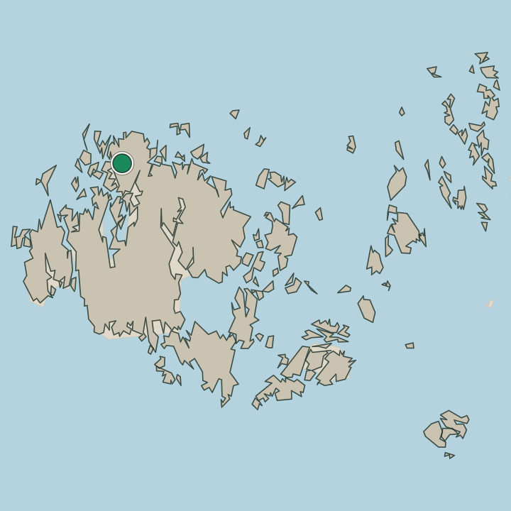
Where Geta sits
Boundaries © geoBoundaries (CC BY) & Wikidata (CC0); water & neighbours: Natural Earth.