Where to stay in Lemi
The right area depends on your trip. Here's who each one suits — pick the place, then the hotel.
Lemi is a rural base, and beds here are few. The natural centre is the church village, where Lemin kirkko and its belfry mark the heart of the municipality and the small services of South Karelia's countryside gather. It suits you if you want a quiet lakeside corner with the wartime Salpalinja and the old rock paintings within reach.
This is farmland and forest. Out toward the lakes, scattered cottages and farmsteads such as the heritage houses at Keskitalo and Alatalo sit near the shores and the painted cliffs at Haukkasaaren kalliomaalaus, for visitors who want water and woods over any kind of town. Few rooms exist in any one place.
Many travellers stay in nearby South Karelia and come to Lemi for the day, walking the line of the Salpalinja, the village church and the rock-painting cliffs before moving on through south-eastern Finland.
About Lemi
What is Lemi known for?
Lemi is best known for its old wooden church and the wartime line that runs nearby. Lemin kirkko stands at the village centre with its separate belfry, the Lemin kirkon tapuli, while the bunkers and tank barriers of the Salpalinja thread the country around the municipality. The lakes hold older marks still.
Prehistoric rock paintings survive on the cliffs at Haukkasaaren kalliomaalaus, Linnasaaren kalliomaalaus and Venäinniemen kalliomaalaus, set high above the water across this corner of South Karelia.
What are the main landmarks in Lemi?
The Salpalinja is the landmark visitors trace through Lemi. Built as a defensive line along Finland's eastern edge, its concrete bunkers and lines of granite tank barriers still cross the forest here. Older marks rise from the lakes.
Lemin kirkko keeps its detached belfry, the Lemin kirkon tapuli, while red-ochre rock paintings survive on the cliffs at Haukkasaaren kalliomaalaus, Ilmuksenvuoren kalliomaalaus, Linnasaaren kalliomaalaus, Ruominkapian kalliomaalaus and Venäinniemen kalliomaalaus, high above the water across the municipality.
What is the history of Lemi?
Lemi has been lived in since long before its parish. The painted cliffs at Haukkasaaren kalliomaalaus, Linnasaaren kalliomaalaus and Venäinniemen kalliomaalaus mark a hunting and fishing people who left red-ochre figures on the rock above the lakes thousands of years ago, and farming villages later grew on the better land between the waters of South Karelia. A parish gathered around the church.
Lemi was set apart as its own parish late in the seventeenth century, and the wooden Lemin kirkko with its separate belfry, the Lemin kirkon tapuli, became the fixed centre of a scattered farming community by the lakes. War later marked the land. As the eastern frontier hardened, the great defensive Salpalinja was dug and built across this country, leaving bunkers and granite tank barriers in the forests around the municipality that still record the twentieth-century border.
Through all of it the village held. Church, lake and farm have kept Lemi a quiet rural corner of south-eastern Finland.
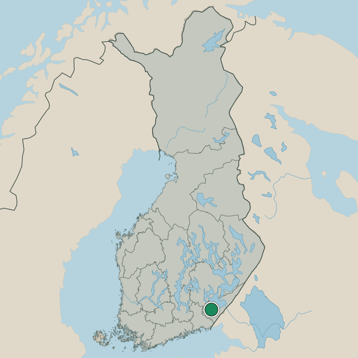
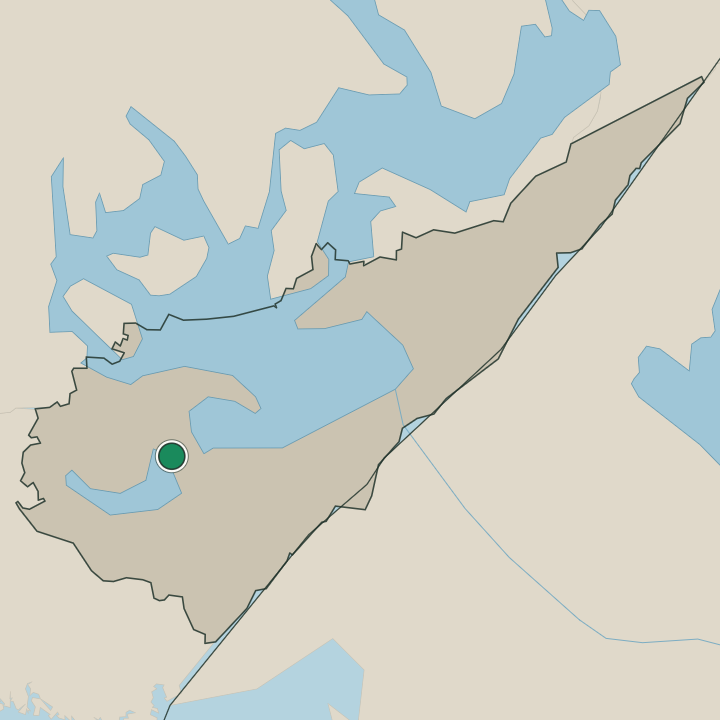
Where is Lemi?
Lemi lies in south-eastern Finland, in the lake country of South Karelia. Water breaks the land everywhere. Lakes and forested ridges fill the municipality, with steep cliffs such as those at Haukkasaaren kalliomaalaus and Venäinniemen kalliomaalaus dropping straight to the water, while the church village sits on firmer ground around Lemin kirkko.
The eastern frontier of Finland runs not far off, and the Salpalinja was set across this borderland of woods and lakes.
What is the climate of Lemi?
Lemi has the cold inland winters and short summers of eastern lake Finland. The lakes that fill South Karelia freeze through long, dark months of deep snow, locking the painted cliffs and the forests of the Salpalinja under ice. Spring is slow to arrive.
The thaw frees the water below cliffs such as Venäinniemen kalliomaalaus, and brief, bright summers draw people onto the lakes and out around Lemin kirkko while the long northern light holds.
How do you get to Lemi?
Reaching Lemi means driving the roads of South Karelia. The municipality has no station of its own, so most visitors come by car along the regional roads that wind between the lakes of south-eastern Finland. Buses serve the village too.
From the wider region the route runs in to the church village around Lemin kirkko, the nearest base for the bunkers of the Salpalinja and the rock-painting cliffs spread across the surrounding lakeland.
Where Lemi sits
Boundaries © geoBoundaries (CC BY) & Wikidata (CC0); water & neighbours: Natural Earth.