Norway · Innlandet
Where to Stay in Kirkenær, Innlandet


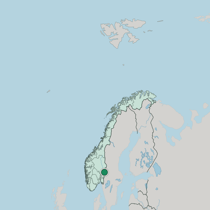
Kirkenær is a village on the river Glomma in south-eastern Norway, in Innlandet.
Find your area →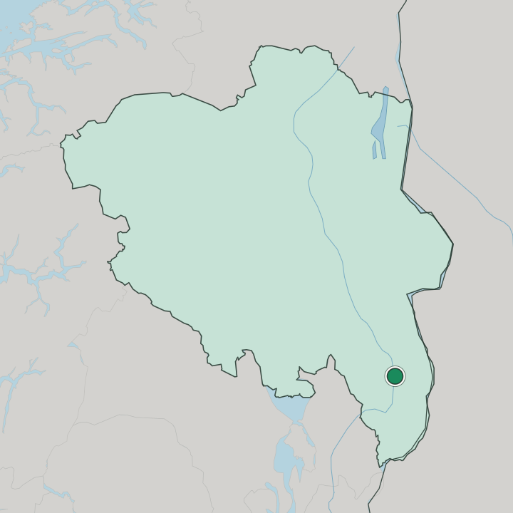
Where to stay in Kirkenær
Not every neighbourhood fits every trip — here's what each one is good for.
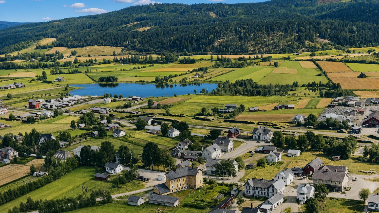
Most beds in Kirkenær gather in the village centre near Grue kirke, where guest rooms and small inns stand within a short walk of the shops, the rail halt and the bank of the river Glomma. The centre suits visitors who want the church and the riverside on the doorstep. The village centre makes the obvious place to stay.
Out by Grue stadion and the road running along the Glomma, roadside rooms take in travellers passing through the Solør valley between the southern towns and the forests north. Those rooms suit a short stay. Up the river toward Namnå and down toward Grinder, farm stays and forest cabins spread among the holdings of Grue Municipality, a quiet base for walkers and anglers working the woods and the water.
Beds thin away from the centre. Reserve ahead in summer, when the river and the forest country draw visitors to this corner of Innlandet.
About Kirkenær
What is Kirkenær known for?
Kirkenær is the administrative centre of Grue Municipality, set on the eastern shore of the river Glomma in the Solør forests. Grue kirke stands as the chief landmark, the parish church that gives the village its name and its old centre. The river runs the district.
Grue stadion lies near the village for sport, and between the church, the ground and the road that follows the Glomma north toward Namnå and south toward Grinder, Kirkenær serves the scattered forest farms of this south-eastern corner of Innlandet.
What are the main landmarks in Kirkenær?
Grue kirke is Kirkenær's chief sight. The parish church stands at the old centre on the eastern shore of the river Glomma, the building that gave the village its name. The village keeps a sports ground of its own as well.
Grue stadion lies near the village for the games of the district, while the river itself, running down the Solør valley past Namnå and Grinder, is the great natural mark of this south-eastern corner of Innlandet, the line along which the whole settlement is set.
What is the history of Kirkenær?
Kirkenær grew on the eastern shore of the river Glomma in the forest country of Solør. The farms of the district lay strung along the river and the woods, and Grue kirke gathered the parish to the bank where the village would rise, the church that lent the place its very name. The river carried the trade.
Timber floated down the Glomma and the road ran beside the water between the villages of Namnå and Grinder, drawing shops and lodgings to the centre that became Kirkenær. The settlement settled into its role as the centre of Grue Municipality. Trade, the rail and the administration of the district gathered by the river, the place where the forest parishes came together, and Grue stadion was laid out near the village for the games of the community.
The Glomma kept its hold on the life of the place, the great river of the eastern interior running on past the houses, and Kirkenær held its place as the hub for the scattered farms of this south-eastern corner of Innlandet.
Where is Kirkenær?
Kirkenær lies on the eastern shore of the river Glomma in the Solør forests, in the south-eastern part of Innlandet, in south-eastern Norway. The village stands by the water where the road runs north toward Namnå and south toward Grinder, the centre gathered near Grue kirke. Woods press in along the river.
Grue Municipality reaches across the forest and the farms on both banks of the Glomma, taking in the scattered holdings and the long river valley that runs through the district around Kirkenær.
What is the climate of Kirkenær?
Kirkenær has the cold, continental climate of the inland river valley. Winters run hard and snowy along the Glomma, frost gripping the river and the forests around the village through the long dark months under the inland sky. The summer is brief.
The woods and the water hold the heat of the long northern days, the air mild over the river valley toward Namnå and Grinder, when the late daylight falls on the bank by Grue kirke in this corner of Innlandet.
How do you get to Kirkenær?
Kirkenær sits on the rail line and road running up the Solør valley beside the river Glomma. Trains stop in the village near Grue kirke on the route through the forest country, the chief link for travellers without a car. Many arrive by road.
The valley road carries drivers through Kirkenær between Namnå to the north and Grinder to the south along the Glomma, while the wider airports of Innlandet and the southern lowlands handle the longer journeys into this forest corner of the county.
More cities in Innlandet
Updated July 2026