Bangladesh
Rangpur Division, Bangladesh — Towns & Travel Guide


Rangpur Division is the northernmost of Bangladesh, a flat farming country between the Teesta and Jamuna rivers.
About Rangpur Division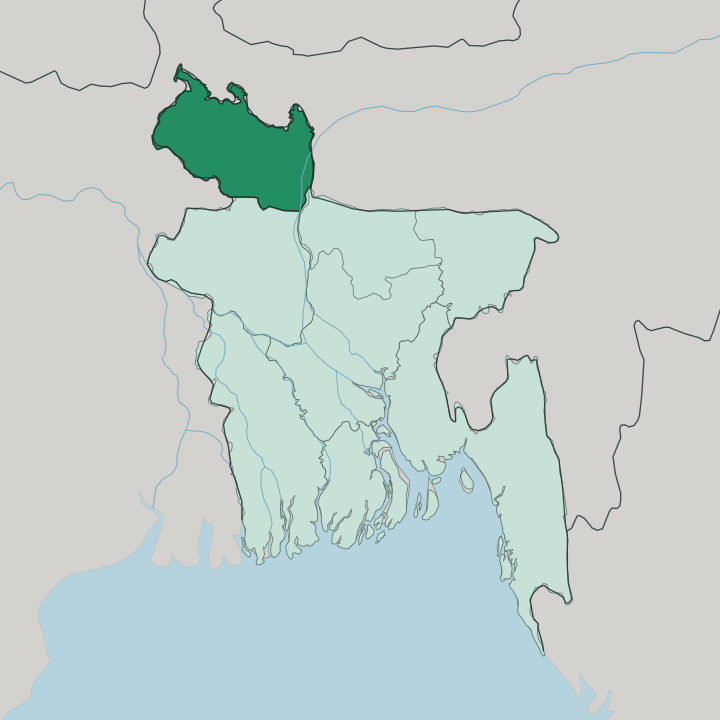
Towns & cities in Rangpur Division
Pick a town or city — each links to where to stay.
Rangpur City is the practical base. As the divisional headquarters it holds the widest choice of rooms, and everything from the Teesta Barrage to the highway south lies within easy reach of it. Saidpur is the convenient arrival point, sitting beside the division's only airport out in Nilphamari.
Dinajpur suits anyone drawn to the terracotta Kantajew Temple and the lychee orchards around it. Beyond those three towns, out in the villages between the Teesta and the Jamuna, hotels thin out fast. Fly into Saidpur; sleep in Rangpur City.
About Rangpur Division
This is Bangladesh at its most agricultural.
What is Rangpur Division known for?
Rangpur Division grows much of the country's rice, potatoes and sugarcane, and Dinajpur earns its old name as the granary of Bengal. Few foreign travellers come. Those who do find the Kantajew Temple near Dinajpur, a terracotta shrine covered in carved panels, and the plaintive Bhawaiya songs that the cart drivers of the north once sang across these fields.
Rangpur City anchors it all as the divisional headquarters.
Where is Rangpur Division?
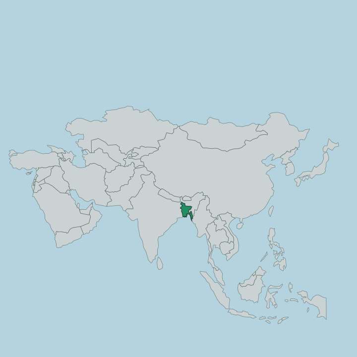
Rangpur Division fills the northernmost corner of Bangladesh, a low farming plain hemmed in by rivers and by India on almost every open side. The Rajshahi and Mymensingh divisions lie to its south. Everywhere else is border.
West Bengal wraps the west, while Assam and Meghalaya press against the east, and the narrow Siliguri Corridor is all that keeps Bhutan and Nepal from touching the division's northern edge. It is a corner of Bangladesh that nearly becomes an island of India. Two rivers give the land its shape.
The Teesta comes down out of the eastern Himalayas and runs through the division before joining the far larger Jamuna, and the Teesta Barrage spreads that water across hundreds of thousands of hectares of rice. The plain is flat. Silt from the two rivers keeps the fields fertile and the horizon wide, broken only by villages, orchards and the occasional brick kiln.
Rangpur City sits near the centre of it, on the Ghaghat, within reach of the Teesta to its north. Eight districts make up the whole, from Panchagarh in the far north-west down to Gaibandha where the Teesta meets the Jamuna.
What is Rangpur Division like?
The culture of the north is a farming culture, tied to the seasons of the paddy and the moods of the Teesta. Its best-known voice is Bhawaiya. These are the songs of the gariyals, the bullock-cart drivers who once hauled goods across the open country, and their verses carry the ache of long distances and the women left waiting at home.
The tunes stretch and dip like the flat land itself. You hear that same longing in the way people here speak of their rivers. Religion has left its mark in brick and terracotta.
The Kantajew Temple near Dinajpur, raised between 1704 and 1752 and once crowned with nine spires before an earthquake took them, remains the great set-piece of Hindu craftsmanship in this part of Bangladesh, every surface worked with scenes of gods, battles and village life. Bengali is the everyday language, spoken here in the distinct Rangpuri manner of the north. Daily life still turns on the field, the orchard and the river.
Dinajpur's lychees and mangoes are prized across the country, and the potato harvest of the plain feeds kitchens far to the south. It is an unhurried, deeply rural place.
What is the history of Rangpur Division?
As an administrative unit Rangpur Division is young, carved out of the Rajshahi Division in 2010 to become the newest of Bangladesh's divisions. The land it covers is far older. Rangpur fell to the armies of the Mughal emperor Akbar in the sixteenth century and was drawn fully into the empire by 1686, and under British rule the plain grew indigo, the dye whose name some link to the town itself.
The temples and towns came long before the modern border ever did.
What is the climate of Rangpur Division?
Rangpur Division has a humid subtropical climate ruled by the monsoon. Rain arrives in force from June to September, when most of the year's downpour falls at once and the Teesta swells enough to flood the low fields along its banks. Winters are dry.
From December to February the plain turns mild and comfortable, the pleasant window when the north is easiest to travel. Spring beforehand brings hot, thundery afternoons.
How do you get to Rangpur Division?
Most travellers come up from Dhaka. Saidpur Airport in Nilphamari is the only airport in the division, and daily flights from the capital make it the fastest way in, cutting a long overland journey to under an hour. Trains and buses run north too.
The railway junction at Saidpur and the highways into Rangpur City tie the north to Dhaka and the rest of Bangladesh, though the road climbs slowly through the plain and takes the better part of a day.
Updated July 2026