Bangladesh
Sylhet Division, Bangladesh — Towns & Travel Guide


Sylhet Division is Bangladesh's tea country in the far north-east, where hills, rivers and haor wetlands meet the Meghalaya border.
About Sylhet Division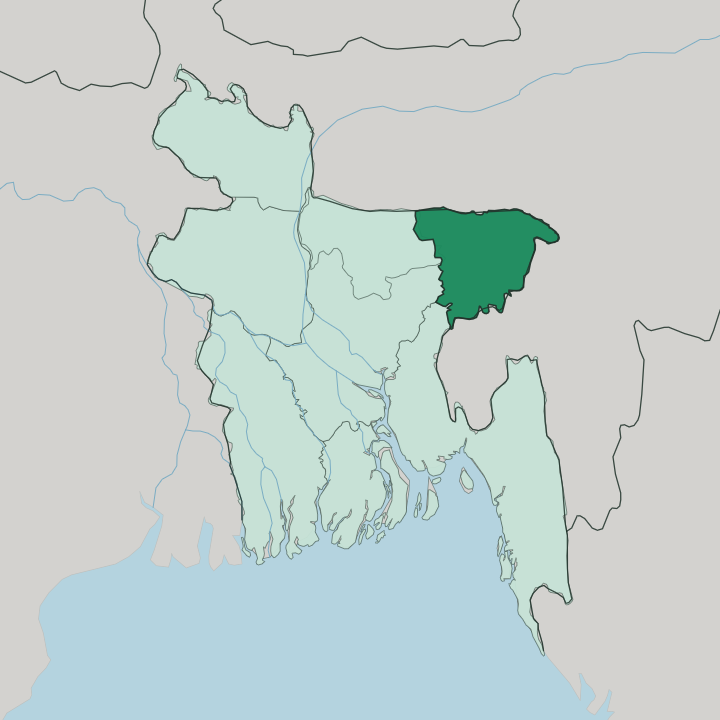
Towns & cities in Sylhet Division
Pick a town or city — each links to where to stay.
Sylhet city is the natural base. It is the divisional capital on the Surma River, the point most trips begin, and the home of the shrine that draws pilgrims year-round. For tea country, travellers head south to Sreemangal in Moulvibazar District, where estate bungalows and small lodges sit among the gardens.
Sunamganj launches the houseboats. Choose Sylhet city for the shrine of Shah Jalal and easy connections; choose Sreemangal for the tea gardens and forest; choose Sunamganj when you want a night on the water among migratory birds.
About Sylhet Division
Tea, above all.
What is Sylhet Division known for?
Most of Bangladesh's tea gardens grow on the slopes of Sylhet Division, and Sreemangal in the south is the country's tea capital. The region is also the spiritual heart of Muslim Bangladesh, drawing pilgrims to the shrine of the fourteenth-century Sufi saint Shah Jalal in Sylhet city. Beyond the estates lie the haors, vast bowl-shaped wetlands that flood into inland seas each monsoon before the water drains and the rice comes in.
Where is Sylhet Division?
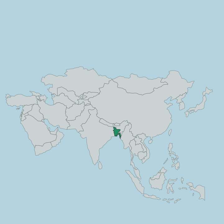
Sylhet Division fills the north-eastern corner of Bangladesh, wrapped on three sides by India. Meghalaya rises along its northern edge, Assam presses against the east, and Tripura sits to the south. The land is a broad lowland called the Surma Valley, named for the river that threads through it.
That river, the Surma, is born where the Barak comes down out of India and splits at the border into two channels; the northern arm is the Surma and the southern arm the Kushiyara, and the pair rejoin far downstream to become the Meghna. Between the rivers spread the haors, enormous saucer-shaped depressions that hold monsoon water like inland seas and shrink back to farmland in the dry months. Ridges of low hills fringe the valley along the foot of the Meghalaya plateau, and streams tumble off those hills carrying stone that villages quarry along the border.
Four districts make up the division. Sylhet holds the capital city, Moulvibazar carries most of the tea country to the south, Habiganj lies to the south-west, and Sunamganj spreads its wetlands across the north-west. It is a green, water-laced land.
Rivers, tea slopes and flood basins define almost every part of it.
What is Sylhet Division like?
Faith shapes the character of Sylhet Division more than any other single thread. The shrine of Shah Jalal, the Sufi who arrived in the fourteenth century and is credited with spreading Islam here, makes the region the spiritual capital of Bangladesh, and pilgrims come to Sylhet city all year. That devotional current runs alongside a distinct local tongue.
People speak Sylheti, a form of Bengali strong enough that its speakers carried it far abroad, and standard Bengali remains the language of school and government across the division. Few regions send more emigrants. Generations of families settled in Britain, and money sent home built mosques, markets and the tall houses that stand in villages across the region.
The tea estates add another layer to the culture. Labourers brought from central India during colonial times settled the gardens and kept their own languages and festivals, and hill communities such as the Khasi and the Manipuri farm and weave along the Meghalaya fringe. Food leans toward the fiery and the pickled, with dried fish and satkora citrus flavouring the curries.
It is a region proud of its difference. Sylhet feels its own place, tied to Bengal by language yet marked by the shrine, the diaspora and the gardens.
What is the history of Sylhet Division?
Sylhet's recorded history turns on the year 1303, when the Sufi saint Shah Jalal and his companions helped defeat the local Hindu raja and opened the region to Islam. Muslim rule and then the Mughals followed. Under the British the town was tied to Assam rather than Bengal, an administrative quirk that lasted decades even though its people spoke a Bengali tongue.
A referendum in 1947 sent most of Sylhet into East Pakistan, and it became part of Bangladesh at independence in 1971. The modern division was carved out in 1995.
What is the climate of Sylhet Division?
Sylhet Division is the wettest part of Bangladesh. It sits where warm monsoon air slams into the foothills below the Meghalaya plateau, wringing out enormous rains from June into October and filling the haors until the flat country turns to inland sea. Villages near the hills catch some of the heaviest downpours in South Asia.
Come in the dry, cooler months. Between November and February the wetlands recede and the tea slopes stay green, which is the time to travel. Flash floods off the hills can strike early.
How do you get to Sylhet Division?
Most visitors reach Sylhet Division by air or rail from Dhaka. Osmani International Airport serves Sylhet city with domestic flights and connections from the Gulf, a route kept busy by the region's large diaspora abroad. Trains climb up from the capital.
They run through the tea country of Moulvibazar and Habiganj, tracking the line of the Surma into the hills. Overland from India, the border crossing at Tamabil below the Meghalaya hills links the division to the road for Shillong. River boats do the rest.
Updated July 2026