Bangladesh
Mymensingh Division, Bangladesh — Towns & Travel Guide


Mymensingh Division fills north-central Bangladesh, a plain of paddy and old river channels below the Garo Hills border with India.
About Mymensingh Division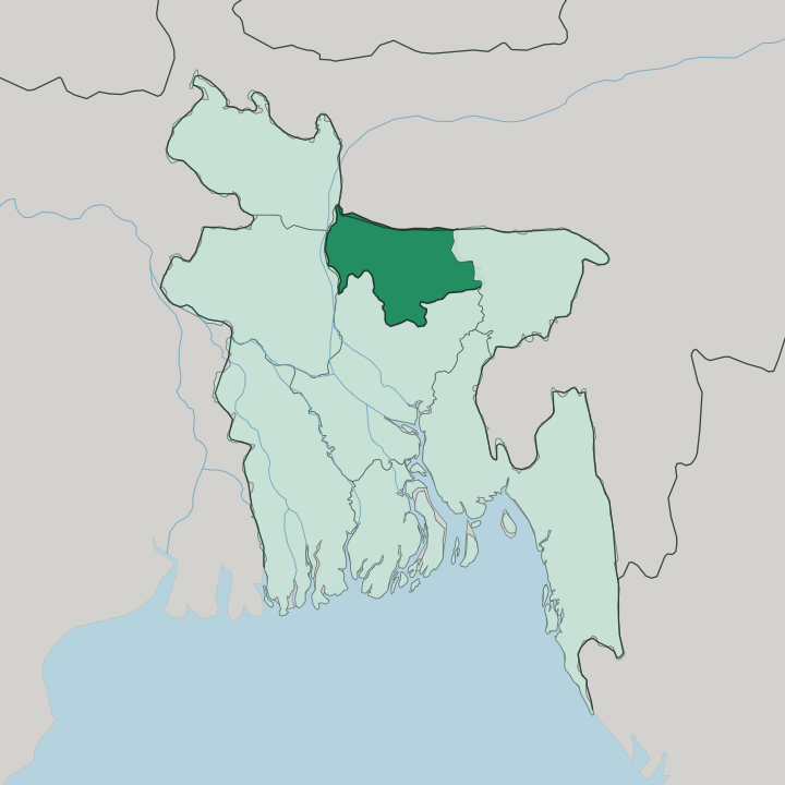
Towns & cities in Mymensingh Division
Pick a town or city — each links to where to stay.
Base yourself in Mymensingh city. It holds the division's headquarters, its railway junction, and nearly all of its hotels, and it sits on the Old Brahmaputra within reach of the Shashi Lodge and the Bangladesh Agricultural University campus. For the Garo hill country, travellers push north to Birishiri in Netrokona District, where simple guesthouses put you beside the Someshwari River and the Durgapur slopes.
Jamalpur and Sherpur see little overnight tourism and thin lodging. Choose the city for comfort and connections; choose Birishiri when the point of the trip is the hills and the villages beneath them.
About Mymensingh Division
This is farm country, not a tourist trail.
What is Mymensingh Division known for?
Mymensingh Division is a young division, carved in 2015 from the northern reach of Dhaka Division, and it draws far fewer travellers than the capital or the tea hills of Sylhet to the east. What pulls people here is the Garo hill edge in the north, where the Someshwari River runs clear past the ceramic-white slopes at Birishiri and the indigenous Garo villages along the Meghalaya border. The rivers set the tone.
Mymensingh city anchors the plain, sitting on the bank of the Old Brahmaputra with its zamindar palaces still standing.
Where is Mymensingh Division?
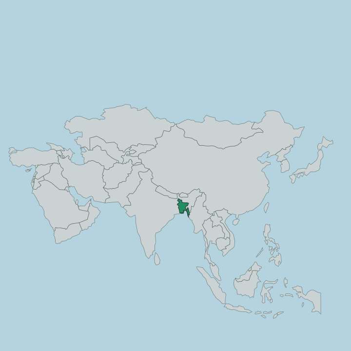
Mymensingh Division spreads across north-central Bangladesh, an alluvial plain built up by shifting rivers. It borders the Indian state of Meghalaya along its northern edge, where the flat farmland runs up against the Garo Hills. Rangpur Division lies to the west, Sylhet Division to the east, and Dhaka Division to the south, out of which this division was carved in 2015.
The land is low and wet. Its four districts are Mymensingh, Jamalpur, Netrokona, and Sherpur, together covering roughly ten thousand square kilometres of paddy, wetland, and river channel. Water has done most of the shaping here.
The Old Brahmaputra threads southeast through the plain, entering near the Jamalpur and Sherpur boundary and running past Mymensingh city, and it is only the older, quieter course of a river that once carried the full Brahmaputra flow. That main flow broke west toward the Jamuna in the late eighteenth century, leaving the old channel behind. In the north the Someshwari drops out of the Garo Hills at Durgapur, running clear over sand and pale clay before it fades into the wetlands.
The result is a division defined by its rivers rather than any coast or ridge.
What is Mymensingh Division like?
Two worlds meet along the northern border. The plain is Bengali and Muslim in the main, its life ordered by the paddy calendar and the market towns, and Bangla is the everyday language across the four districts. Up against the Garo Hills the picture changes.
The indigenous Garo people, a Tibeto-Burman group who spilled south from Meghalaya, hold villages through Haluaghat, Durgapur, and the hills around Birishiri, and theirs is one of the few matrilineal societies left in the world, where property and clan name pass down the mother's line. Australian Baptist missionaries reached these communities in the late nineteenth century and set up a mission at Birishiri, and many Garo households have been Christian since. The division carries a strong folk memory too.
Its old ballads, the Mymensingh Gitika, were gathered from village singers across this countryside and stand among the best-known folk collections in Bengali. Each autumn the Garo mark Wangala, a hundred-drum harvest thanksgiving, at Durgapur and Birishiri. It is a working landscape, not a polished one.
What you find is village life carried on much as it has been for generations, from the mosque-and-market rhythm of the plain to the drums and clan gatherings of the hills.
What is the history of Mymensingh Division?
As a division, Mymensingh is new. It was formed in 2015 from the four northern districts of Dhaka Division, giving the greater Mymensingh region its own administrative centre for the first time. The land itself is old.
Mymensingh city grew as a district seat under British rule in the nineteenth century, and the wealthy zamindar families of that era left the palaces and lodges that still stand along the Old Brahmaputra. Its river geography changed in living memory too, when the Brahmaputra's main flow swung west to the Jamuna around 1787 and left the channel through Mymensingh as a lesser stream.
What is the climate of Mymensingh Division?
The division sits in the tropical monsoon belt, and the year splits sharply into wet and dry. Summers are hot and heavy. From May the rains sweep up off the Bay of Bengal, and June and July drop the bulk of the year's water across the plain, swelling the Old Brahmaputra and the Someshwari and flooding low paddy ground.
Winters run mild and dry, cool enough at night in December and January to want a blanket. The comfortable months to travel are those cool, drier ones, roughly November through February, before the pre-monsoon heat builds again.
How do you get to Mymensingh Division?
Most travellers come up from Dhaka. The capital lies roughly 120 kilometres to the south, and Bangladesh Railway runs trains north to the Mymensingh Junction station several times a day, a ride of about three hours through the paddy country. Buses cover the same route by road.
There is no commercial airport in the division, so the nearest air arrival is Dhaka. From Mymensingh city, local buses and hired cars carry on north to Birishiri and the Garo hill villages, and west toward Jamalpur and Sherpur.
Updated July 2026