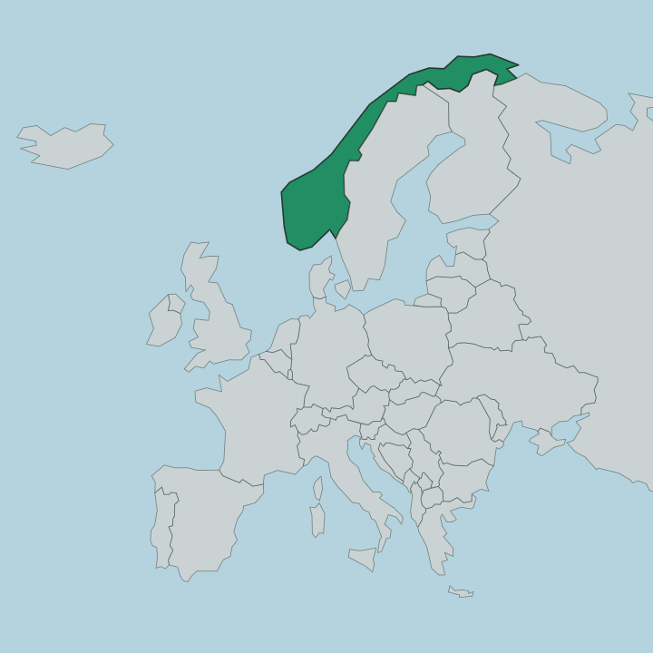
Norway · Nordland
Where to Stay in Mo i Rana, Nordland


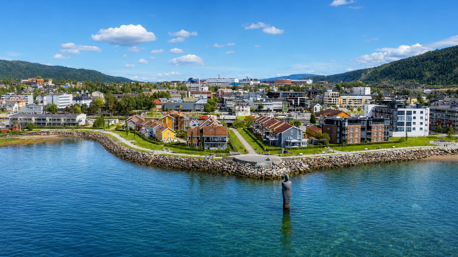
Mo i Rana is the administrative centre of Rana, an inland town in the Helgeland region of northern Norway.
Find your area →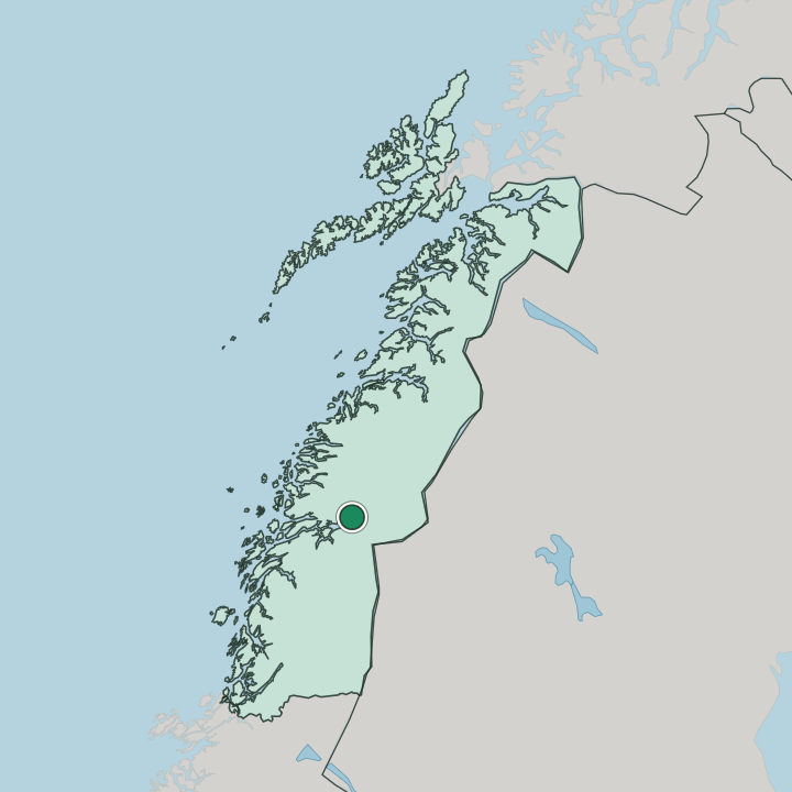
Where to stay in Mo i Rana
Each area has its own feel; here's who each one suits.
The centre gathers the rooms. Mo i Rana keeps its hotels in the compact downtown around Mo Church and the railway station, the easiest base for the town and the surrounding Rana valley, and it suits a stay when you want the shops, the line south, and the fjord head within a short walk. Stay central and the town is at hand.
The suburbs ring the core. South-east toward Gruben, the streets around Gruben Church climb away from the centre into a residential quarter on higher ground. East across the river, Selfors and its church sit on the far bank, while Ytteren and Båsmoen spread north toward the fjord mouth.
Out toward the slopes, the Munklia Hoppsenter ski jump and Sagbakken stadion mark the sports edge of town. Pick the centre for the trains, the suburbs for the quiet ground.
Things to do in Mo i Rana
Ranked by global recognition; descriptions from Wikidata (CC0).
Churches & Religious Sites
3- Mo kirke Heritage
- Gruben kirke Heritage
- Selfors kirke church in Rana
Stadiums & Sports
3- Fageråsbakken
- Sagbakken stadion
- Ranahallen
worth knowingacross 2 categories in Mo i Rana
About Mo i Rana
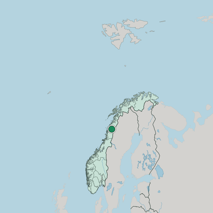
Mo i Rana sits just south of the Arctic Circle.
What is Mo i Rana known for?
The second town of Nordland and the centre of Rana, it grew as an industrial place set well inland at the head of a fjord in the Helgeland region, ringed by mountains rather than open coast. Mo Church anchors the older core. Around it the town spreads into its suburbs of Gruben, Selfors, and Ytteren, each with its own church or hall.
An inland working town below the Circle.
What are the main landmarks in Mo i Rana?
The churches mark the suburbs. Mo Church stands at the heart of the old town, a listed building in the centre of Rana, while Gruben Church and Selfors Church serve the outlying quarters on either side of the river. Sport claims what is left of Mo i Rana.
The Munklia Hoppsenter and Fageråsbakken ski jumps sit on the slopes above town, and Ranahallen and Sagbakken stadion carry the indoor and outdoor games of this inland Helgeland town below the Arctic Circle.
What is the history of Mo i Rana?
Mo i Rana took its city title in the 20th century. The town gained that standing in 1997 at the head of the fjord in the southern part of Nordland, though the settlement around Mo Church had long served the farming and trading life of the Rana valley in the Helgeland region. Its beginnings lay in trade.
The old market place by the water grew on goods moving in and out of the inland district before the modern town existed. Industry remade the place in the modern age. A large ironworks built up at the head of the fjord pulled in workers and pushed the town outward into new suburbs, raising Gruben and Selfors with their own churches as the population spread up the valley sides and across the river.
The ski jumps of Munklia Hoppsenter and the halls of Ranahallen followed for the growing town. From a market settlement around Mo Church, Mo i Rana became the second town of Nordland and the working centre of Rana.
Where is Mo i Rana?
Mo i Rana lies well inland. The town sits at the head of a long fjord in the southern part of Nordland, the Helgeland region, where the water reaches deep among mountains and the built-up ground spreads up the valley away from the shore. Peaks close it in.
A river runs through the centre between the old town around Mo Church and the suburb of Selfors on the far bank, while Gruben climbs the higher ground south-east and Ytteren stretches north toward the open fjord mouth.
What is the climate of Mo i Rana?
Mo i Rana has a sharp inland climate. The town's deep position at the fjord head in Helgeland, away from the moderating open sea, gives it colder and snowier winters than the coast of Nordland keeps. Snow lingers on the slopes.
The ski jumps above Gruben hold their cover well into spring, while the short subpolar summer just south of the Arctic Circle brings long bright days to the valley around Mo Church before the dark returns.
How do you get to Mo i Rana?
The railway reaches the fjord head. Mo i Rana sits on the line that runs north up Nordland, with its station in the centre near Mo Church, and an airfield outside town carries flights into the Helgeland region. Roads follow the valley.
The north-south highway threads the Rana valley past Selfors and Gruben, linking the town to the rest of the county, while the fjord opens a sea route out toward the coast. Most arrivals come by train or road through the valley.
Good for
More cities in Nordland
Updated July 2026