Ukraine
Mykolayiv Oblast, Ukraine — Towns & Travel Guide


Mykolayiv Oblast is a shipbuilding region of southern Ukraine, where the Southern Bug meets the Black Sea steppe.
Find your area →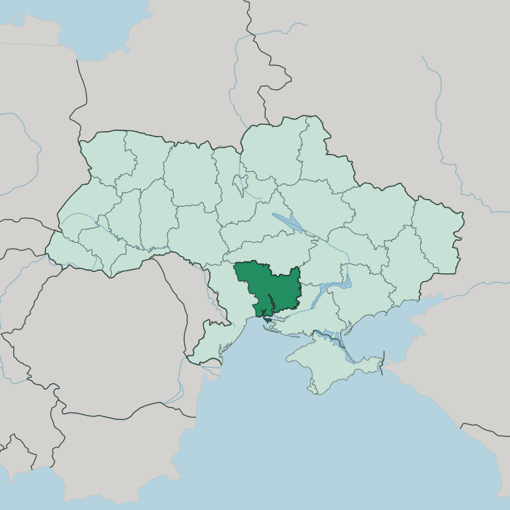
Towns & cities in Mykolayiv Oblast
Pick a town or city — each links to where to stay.
 Ukraine
Mykolayiv
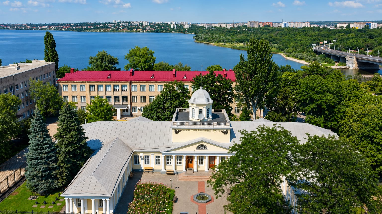
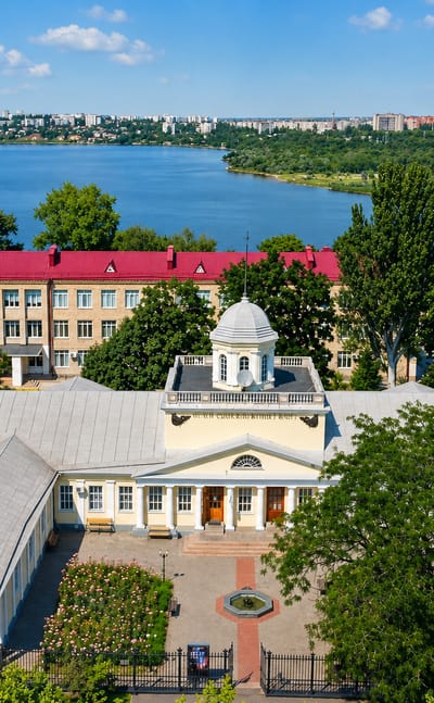
Ship cranes stand over the water at Mykolaiv, a port and shipbuilding city in southern Ukraine and the seat of Mykolaiv Oblast, founded in 1789.Where to stay →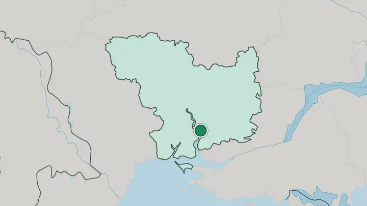
About Mykolayiv Oblast
This is shipbuilding country.
What is Mykolayiv Oblast known for?
Mykolaiv, the capital, grew up around imperial shipyards founded in 1789 at the point where the Inhul joins the Southern Bug, and the trade still marks the city. Beyond the yards, the region is flat grain-growing steppe running down to the Black Sea. Its coast holds the ruins of Pontic Olbia, a Greek colony older than most cities in Ukraine, and the fishing town of Ochakiv guards the mouth of the estuary.
Where is Mykolayiv Oblast?
Mykolayiv Oblast lies in southern Ukraine, spread across the Black Sea Lowland north of the coast. The terrain lies low and level. It is open, grain-growing steppe that slopes gently toward the sea, broken only by river valleys and the spurs of the Podolian and Dnieper uplands reaching in from the north.
The Southern Bug is the defining line. It cuts the oblast into an eastern and a western half as it runs down its final stretch toward the Black Sea, and at the city of Mykolaiv the Inhul joins it from the north. Below that confluence the combined water widens into the long Dnieper-Bug estuary before reaching the open sea.
The coast is the region's other edge. Sandbars and shallow inlets line it, and the Kinburn Peninsula reaches out as a low sandy spit of salt lakes and planted pine, dividing the estuary from the sea. Ochakiv sits at the estuary mouth, and Berezan Island lies offshore.
Kirovohrad Oblast borders the region to the north, Odesa to the west, Kherson and Dnipropetrovsk to the east. Only the Black Sea closes it to the south.
What is Mykolayiv Oblast like?
The region thinks of itself through ships. Mykolaiv was built in 1789 as a naval yard, and generations of engineers, welders, and sailors gave the capital an industrial, working identity that still frames how the place sees itself. That maritime culture shows in the museums of shipbuilding, the astronomical observatory, and streets laid out in the grid a naval town needs.
Ukrainian is the everyday language, spoken alongside Russian in a port that drew people from across the old empire. But the region reaches much further back than the yards. On the estuary near Parutyne stand the ruins of Pontic Olbia, founded by Greek colonists from Miletus in the seventh century BC and lived in for roughly a thousand years.
Its walls, cellars, and lapidarium of carved stones sit in open steppe above the water. That layering is the local character. A young imperial shipyard, an ancient Greek port, and the wide Black Sea grain steppe all belong to the same short drive.
What is the history of Mykolayiv Oblast?
The land here changed hands for centuries. Greek Olbia traded on the estuary from the seventh century BC, and the Ochakiv fortress later guarded the same waters for the Crimean Khanate and the Ottomans. Russia took the coast after the Russo-Turkish wars, and Prince Potemkin founded Mykolaiv as a shipyard in 1789 to arm the new Black Sea fleet.
The oblast in its present borders was drawn much later, established in 1937 under Soviet Ukraine.
What is the climate of Mykolayiv Oblast?
The steppe here runs dry and warm. Summers are hot and arid, the grain fields baking under long clear spells, while winters stay mild and bring little snow. Rain is sparse and falls unevenly across the year, which is why the Southern Bug and its reservoirs matter so much to the farms and to the city of Mykolaiv.
The Black Sea softens the coast, keeping Ochakiv and the Kinburn Peninsula a shade milder than the open steppe inland.
How do you get to Mykolayiv Oblast?
Mykolaiv is the hub. The capital sits at a road and rail junction and has its own river and sea ports on the Southern Bug, so most arrivals pass through it first. From there roads run north up the river valley through Voznesensk and Pervomaisk toward the Kirovohrad border, and south to Ochakiv and the coast.
The estuary and the Black Sea close off the region below, so overland routes come in from the neighbouring oblasts.
Updated July 2026