Ukraine
Kharkiv Oblast, Ukraine — Towns & Travel Guide


Kharkiv Oblast fills the northeastern corner of Ukraine, a forest-steppe region built around the industrial city of Kharkiv.
Find your area →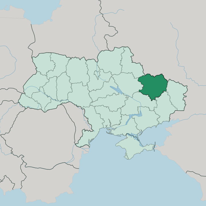
Towns & cities in Kharkiv Oblast
Pick a town or city — each links to where to stay.
 Ukraine
Kharkiv
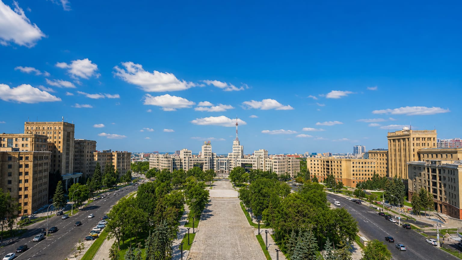
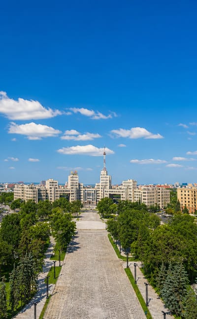
Three rivers gather on a hilly plain at Kharkiv, the second-largest city in Ukraine, known for Freedom Square and the Cathedral of the Assumption.Where to stay →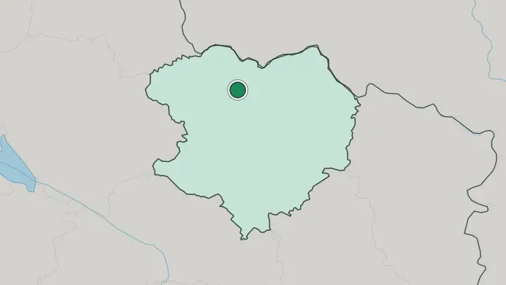
About Kharkiv Oblast
Kharkiv is the anchor.
What is Kharkiv Oblast known for?
The oblast's capital was the first capital of Soviet Ukraine from 1919 to 1934, and its Freedom Square carries the Derzhprom, a Constructivist office complex finished in 1928 that was among the tallest structures in the Soviet Union. Universities define the mood. V. N. Karazin University, founded in 1805, made the city a centre of learning long before the factories arrived.
Beyond the capital the land is farmland, chernozem black earth worked for grain, threaded by the Siverskyi Donets and its sandy pine terraces.
Where is Kharkiv Oblast?
Kharkiv Oblast occupies the northeastern edge of Ukraine, its northern border running along the frontier with Russia. The land is not flat everywhere. Its northern reach lies on the Central Russian Upland, the western half drops into the Dnipro Lowland, and the southeastern third slopes down into the Donets Lowland.
The Siverskyi Donets is the master river, cutting a broad diagonal across the region from the north toward the southeast, and it collects nearly everything that drains the oblast. Its right-bank tributaries gather the streams that give the capital its name. The Udy, the Lopan and the Kharkiv rivers meet within the city itself.
From the left bank the Oskil comes down out of Russia to join the Donets near Izium. Sandy terraces line those valleys, carrying planted stands of Scots pine that break the otherwise open country. This is forest-steppe fading to steppe.
The northwest keeps patches of oak and lime woodland on dark podzolized chernozem, while the drier southeast is grassland worked for grain, its rivers the only relief in a landscape of fields. Water and black earth together set the shape of the place.
What is Kharkiv Oblast like?
The northern and central parts of the oblast belong to Sloboda Ukraine, the historic frontier region that took shape in the seventeenth and eighteenth centuries when Cossack settlers moved into the wooded steppe. That heritage runs under the modern surface. The wandering philosopher Hryhorii Skovoroda taught poetics at the Kharkiv Collegium and spent his last years in a village of the region, and the painter Ilya Repin was born at Chuhuiv on the Siverskyi Donets.
Learning shaped the character as much as any of that. When the Karazin University opened in 1805, it turned the capital into an intellectual centre, and the tradition carried into the 1920s, when Kharkiv served as the capital of Soviet Ukraine and drew a generation of writers and theatre directors. That decade left its mark in stone.
The Constructivist blocks around Freedom Square date from those years, blunt and monumental. Ukrainian is the common language across the region, spoken alongside Russian in a city long shaped by both. Away from the capital, life follows the farming calendar of the black-earth belt.
Grain, gardens and river towns. The rhythm out there is slower than the university city suggests.
What is the history of Kharkiv Oblast?
The story starts with a fort. Kharkiv began in 1654 as a Cossack stronghold on the Muscovite frontier, guarding the wooded steppe of Sloboda Ukraine against raids from the south. It grew into a market and university town.
Everything sped up when the railway reached the Donets coalfield in 1869 and turned the place into an industrial hub, drawing workers and factories onto the black earth. The revolutionary years made it a capital, and from 1919 to 1934 Kharkiv served as the seat of Soviet Ukraine before that role passed to Kyiv. The oblast was drawn in its modern borders in 1932.
Grain has been worked here ever since.
What is the climate of Kharkiv Oblast?
The oblast has a temperate-continental climate, colder and drier than western Ukraine. Winters bite. January runs well below freezing across the black-earth plains, and snow lies for weeks on the open fields.
Summers are warm and often dry, with July heat over the steppe broken by afternoon storms, and the driest ground lies in the southeast where the rain thins toward the Donets Lowland. Spring can turn dusty when hot winds sweep in off the grassland. Rain, when it comes, favours the wooded northwest.
How do you get to Kharkiv Oblast?
Kharkiv is the way in. The capital sits at the centre of the oblast's transport, a major rail junction since the line to the Donets coalfield opened in 1869, with routes fanning out toward Kyiv, the south and the Russian border to the north. Trains link the capital with Izium and Lozova and the smaller river towns.
Roads follow the same spokes. Most journeys through the region begin in Kharkiv and work outward along the rail lines from there.
Common questions
What is the best area to stay in Kharkiv Oblast?
Kharkiv: first-time visitors to the region.
Updated July 2026