India
Meghālaya, India — Towns & Travel Guide


Meghālaya is India's cloud-wrapped hill state, where monsoon rains carve waterfalls and the Khasi tie tree roots into bridges.
Find your area →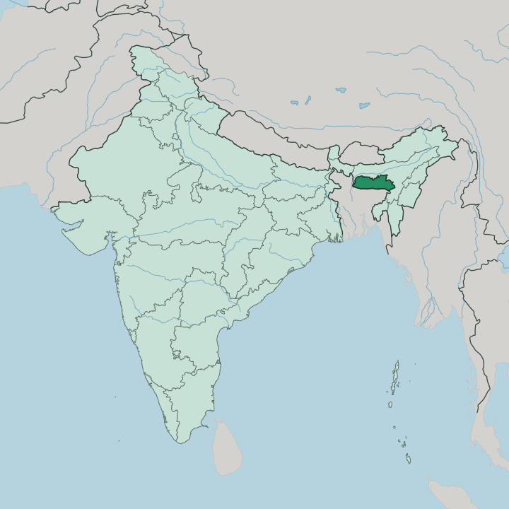
Towns & cities in Meghālaya
Pick a town or city — each links to where to stay.
 India
India
Shillong
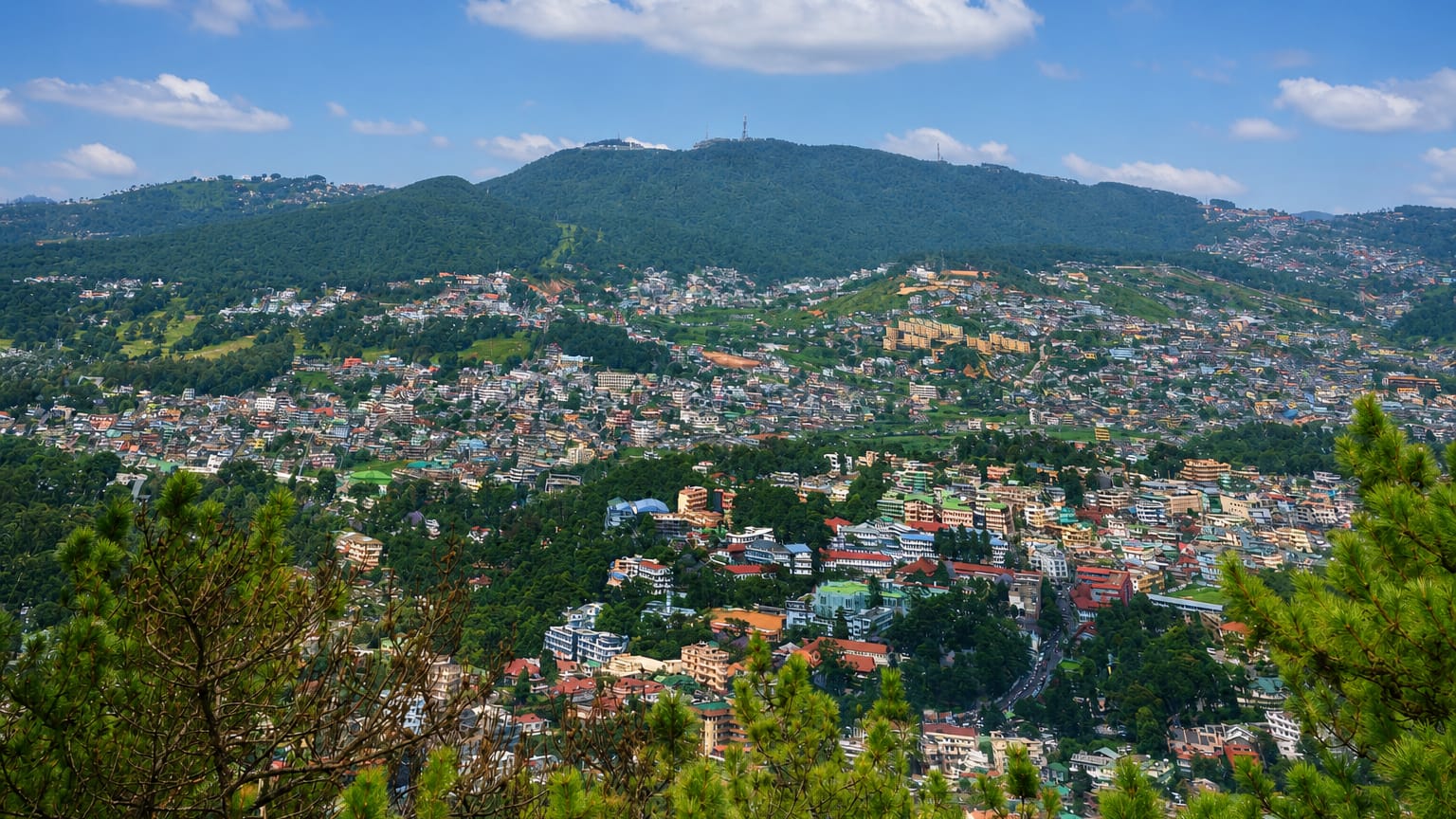
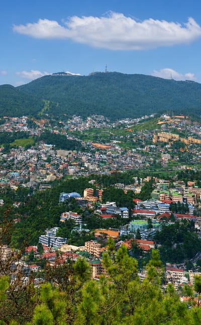
Pine ridges wrap Shillong, a hill station and capital of Meghalaya in the East Khasi Hills, known as the Scotland of the East.Where to stay →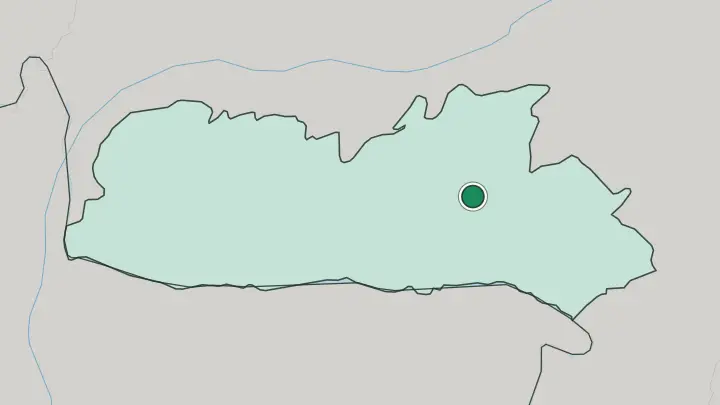
About Meghālaya
Rain defines Meghālaya.
What is Meghālaya known for?
The state sits on a plateau in north-eastern India, and its very name means the abode of clouds. Cherrapunji and its neighbour Mawsynram, both in the Khasi Hills, trade the title of wettest inhabited place on earth year after year. That downpour feeds Nohkalikai Falls, the tallest plunge waterfall in the country, and the crystal-clear Umngot River at Dawki near the border with Bangladesh.
Shillong, the capital, sits high in the hills and serves as the base for almost every visitor.
Where is Meghālaya?
Meghālaya is a small state in north-eastern India, a raised plateau standing apart from the older highlands to its south. Assam wraps around it to the north and east, the plains of that larger state falling away from the hill edge. Bangladesh lies along the whole southern flank. Its lowlands begin right where the escarpment drops.
The plateau splits into three ranges named for the peoples who live on them: the Khasi Hills hold the centre and the capital at Shillong, the Garo Hills rise in the west, and the Jaintia Hills close off the east. The southern rim is the key. It stands as a wall directly in the path of the wet monsoon winds blowing north off the Bay of Bengal.
The land climbs steeply from the Bangladeshi plain to summits well over a thousand metres. Rivers born up here tumble off that southern edge in long falls, Nohkalikai Falls among the tallest of them. One runs south to the border.
That is the Umngot River, which flows down through Dawki and across into Bangladesh. Shillong sits near the plateau's high centre, and from there the ground rolls out across all three hill ranges toward every frontier.
What is Meghālaya like?
Three indigenous peoples give Meghālaya its character. The Khasi and the closely related Jaintia hold the central and eastern hills, while the Garo live in the west, and each keeps its own language, dress and custom. What sets the state apart across all of India is descent through the mother.
Khasi and Garo society is matrilineal. Property and the family name pass down the female line, and the youngest daughter inherits the home and the care of her parents. This is one of the largest matrilineal cultures anywhere on earth.
The most striking thing the Khasi and Jaintia have made is grown, not built. For generations they have trained the aerial roots of the rubber fig across rivers and gorges, coaxing them over decades into living root bridges the local tongue calls jingkieng jri. The double-decker span near Nongriat below Cherrapunji is the best known.
Christianity arrived with British missionaries and now shapes much of daily life, and English stands as one of the state's official languages alongside Khasi and Garo. Music runs strong in Shillong, long a centre for the guitar and the choir. Markets, festivals and clan gatherings still hold the older world together.
What is the history of Meghālaya?
The hills long stood apart. For most of its recorded past the plateau lay outside the plains states around it, and the Khasi, Jaintia and Garo ruled their own small chiefdoms until the British reached the highlands in the nineteenth century. The colonial administration disliked the drenching climate of Cherrapunji and moved its headquarters to cooler Shillong.
That town grew into the capital of the whole Assam province. After independence the hill peoples pressed for a state of their own, peacefully and by petition rather than by revolt. In 1972 Meghālaya was cut out of Assam as a full state, its three hill regions joined under one government at Shillong.
What is the climate of Meghālaya?
Meghālaya is built around the monsoon. Wet winds sweep north off the Bay of Bengal across the Bangladeshi plain and strike the southern wall of the Khasi Hills, rising, cooling and dumping their water in torrents from June to September. That orographic squeeze is why Cherrapunji and Mawsynram record rainfall found almost nowhere else on the planet.
The high plateau tempers the heat, so Shillong stays mild and cool where the plains below bake. Winters are dry and pleasant, the clouds gone and the hills sharp.
How do you get to Meghālaya?
Most travellers reach Meghālaya through Assam. No railway runs into the hills, so the nearest big station and the main airport both sit at Guwahati, in the plains state to the north. From there it is a road climb of roughly three hours up to Shillong, by shared taxi, bus or the occasional helicopter hop.
A small airstrip at Umroi outside the capital takes a handful of flights. Once you are on the plateau, road is the only way on to Cherrapunji, Dawki and the villages, and the mountain routes are slow.
Common questions
What is the best area to stay in Meghālaya?
Shillong: a first foothold on the Shillong plateau.
Updated July 2026