Where to stay in Kauhajoki
The right area depends on your trip. Here's who each one suits — pick the place, then the hotel.
Kauhajoki holds a modest stock of beds, a farming town of South Ostrobothnia with most of its rooms in the centre near the Kauhajoen kirkko among the shops and services. The town centre suits first-time visitors, with the church and the Kauhajoen kotiseutumuseo within reach, the easy base for the national park and the wider municipality. Rooms are few here.
Out toward the lake at Nummijärvi, holiday cottages and camp lodging gather by the water, the obvious base for the Nummirock festival and for walks into the bogs of the Kauhaneva-Pohjankankaan kansallispuisto, though they fill fast in the festival week. Farms take guests too. Cottages and farm stays stand across the country near the heritage farmstead of Hämes-Havunen and the old Toikan tila, a quiet base for travellers touring the Ostrobothnia plain of western Finland by car, while others sleep in the larger towns of South Ostrobothnia and drive in for the day.
Book the Nummijärvi cabins far ahead for the festival.
Things to do in Kauhajoki
Ranked by global recognition; descriptions from Wikidata (CC0).
Churches & Religious Sites
4- Nummijärven kirkko Heritage
- Kauhajoen kirkko
- Kauhajärven kirkko
- Kauhajoen adventtiseurakunta
Landmarks & Notable Places
2- Toikan tilan asuinrakennus Heritage house
- Nummirock music fesival
worth knowingacross 2 categories in Kauhajoki
About Kauhajoki
What is Kauhajoki known for?
Kauhajoki is known for the wild bogs of the Kauhaneva-Pohjankankaan kansallispuisto, the national park of open mire and pine ridge that spreads south of this South Ostrobothnia town. Mire and forest define it. The town in western Finland gathers around the Kauhajoen kirkko, and the Nummirock festival at Nummijärvi draws crowds to the lake each summer.
Beyond the park and the music, Kauhajoki is a broad farming municipality, its old life kept in the Kauhajoen kotiseutumuseo and the heritage farmstead of Hämes-Havunen on the Ostrobothnia plain.
What are the main landmarks in Kauhajoki?
The Kauhaneva-Pohjankankaan kansallispuisto is the great landmark of Kauhajoki, a national park of open bog and pine ridge laid across the southern reach of this South Ostrobothnia town. Churches mark the old parishes. The Kauhajoen kirkko, the Kauhajärven kirkko and the heritage Nummijärven kirkko stand across the municipality, while the Kauhajoen kotiseutumuseo keeps the local past, the heritage farmstead of Hämes-Havunen preserves an Ostrobothnia farm, and the old Hämeenkankaan- ja Kyrönkankaantie road runs through the western Finnish forest.
What is the history of Kauhajoki?
Kauhajoki grew as a farming parish on the southern edge of the South Ostrobothnia plain. Long a scattered country of farms set among the bogs and pine ridges of western Finland, the settlement gathered its life around the Kauhajoen kirkko, while the old road of the Hämeenkankaan- ja Kyrönkankaantie carried travellers across the heathland to the parishes beyond. Bog and forest shaped the work.
Generations farmed the land and cut the timber, their household life now kept in the Kauhajoen kotiseutumuseo and in the timbered farmstead of Hämes-Havunen on the open plain. The modern town drew its outlying villages together around the centre. The chapel parishes of Kauhajärvi and Nummijärvi kept their own churches, the heritage Nummijärven kirkko among them, as the municipality took its modern shape across the broad Ostrobothnia country.
Mire became a park. The wild bogs to the south were set aside as the Kauhaneva-Pohjankankaan kansallispuisto, and the lake at Nummijärvi grew into the home of the Nummirock festival, as Kauhajoki settled into its role as a farming and forest town of South Ostrobothnia in western Finland.
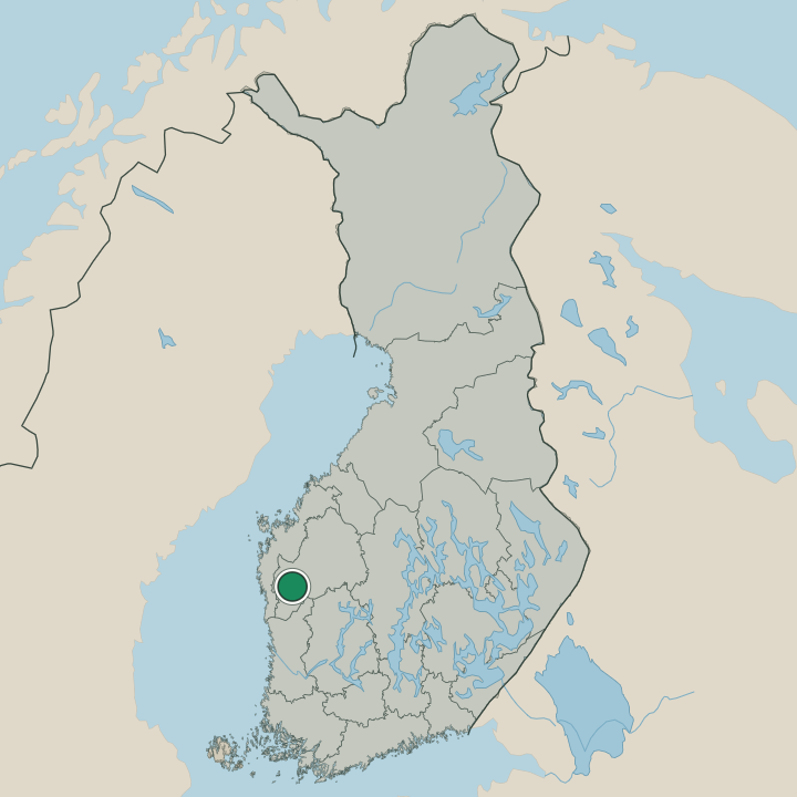
Where is Kauhajoki?
Kauhajoki lies on the southern edge of the South Ostrobothnia plain, in western Finland, where the farmland gives way to bog and pine ridge. Mire spreads to the south. The wide municipality runs from the farms around the Kauhajoen kirkko down to the open wetland of the Kauhaneva-Pohjankankaan kansallispuisto, a country of low ridges, peat bog and forest.
Lakes break the woods. The water at Nummijärvi sits among the pines south of the centre, the level Ostrobothnia landscape of farm, mire and forest that has shaped Kauhajoki since its parish days.
What is the climate of Kauhajoki?
Kauhajoki has a cold inland climate set by the bogs and plains of South Ostrobothnia in western Finland. Winters are long and snowed, the mire of the Kauhaneva-Pohjankankaan kansallispuisto and the fields around the Kauhajoen kirkko lying under deep snow from autumn into the late thaw. Frost holds the bog.
Summers are short and bright, the long northern daylight warming the wetland and the pinewoods around Nummijärvi through the brief season that carries the festival before the snow returns to this corner of western Finland.
How do you get to Kauhajoki?
Kauhajoki sits on the main road across the southern plains of South Ostrobothnia, the route carrying most traffic to the town centre by the Kauhajoen kirkko. A station serves the line. Buses and trains link the town to the wider region, and the roads run south toward the bogs of the Kauhaneva-Pohjankankaan kansallispuisto and the lake at Nummijärvi, while travellers from farther afield reach the larger towns of western Finland by rail or air before driving the last stretch to Kauhajoki across the Ostrobothnia plain.
Where Kauhajoki sits
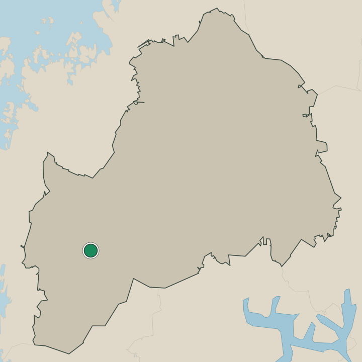
Boundaries © geoBoundaries (CC BY) & Wikidata (CC0); water & neighbours: Natural Earth.