
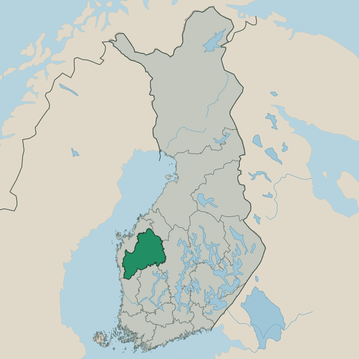
 In Republic of Finland
Where to stay in South Ostrobothnia
The right area depends on your trip. Here's who each one suits — pick the place, then the hotel.
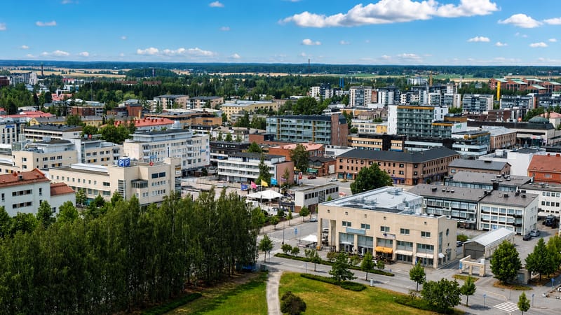
Seinäjoki
4 areasSeinäjoki is the capital of South Ostrobothnia, a railway city on the flat plains of western Finland (Ostrobothnia).Kurikka
Kurikka is a farming and small-industry town in South Ostrobothnia, western Finland, on the Kyrönjoki plain.Kauhava
Kauhava is a farming town in western Finland, in the South Ostrobothnia region, long home to the Lentosotakoulu air force school.Lapua
Lapua is a town in South Ostrobothnia, western Finland, gathered on a river plain around its cathedral.Kauhajoki
Kauhajoki is a town in western Finland, in the South Ostrobothnia region beside the Kauhaneva-Pohjankankaan kansallispuisto.Ilmajoki
Ilmajoki is an old farming parish in South Ostrobothnia, western Finland, on the broad river plain.Alavus
Alavus is a railway town of South Ostrobothnia in western Finland, chartered in 1865 around the Alavuden kirkko.Alajärvi
Alajärvi is a small town in South Ostrobothnia, western Finland, set in the lake-and-field country and home to the Nelimarkka-museo.All towns & cities (22)
Ähtäri
Ähtäri is a town in South Ostrobothnia, in western Finland, set among lakes and forest south-east of Seinäjoki.Alahärmä
Alahärmä is a district of Kauhava in South Ostrobothnia, in western Finland, known for the Powerpark amusement park.Teuva
Teuva is an inland municipality in South Ostrobothnia, in western Finland, in the Ostrobothnia country.Jurva
Jurva is a former municipality of South Ostrobothnia, now part of Kurikka, its parish gathered around the Jurvan kirkko.Isokyrö
Isokyrö is a riverside municipality in South Ostrobothnia, western Finland, known for its old churches and the Levänluhta site.Kuortane
Kuortane is a rural parish in South Ostrobothnia, western Finland, the birthplace of the architect Alvar Aalto.Ylihärmä
Ylihärmä is a former municipality in western Finland, joined to Kauhava in South Ostrobothnia and known for the Powerpark rides.Lappajärvi
Lappajärvi is a lakeside municipality in South Ostrobothnia, western Finland, ringed around its broad namesake lake.Vimpeli
Vimpeli is a small lake-and-farm municipality in western Finland, famed across the country as a home of pesäpallo.Kortesjärvi
Kortesjärvi is a small church village of South Ostrobothnia in western Finland, home to the Suomen Jääkärimuseo.Evijärvi
Evijärvi is a small lake parish of South Ostrobothnia in western Finland, chartered in 1867.Soini
Soini is a small municipality in western Finland (Ostrobothnia), a lakeland parish in the Järviseutu of South Ostrobothnia.Isojoki
Isojoki is a small river-valley municipality in South Ostrobothnia, western Finland, gathered around its parish church.Karijoki
Karijoki is a small farming municipality in western Finland, a quiet church village under the wooded ridge of Paarmanninvuori.About South Ostrobothnia
Open fields and grain barns mark this region.
What is South Ostrobothnia known for?
Open fields and grain barns mark this region. Seinäjoki, its hub city, holds a civic centre designed by Alvar Aalto and hosts the country's largest music festivals each summer. Lapua and Kauhava carry an old reputation for craft and a blunt, independent temper.
The lake town of Lappajärvi sits on water that fills an ancient meteorite crater. Plain, festival, and a stubborn local pride define it.
Where is South Ostrobothnia?
South Ostrobothnia lies on the flat Ostrobothnian plain of western Finland, well inland from the sea. The land is among the most level in the country, a sweep of open grain fields and drained bogs threaded by slow rivers that run north-west toward the Gulf of Bothnia. Seinäjoki sits near the middle of this plain, where several of those rivers meet and the farm country spreads out in every direction.
The region holds the upper basins of the rivers that drain the Ostrobothnian flats. Lappajärvi, its largest lake, fills an ancient meteorite crater in the north-east and feeds one of those river systems. The eastern edge rises into low forested hills around Ähtäri, where the plain gives way to the lake uplands.
South Ostrobothnia borders Ostrobothnia and Central Ostrobothnia to the north-west, Central Finland to the east, Pirkanmaa to the south-east, and Satakunta to the south-west. Peat bogs and ditched fields repeat across the interior. The roads run dead straight.
Space and a wide sky shape the land.
What is South Ostrobothnia like?
The region is deep farming country with a strong sense of itself. Its people carry a name across Finland for plain speech, self-reliance, and a stubborn, sometimes proud temper bred on the open plain. The old knife-fighting jousseukot of Lapua and the surrounding parishes passed into folklore and song, and the dialect of the flats is unmistakable.
Seinäjoki carries the region's modern face. The Alvar Aalto civic centre gave the hub a landmark of national standing, and the city now stages some of the country's biggest summer music festivals on its festival grounds. Lutheran faith and a free-church revival both ran deep here, and the white wooden churches stand tall over the fields.
Lapua keeps its memory of a cartridge industry and of older unrest. Country dances, harvest fairs, and a strong farm life still fill the warm season. The wide plain, the festival summer, and a blunt local pride together give South Ostrobothnia its hardy, open character.
What is the history of South Ostrobothnia?
Settlers cleared the Ostrobothnian plain for grain over many centuries. Tar burning and farming long ruled a poor, crowded countryside, and the region sent its share of emigrants across the ocean. Lapua gave its name to a political movement of the early twentieth century that left a hard mark on the country.
Then the rail lines arrived. Seinäjoki, once a small junction, grew into the regional hub when those tracks crossed the flats and drew the administration, the markets, and later the festivals to the meeting of the roads.
What is the climate of South Ostrobothnia?
The region has a cold inland climate softened a little by the nearby Gulf of Bothnia. Winters run long and snowy across the open plain, with hard frosts that grip the fields and the slow rivers for months on end. Summers stay short.
They bring long northern light and the dry spells that ripen the grain and fill the festival weeks at Seinäjoki. Spring floods come when the snow melts and the rivers spill over their low banks across the flats. Autumn closes fast.
Mist settles over the bogs, and the first frosts arrive soon after the harvest.
How do you get to South Ostrobothnia?
Seinäjoki sits on the main railway north from Tampere, a junction where the line splits toward Vaasa and toward the far north. Through trains make the region easy to reach from Helsinki. Seinäjoki Airport handles light traffic, and drivers come on the highways that run straight across the plain from every direction toward the hub.
Regional buses link Seinäjoki with Lapua, Kurikka, and Ähtäri. Rail from Tampere is simplest.
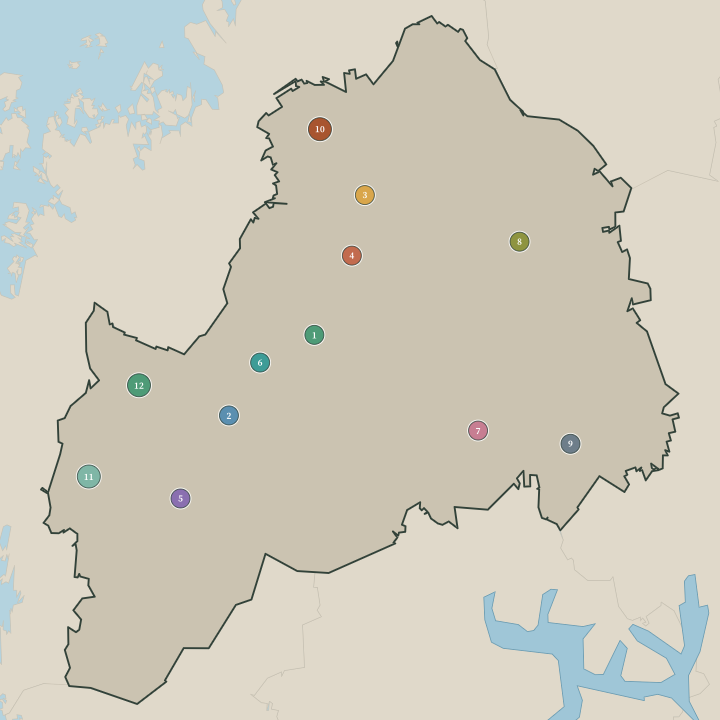
Towns & cities in South Ostrobothnia
Boundaries © geoBoundaries (CC BY) & Wikidata (CC0); water & neighbours: Natural Earth.
Common questions
What is the best area to stay in South Ostrobothnia?
Seinäjoki: festival-goers and rail travellers. Ähtäri: families touring the wildlife park.