Indonesia
Provinsi Kalimantan Tengah, Indonesia — Towns & Travel Guide


Central Kalimantan is Indonesia's largest province by area, a sweep of rivers and peat-swamp rainforest across the south of Borneo.
About Provinsi Kalimantan Tengah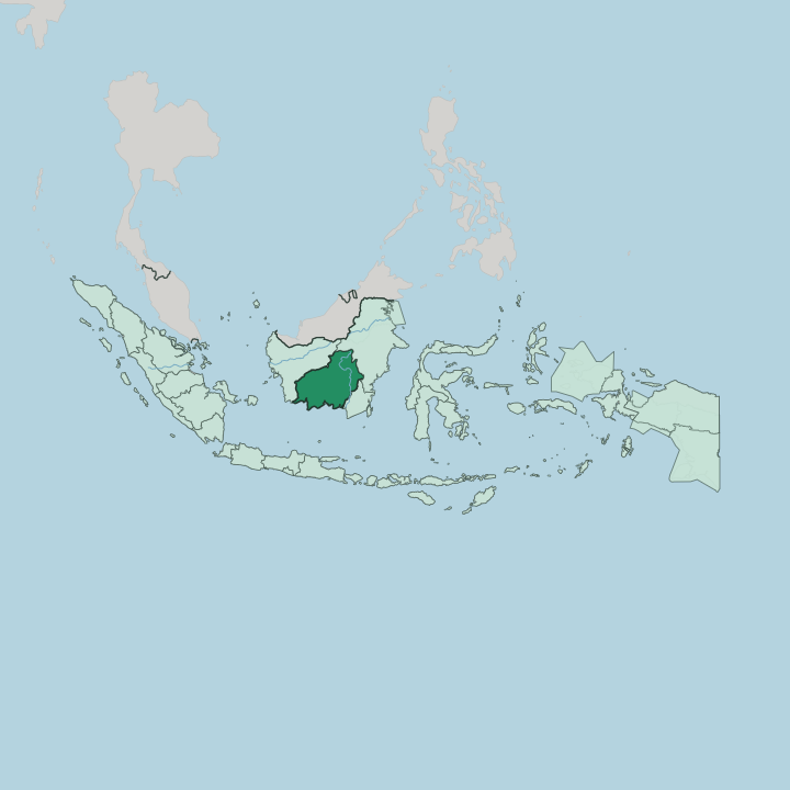
Towns & cities in Provinsi Kalimantan Tengah
Pick a town or city — each links to where to stay.
Central Kalimantan has no resort strip. You sleep where the rivers and the parks are. Palangka Raya, the planned capital laid out along the Kahayan River, holds the widest choice of beds and the province's main airport, Tjilik Riwut Airport.
For orangutans, base yourself at Pangkalan Bun and its port neighbour Kumai, where wooden klotok liveaboards board for Tanjung Puting and most nights are spent out on deck. Sampit, the timber port on the Mentaya River, serves the road east. Pick the capital for comfort, the coast for wildlife.
About Provinsi Kalimantan Tengah
What is Provinsi Kalimantan Tengah known for?
Two things put Central Kalimantan on the map: orangutans and rivers. Tanjung Puting National Park, on the province's south coast near Kumai, protects one of the largest groups of wild orangutans on Borneo, and visitors reach it aboard slow wooden klotok boats. Beyond the park, life follows the water.
The Barito River and the Kahayan River run down from forested interior hills to the Java Sea, carrying goods, ferries and floating markets. The Dayak peoples give the province its cultural signature, in longhouses, carved ironwood totems and the Kaharingan faith.
Where is Provinsi Kalimantan Tengah?
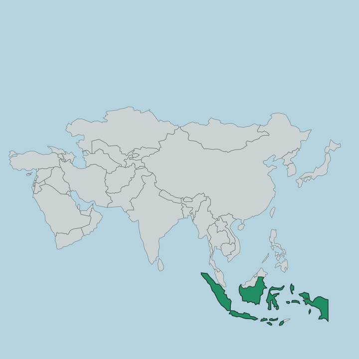
Central Kalimantan fills the south-central quarter of Borneo, the great island Indonesia shares with Malaysia and Brunei. It is the country's largest province by area. West Kalimantan lies to the west, East Kalimantan wraps around the north and north-east, and South Kalimantan sits to the south-east; the shallow Java Sea forms the whole southern edge. The land tilts from high ground in the north-west down to the coast.
Along that upland rim run the forested Schwaner and Müller ranges, the province's watershed and its border with West Kalimantan. Everything drains south from there. What lies between the hills and the sea is water and peat.
The southern half is a low alluvial plain of peat-swamp forest, threaded by eleven major rivers and dozens of smaller creeks. At roughly 900 kilometres, the Barito River is the longest and stays navigable far upstream. The Kahayan and Katingan rivers run parallel courses south to the Java Sea, and country boats still do much of the work the few roads cannot.
Palangka Raya, the capital, sits inland between the Kahayan River and the Sabangau. Near the south coast, the blackwater Sekonyer River winds out through Tanjung Puting to the Java Sea. Rivers are the roads here.
What is Provinsi Kalimantan Tengah like?
Culture here is Dayak first. The interior belongs to the Ngaju, the Ot Danum, the Ma'anyan and other Dayak groups, whose villages string along the riverbanks in long communal houses called betang. Their old faith is Kaharingan, an ancestor-and-spirit religion that Tjilik Riwut named after a Ngaju phrase for the water of life.
Its great ceremony is the tiwah, a secondary funeral that frees the souls of the dead. Carved wooden figures and painted sandung ossuaries mark the villages that still keep it. Downriver and along the Java Sea coast the mix changes.
Malay and Banjar Muslim traders settled the ports and the lower rivers long ago, so mosques and Dayak longhouses belong to the same province. Indonesian is the shared language, with Ngaju and Banjar spoken at home. Palangka Raya, purpose-built as the capital, gathers all of this into one young inland city.
It shows in the food, from river fish and forest greens to the palm sugar of the coast. Rattan weaving and beadwork are old Dayak crafts still sold in the river towns. The two worlds meet on the water.
What is the history of Provinsi Kalimantan Tengah?
Central Kalimantan is a young province on old ground. Dayak communities and the coastal sultanate of Kotawaringin held these rivers long before the Dutch drew the region into the East Indies. The province itself dates only to 1957, when Jakarta split it from South Kalimantan to give the Dayak majority a homeland of their own.
Sukarno named the Dayak revolutionary Tjilik Riwut its first governor. Palangka Raya was then laid out in the forest as a brand-new capital.
What is the climate of Provinsi Kalimantan Tengah?
Central Kalimantan sits almost on the equator, and its weather barely changes through the year. Days are hot and humid, nights warm, and rain is never far away. There is no cold season and no true dry one.
The wetter months run from about November to April, when the rivers rise and the peat swamps flood; the drier stretch falls between May and September. In that drier spell, smoke from burning peatland can haze the sky over Palangka Raya and the Sekonyer River. Bring light clothes and a rain layer.
How do you get to Provinsi Kalimantan Tengah?
Central Kalimantan has no railways. Nearly every visitor arrives by air or by sea. Palangka Raya's Tjilik Riwut Airport handles the domestic flights from Jakarta and Surabaya, while travellers bound for the orangutans instead fly to Iskandar Airport at Pangkalan Bun, the closest airstrip to Tanjung Puting.
Pelni passenger liners and ferries call at the coastal ports of Kumai and Sampit from Java. Roads run east to Banjarmasin in South Kalimantan. Inside the province, the rivers still carry much of the traffic.
Updated July 2026