Indonesia
Provinsi Kepulauan Riau, Indonesia — Towns & Travel Guide


Kepulauan Riau scatters roughly 2,400 islands south of Singapore, a Malay heartland facing the South China Sea and the Strait of Malacca.
About Provinsi Kepulauan Riau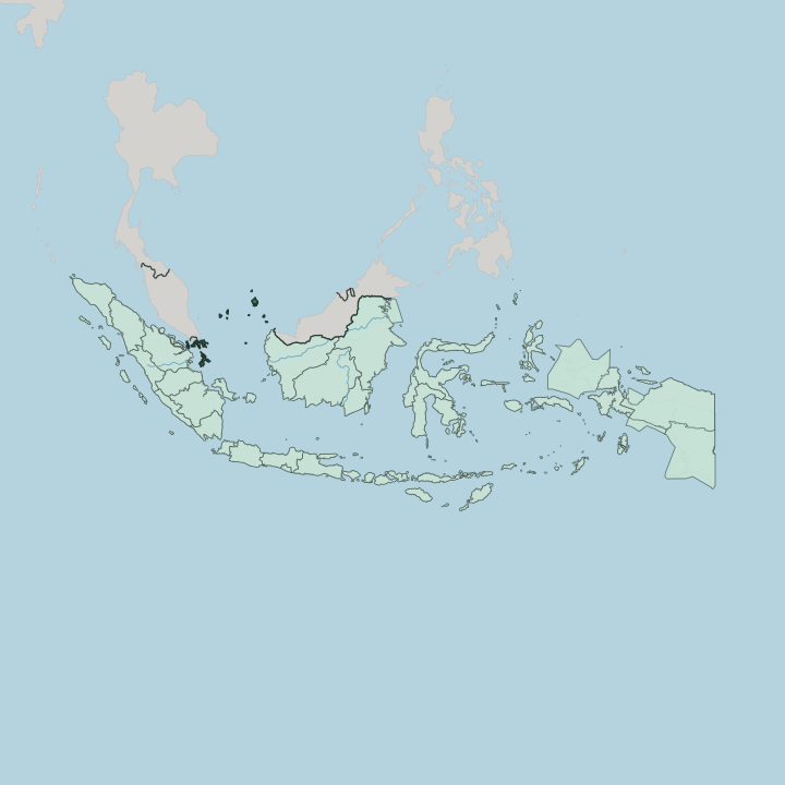
Towns & cities in Provinsi Kepulauan Riau
Pick a town or city — each links to where to stay.
Most beds cluster on the two islands nearest Singapore. Batam keeps the practical rooms: business hotels around the Nagoya district, ferry-terminal chains at Batam Centre, and beach places along the quieter south coast. Bintan splits in two.
The manicured resort strip at Lagoi, on the north shore, is the island's holiday face, while Tanjungpinang in the south stays a working Malay port with cheaper guesthouses and boats out to Penyengat. Pick Batam for a fast hop across the strait; choose Bintan when you want both the sand and the old court island of Penyengat within reach.
About Provinsi Kepulauan Riau
What is Provinsi Kepulauan Riau known for?
Two things put Kepulauan Riau on the map: nearness to Singapore, and the sea. Batam, the largest city, sits barely 20 km from the city-state and runs on shipyards, electronics plants and cross-border trade. Bintan answers with beaches. The resorts and golf courses at Lagoi, on Bintan's north shore, fill up with weekenders straight off the Singapore ferries.
Past the two big islands the province thins into Malay fishing kampungs, mangrove channels and coral reefs strung out toward the open South China Sea.
Where is Provinsi Kepulauan Riau?
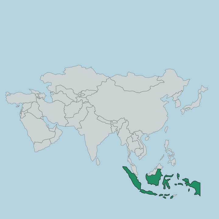
Kepulauan Riau is mostly water. The province takes in something like 2,400 islands scattered off the east coast of Sumatra, in the sea between the Malay Peninsula and Borneo, and only a thin fraction of its area is dry land. Its core sits just south of Singapore.
Batam, Bintan and Great Karimun crowd the Singapore Strait and the eastern mouth of the Strait of Malacca, close enough to the city-state that the skyline is a ferry ride away. Malaysia lies across the water to the north, and the shipping lanes of one of the world's busiest sea corridors thread between them. From that crowded core the islands string out in every direction. Lingga trails south, where the jagged peak of Mount Daik rises over the rainforest.
The Karimun group guards the strait to the west. Far to the north, alone in the South China Sea between Borneo and the Asian mainland, lie the Natuna and Anambas islands, remote clusters of reef and jungle nearer to other countries than to Batam. Tanjungpinang, the capital, stands on southern Bintan.
Beyond it, no road links the scattered groups, and the only way between islands is the deck of a ferry. Everything is measured by boat.
What is Provinsi Kepulauan Riau like?
This is Malay country in the deepest sense. The court on Penyengat, a small island off Tanjungpinang, was in the nineteenth century the literary capital of the Malay world, and the scholar Raja Ali Haji wrote here the grammar and dictionary that later shaped Standard Indonesian. The refined Malay spoken in the old Riau-Lingga Sultanate became the yardstick for the whole language.
Islands this small rarely carry that kind of weight. Modern Indonesian still traces a line back to these shores. Islam and Malay adat set the rhythm of ordinary life across the province.
Village mosques, the pantun verse traded at weddings, the slow gurindam couplets Raja Ali Haji made famous, the old forms survive alongside satay, mie tarempa noodles from Anambas, and the seafood that a fishing province eats every day. Bugis seafarers, Chinese traders and Orang Laut sea-people all left their mark, and Batam's factory boom has since pulled in workers from across Indonesia. The result on the big islands is louder and more mixed than the quiet Malay kampungs of Lingga or Natuna.
Both belong to the same province.
What is the history of Provinsi Kepulauan Riau?
The Malay sultans ruled here first. When the old Johor-Riau realm was carved up in 1824, the seaward half became the Riau-Lingga Sultanate, governed from Penyengat and Daik until the Dutch dissolved it in 1911. The islands then spent a century bound to the mainland Riau province, across the strait on Sumatra.
That tie broke in 2002. Kepulauan Riau was cut loose as Indonesia's own island province, with Batam already remade into a free-trade zone facing Singapore.
What is the climate of Provinsi Kepulauan Riau?
Sitting almost on the equator, Kepulauan Riau is hot and wet the year round. There is no cool season, only a wetter one. The northeast monsoon, from about November into March, drives the heaviest rain and the roughest seas, and in the exposed north it can shut down the ferries to Natuna and Anambas for days.
The drier stretch from around April to October brings calmer water and the easier sailing that resort season depends on. Afternoon downpours are normal in any month. The sea keeps the air thick and warm from dawn to dusk.
How do you get to Provinsi Kepulauan Riau?
For most travellers the way in is a boat from Singapore. Fast ferries cross the strait in under an hour, running from the city-state's terminals to Batam Centre, Nagoya and the resort jetty at Lagoi on Bintan. Flights come too.
Hang Nadim in Batam handles the busiest air traffic, with Raja Haji Fisabilillah serving Tanjungpinang, and small strips linking the far Natuna and Anambas groups. Between the islands themselves it is ferries all the way, scheduled speedboats on the busy runs, slower Pelni liners out to the distant north.
Good for
Updated July 2026