Norway · Rogaland
Where to Stay in Sand, Rogaland


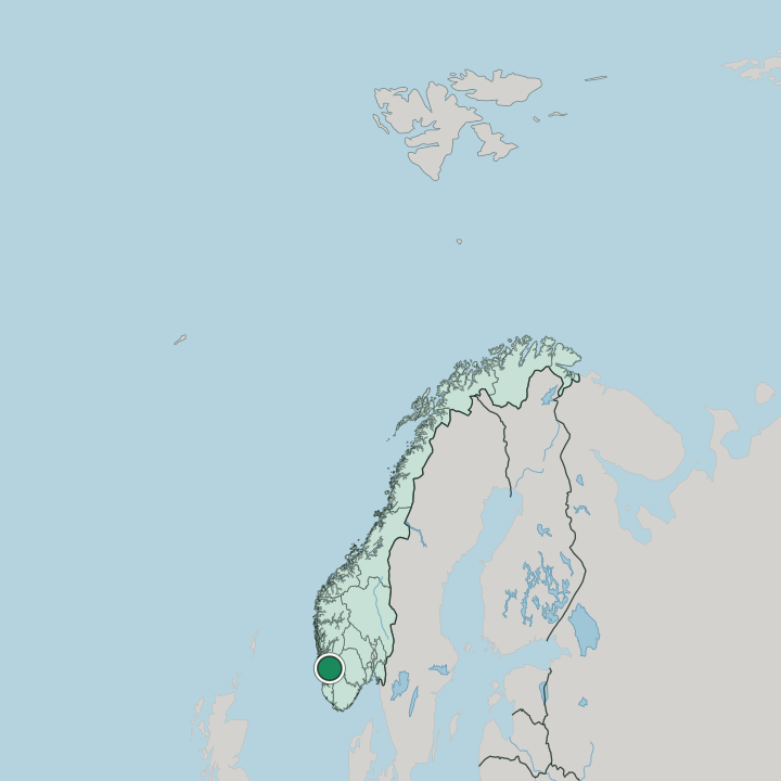
Sand is a fjord-side village and the centre of Suldal, in the north-eastern part of Rogaland, western Norway (Vestlandet).
Find your area →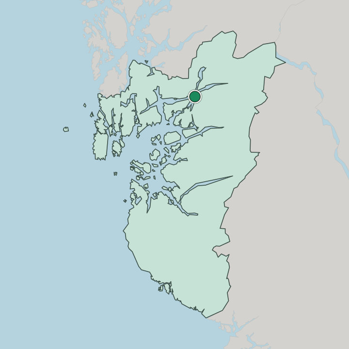
Where to stay in Sand
The right area depends on your trip — here's what each neighbourhood is best for.
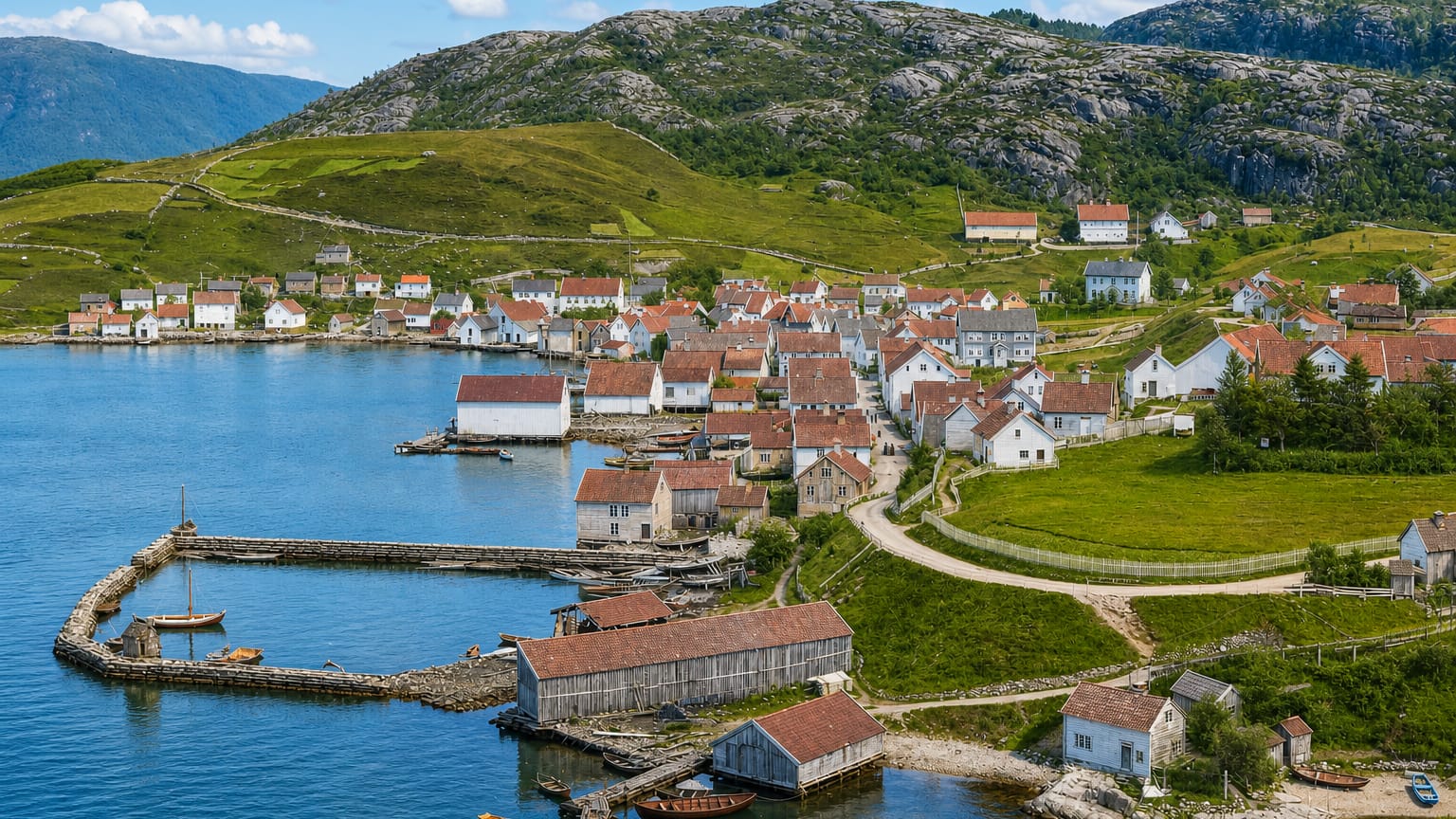
The Sand waterfront is the obvious base. It lines the quay below Sand kirke, with the Nesasjøhuset sea-house museum on the shore and the steep walls of the Ryfylke fjords rising close behind, putting you at the centre of Suldal and the river mouth in one. Staying here keeps you on the water in the north-eastern part of Rogaland, within reach of the fjord boats and the salmon river.
Up the valley the farms and hamlets of inland Suldal spread along the river, a quieter setting away from the fjord-side village. River lodges and farm rooms sit among them, geared to the anglers who come for the salmon. Beds cluster on the waterfront.
Stay by the Sand quay first. Choose a river lodge upstream if you want the valley and the fishing over the fjord shore. Either suits a Ryfylke break.
About Sand
What is Sand known for?
Sand is Suldal's fjord village. It sits where the river comes down to the water in the Ryfylke fjord country of the north-eastern part of Rogaland, the administrative seat of the municipality. Sand kirke stands above the quay.
The Nesasjøhuset, a sea-house museum on the waterfront, holds the salmon-river and trading history of Suldal, and the steep fjord walls of Ryfylke rise straight from the shore around it.
What are the main landmarks in Sand?
The waterfront carries the sights at Sand. Sand kirke stands above the quay, and the Nesasjøhuset, a preserved sea-house on the shore, keeps the salmon-river and coastal-trade story of Suldal as part of the Ryfylke museum collection. The fjord is the wider draw.
Steep walls of the Ryfylke fjords climb from the water around the village, and the salmon river that meets the shore here has long pulled anglers into this corner of Rogaland.
What is the history of Sand?
The river and the fjord made Sand. The village grew where the salmon river meets the Ryfylke fjords in the north-eastern part of Rogaland, a natural landing where boats from the coast met the inland valleys of Suldal. Trade and timber moved through the quay, and the preserved sea-house now kept as the Nesasjøhuset shows how goods were handled on the waterfront before the roads came.
The salmon river drew its own visitors. From the nineteenth century the river became a famous angling water, and Sand grew as the seat of Suldal around it, with Sand kirke set above the harbour. The sea-houses and the church mark that older fjord economy, when the village lived by the water and the fish.
Sand stayed the working centre of the municipality, its life still tied to the river mouth and the deep Ryfylke fjord that carries the road and the boats inland through this part of western Norway.
Where is Sand?
Sand sits at a river mouth on the Ryfylke fjords in the north-eastern part of Rogaland. The village lines the narrow shore below Sand kirke, where the salmon river runs down out of the inland valleys of Suldal to meet the deep fjord water. The mountains close in tight.
Steep forested walls rise straight from the shore around the village, leaving only the slim waterfront and the river flat in this rugged stretch of western Norway.
What is the climate of Sand?
Sand has a wet fjord climate. The deep Ryfylke water keeps the village mild through the winter, while the surrounding mountains wring heavy rain from the cloud that rolls in off the coast of the north-eastern part of Rogaland. The fjord moderates the cold.
Sheltered below the steep walls around Sand kirke, the waterfront sees soft, damp winters and cool, green summers in this corner of western Norway.
How do you get to Sand?
Sand is reached by fjord and road. The village lies on the Ryfylke fjords in the north-eastern part of Rogaland, served by the fjord ferries and the coastal road that threads the steep shore of Suldal. The road runs inland up the valley.
It follows the salmon river deeper into the municipality, and most visitors arrive by car or fjord boat rather than by rail along this mountainous corridor.
Good for
More cities in Rogaland
Updated July 2026