
Pakistan
Islamabad, Pakistan — Towns & Travel Guide


Islamabad is Pakistan's planned capital, laid out below the Margalla Hills on the Pothohar Plateau in the country's north.
Find your area →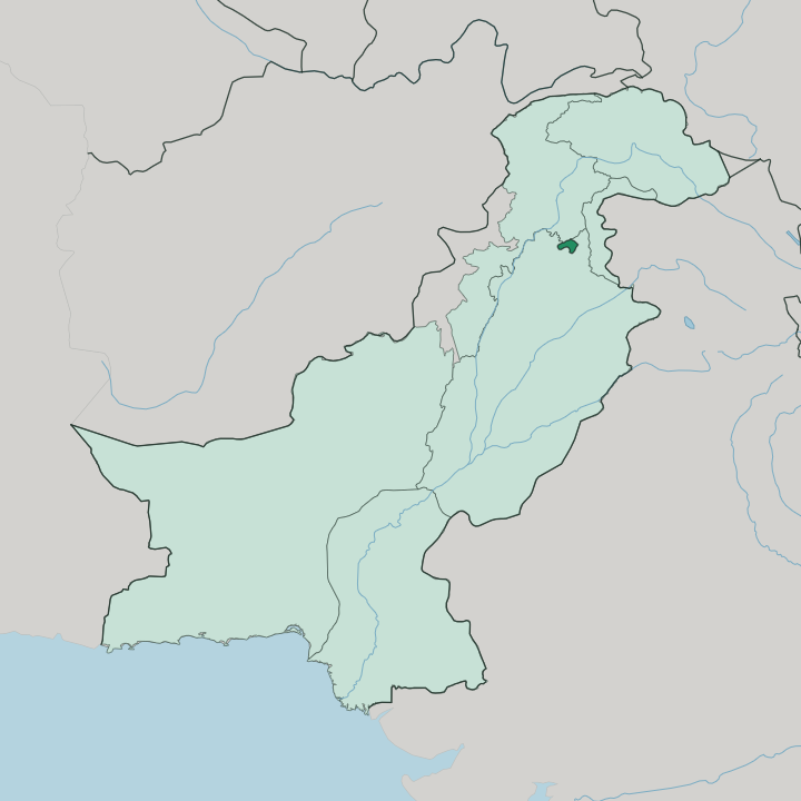
Towns & cities in Islamabad
Pick a town or city — each links to where to stay.

 Pakistan
Islamabad
The Margalla Hills rise green above Islamabad, Pakistan's planned capital on the Pothohar Plateau, known for the Pakistan Monument and Lok Virsa Museum.Where to stay →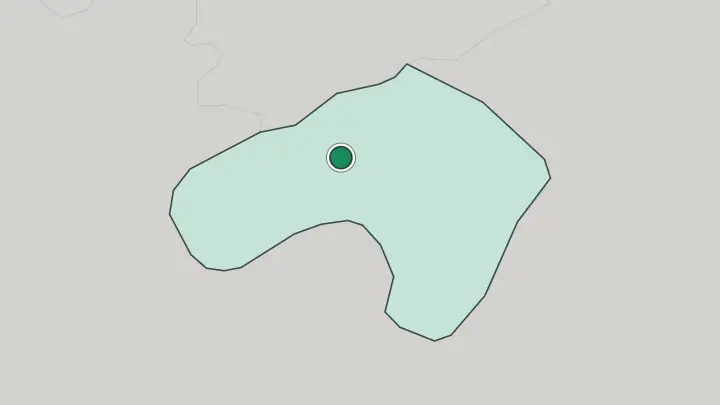
About Islamabad
What is Islamabad known for?
Islamabad stands apart from every other Pakistani city because it was drawn on paper before it was built. The Greek planner Constantinos Doxiadis laid it out in a grid of numbered sectors, each with its own markets, mosques and parks. It is calm.
Wide avenues, deep tree cover and the green wall of the Margalla Hills give the capital a spaciousness that older, denser cities like Karachi and Lahore never had. The Faisal Mosque, shaped like a folded Bedouin tent against the hills, is the image most travellers carry away from here.
Where is Islamabad?
The Islamabad Capital Territory occupies the northern edge of the Pothohar Plateau, in the far north-west of Punjab, where the plain begins to fold up into the mountains. The Margalla Hills, the outermost ridge of the Himalayan foothills, wall the city along its northern side and rise to well over a thousand metres. Rawalpindi presses against Islamabad from the south. The two run together as twin cities, sharing one metropolitan sprawl, though Islamabad keeps its planned grid and Rawalpindi its older tangle of bazaars.
Rawal Lake, an artificial reservoir dammed on the Korang River, supplies both cities with water and marks the territory's south-eastern quarter. West of the built-up sectors the ground opens into farmland and scattered villages that predate the capital. The whole territory tilts down from the hills.
Small streams called nullahs run off the Margallas and cut through the sectors toward the plateau below, and the land is greener and cooler here than across most of lowland Pakistan.
What is Islamabad like?
Islamabad is younger than almost everyone who lives in it, and that shapes its character. The city drew civil servants, diplomats and professionals from every province, so no single regional culture dominates the way Punjabi life dominates Lahore or Sindhi life colours Karachi. Urdu is the common tongue of the streets and offices.
English runs alongside it in government and business, a legacy of the bureaucratic role the capital was built to house. Faith is woven into daily life. The Faisal Mosque, a gift from Saudi Arabia and the work of the Turkish architect Vedat Dalokay, anchors that life with its stark modern geometry rather than the domes and arches of Mughal tradition.
Weekends pull families out of the sectors and up into the Margalla Hills. They walk the trails, eat at the ridge-top viewpoint of Daman-e-Koh, and look back down over the grid of their own strange, deliberate city. The Pakistan Monument on the Shakarparian hills gathers the country's four provinces into one granite flower, a piece of national symbolism the capital wears openly.
What is the history of Islamabad?
Islamabad did not grow. It was decided. In 1959 the government resolved to move the capital away from crowded, coastal Karachi, and on the 24th of February 1960 it named the new city Islamabad.
The site chosen sat on the Pothohar Plateau beside the old garrison town of Rawalpindi, near the army's headquarters and the northern frontier. Construction began in 1961 to a master plan by Constantinos Doxiadis, and the government finished moving in around 1966, after a spell governing from Rawalpindi while the sectors rose from bare ground.
What is the climate of Islamabad?
Islamabad has a humid subtropical climate with a sharp monsoon, milder than the searing plains to the south. June is the hottest month, when highs push past 37 degrees before the rains arrive. July brings the monsoon, and evening thunderstorms wash the sectors and swell the streams off the Margalla Hills.
Winters are cool and foggy. January is the coldest month, and snow dusts the higher Margalla ridges every few years while the sectors below stay just above freezing.
How do you get to Islamabad?
Most travellers reach Islamabad by air, through Islamabad International Airport, which opened in 2018 on the plateau some twenty kilometres south-west of the twin cities. It replaced the cramped old airport that sat inside Rawalpindi. The new terminal handles the long-haul flights from the Gulf, Europe and East Asia that carry most foreign arrivals.
By land, the M-2 motorway runs the long straight line south to Lahore, while the Grand Trunk Road and the Karakoram Highway climb north toward Kashmir and the mountains. Rawalpindi is the rail head.
Common questions
What is the best area to stay in Islamabad?
Rawalpindi: a cheaper base with the region's train connections.
Good for
Updated July 2026