Pakistan
Balochistan, Pakistan — Towns & Travel Guide


Balochistan is Pakistan's largest province, a dry expanse of mountain and desert reaching from Quetta to the Arabian Sea.
About Balochistan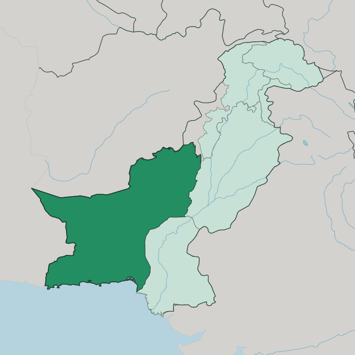
Towns & cities in Balochistan
Pick a town or city — each links to where to stay.
Balochistan splits between its northern highlands and its southern coast, with vast dry country in between. Quetta is the practical base, the capital and largest city, ringed by mountains and served by the province's main airport. Ziarat lies a short way east of it, a hill town set in one of the world's largest juniper forests, cool in summer and deep under snow in winter.
On the far shore, Gwadar anchors the Makran coast, a fishing and port town on the Arabian Sea reached by the long Makran Coastal Highway from Karachi. Distances between these places are immense. Choose Quetta for the highlands and the mountains, Gwadar for the sea.
About Balochistan
Balochistan is known first for its size and its emptiness.
What is Balochistan known for?
It fills roughly two-fifths of Pakistan yet holds fewer people than any of the other three provinces, a land of arid mountains, gravel plains and open desert. Quetta, the capital, sits high in the north among the folds of the Sulaiman Mountains. Far to the south, the Makran coast runs along the Arabian Sea, where the deep-water port of Gwadar has drawn attention as an outlet on the Arabian Sea for trade routes reaching toward China.
Space defines the province. Mineral wealth lies beneath much of it.
Where is Balochistan?
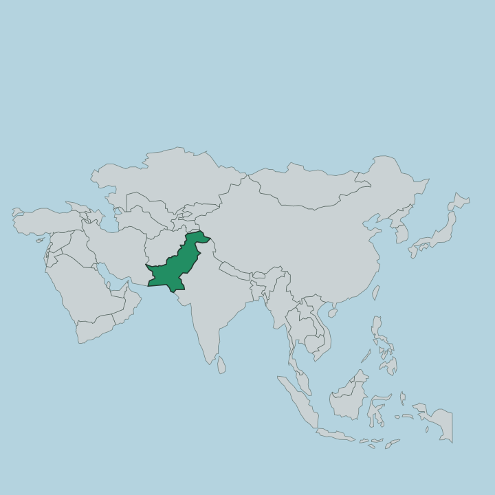
Balochistan occupies the southwest corner of Pakistan, on the far southeastern edge of the Iranian plateau above the Arabian Sea. It is the largest of the country's four provinces by a wide margin, covering close to half of Pakistan's land. Afghanistan borders it to the north and northwest, Iran to the west, and the Pakistani provinces of Punjab and Sindh to the east. The Arabian Sea forms its whole southern edge.
Most of the province is mountain and desert. The Sulaiman Mountains rise in the north around Quetta, and the Kirthar Mountains run down the eastern border with Sindh, while dry plateaus and gravel plains fill the centre. The Makran coast stretches for a long reach of shoreline along the Arabian Sea in the far south, its fishing towns and the port of Gwadar strung out facing the water.
Water is the scarce thing here. Settlement clusters where there is any of it, at oasis towns inland and at the fishing harbours along the coast, leaving huge tracts of the interior all but empty. Quetta stands high and cold in the north, the province's main crossing toward Afghanistan through the mountains.
From that northern city to the southern shore, the land runs dry the whole way.
What is Balochistan like?
Balochistan takes its name and its character from the Baloch, the people who form the majority across most of the province. They give the land its language, Balochi, spoken through the deserts and mountains and along the Makran coast. The Baloch are not the only people here.
In the centre live the Brahui, whose tongue is unusual for the region, and the north around Quetta is largely Pashtun, where Pashto is heard in the streets and bazaars. Tribe and lineage still shape social life across the province. Balochi music, folk poetry and handwoven textiles run through the culture, carried by a people long used to distance and to a hard, dry country.
Hospitality is prized here. In Quetta the mix is at its most visible, a highland city where Baloch, Brahui and Pashtun trade and mingle at the meeting of the mountain routes. The coast keeps its own rhythm.
Along the Makran shore the towns face the Arabian Sea, their lives tied to fishing and to the boats that have worked these waters for generations, a different world from the interior. One province holds both. The thread that ties them is the Baloch name the whole land carries.
What is the history of Balochistan?
The Khanate of Kalat drew the tribes of Balochistan into a single polity, a Brahui-led confederacy founded in 1666 that ruled much of the region for close to three centuries. Its khans held sway from the town of Kalat over Baloch and Brahui alike. The British brought the area under their oversight in the later years of their Indian empire while leaving the tribes their own affairs.
Kalat acceded to Pakistan after independence. The province took roughly its present shape as one unit in 1970, gathering the old khanate lands, the Makran coast and the Pashtun north into a single modern province.
What is the climate of Balochistan?
Balochistan is dry almost everywhere, but its weather swings hard with height. The northern highlands around Quetta and Ziarat freeze in winter, with snow on the juniper slopes and bitter cold in the mountains, then warm to pleasant summers. The plains and deserts of the interior turn ferociously hot once the sun is high.
Down on the Makran coast the Arabian Sea keeps the air warm and humid through much of the year, milder in winter than the frozen north. Rain is scarce across all of it.
How do you get to Balochistan?
Most travellers reach Balochistan through Quetta, whose airport is the province's main gateway and whose mountain passes have carried traffic toward Afghanistan for centuries. Rail and road climb up to the highland capital from the rest of Pakistan. The coast is reached another way.
Gwadar and the Makran shore sit at the end of the Makran Coastal Highway, the long road that runs west from Karachi along the Arabian Sea. Between the highland north and the southern coast, distances are great and the country in between is thin of towns and of people.
Good for
Updated July 2026