Pakistan
Gilgit-Baltistan, Pakistan — Towns & Travel Guide


Gilgit-Baltistan is Pakistan's northernmost territory, where the Karakoram, Himalayas, and Hindu Kush collide around K2.
About Gilgit-Baltistan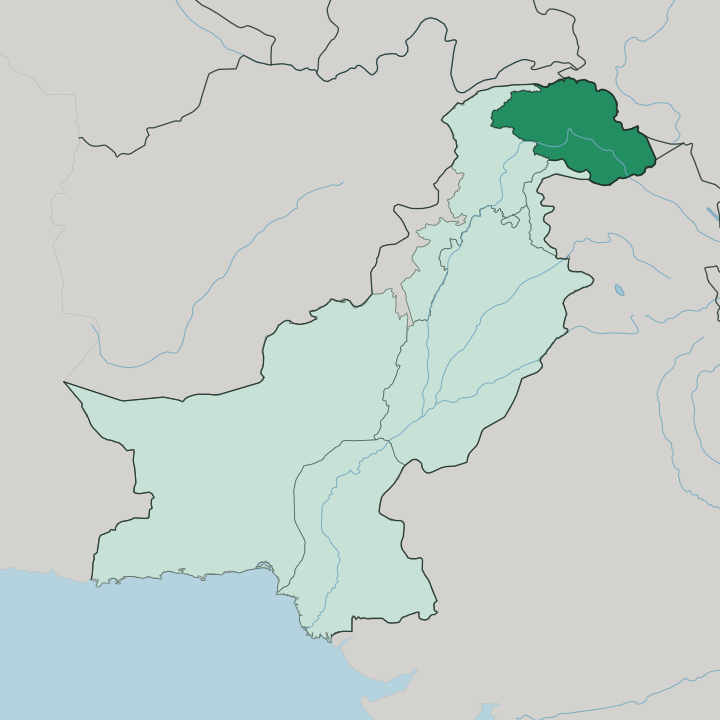
Towns & cities in Gilgit-Baltistan
Pick a town or city — each links to where to stay.
Gilgit, the capital, sits at the road junction of the main valleys and makes the natural first base, with the widest choice of hotels and onward transport toward Hunza and beyond. Karimabad, the old capital of Hunza below Baltit Fort, is the region's most developed tourist hub and the usual stop on the drive up the Karakoram Highway. Skardu opens the way into Baltistan and the Baltoro glacier trek, reached by air or a long road along the Indus.
You want Gilgit for logistics, Karimabad for comfort and views, Skardu for the high-mountain approaches. Beds thin fast beyond them.
About Gilgit-Baltistan
The high peaks give Gilgit-Baltistan its character.
What is Gilgit-Baltistan known for?
Gilgit-Baltistan holds five of the world's fourteen peaks above eight thousand metres, and K2, the second-highest of them all, rises on its border with China. Around K2 the Karakoram grinds out some of the longest glaciers on earth outside the poles, the Baltoro among them. The Karakoram Highway threads north from the lowlands toward the Chinese frontier, and along it lie the apricot-orchard valleys of Hunza and the cold desert around Skardu.
Trekkers and climbers come for the peaks; nearly everyone else comes for the road and the valleys it opens.
Where is Gilgit-Baltistan?
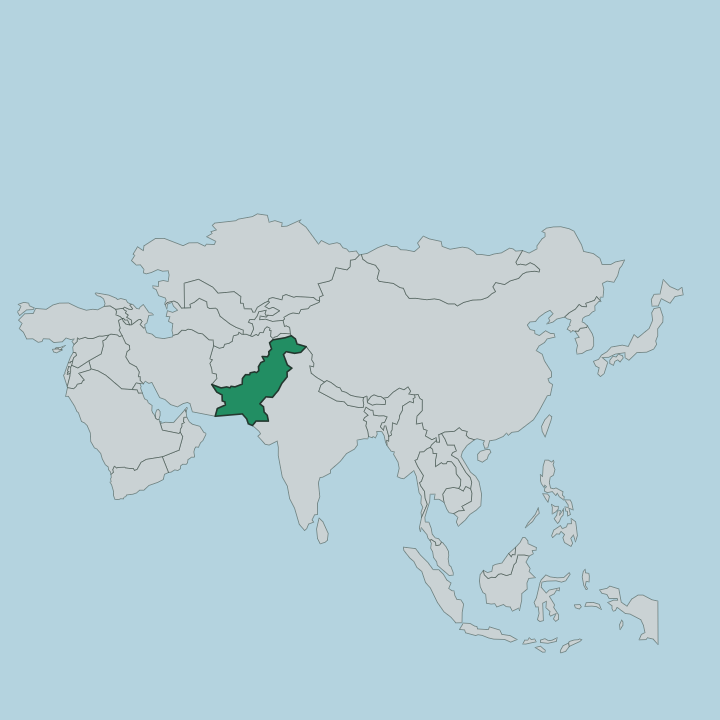
Gilgit-Baltistan occupies the far north of Pakistan, the northern portion of the wider Kashmir region that India and Pakistan have contested since 1947. Its borders read like a roll-call of Asia's great ranges. The narrow Wakhan corridor of Afghanistan brushes it in the north, the Xinjiang region of China runs along the east and northeast, Azad Kashmir lies to the south, and the province of Khyber Pakhtunkhwa closes it off to the west.
To the southeast sit the Indian-administered territories of Ladakh and Jammu and Kashmir. Three of the world's mightiest mountain systems converge inside it. The Karakoram fills the north and east, the western Himalayas anchor the south around Nanga Parbat, and the Hindu Kush reaches in from the west, the three meeting near the town of Jaglot where the ranges physically touch.
The Indus is the thread that ties it together, cutting west out of Tibet and Ladakh, slicing between the Himalayas and the Karakoram, and gathering the Gilgit River near Bunji before it turns south for the plains. Glaciers cover more of this land than forest ever could. The Baltoro, the Biafo, and the Batura are among the longest ice-streams outside the polar world, and above them the Deosai plateau spreads out beyond the tree line as the second-highest plateau on earth.
Little of the territory sits low. Rock, ice, and river run the whole of it.
What is Gilgit-Baltistan like?
No single people fills these valleys. Each drainage cradled its own tongue, and the result is one of the densest patches of linguistic variety in Asia. Balti, a relative of Tibetan, is spoken across Baltistan in the east; Shina carries the central valleys around Gilgit and Chilas; Burushaski, a language isolate tied to no other on earth, survives in Hunza and Nagar; and Wakhi and Khowar hold pockets in the far upper valleys.
Urdu serves as the common ground between them all. Faith divides along the same fine grain. The population is entirely Muslim yet split as no other part of Pakistan is, among Twelver Shia, Nizari Ismaili who follow the Aga Khan, Sunni, and the small Nurbakhshi Sufi community of Baltistan.
History left its layers openly on the rock. Before Islam arrived with Sufi preachers in the fourteenth century, this was Buddhist country, and the Kargah Buddha still stands carved into a cliff outside Gilgit, a relic of the caravans that once carried the faith along the Silk Road. Trade shaped the culture as much as the mountains did.
Traders, pilgrims, and armies all passed this way, and each left something behind in the polyglot valleys.
What is the history of Gilgit-Baltistan?
British India ran the frontier from Gilgit as a listening post against Russia, the old Gilgit Agency of the Great Game. When the subcontinent split in 1947, the local Gilgit Scouts rose against the maharaja of Kashmir under Major William Brown and handed the territory to the new state of Pakistan. For decades it stayed the Northern Areas.
Only in 2009 did it take the name Gilgit-Baltistan and a measure of self-government, joining the two old halves of Baltistan in the east and the Gilgit valleys in the west that a 1972 merger had first bound into one.
What is the climate of Gilgit-Baltistan?
Altitude rules the weather here, not the season. The great ranges block the monsoon, so Gilgit-Baltistan is a high-mountain desert that sees little rain and depends on glacier melt for its water. Down in the valley floors around Gilgit and Chilas the summer days turn fierce and hot while the nights stay cold, a swing that catches out first-time visitors.
Climb higher and it never really warms: the upper valleys and the Deosai plateau hold snow deep into summer and lock shut for much of the year. Winter shuts the high passes.
How do you get to Gilgit-Baltistan?
Two ways lead in. Short flights from Islamabad reach both Gilgit and Skardu in under an hour, threading between the peaks, though the mountain weather grounds them often and without warning. The overland alternative is the Karakoram Highway, one of the highest paved roads on earth, which climbs from the Pakistani lowlands up the Indus and Hunza valleys and on over the Khunjerab Pass into China.
The drive up to Hunza runs the better part of a full day. Public buses cover the same route between Gilgit, Skardu, and the valleys for those without a car.
Good for
Updated July 2026