Turkey
Adıyaman, Turkey — Towns & Travel Guide


Adıyaman is a province of southeastern Turkey, the Commagene heartland, crowned by the colossal stone gods of Mount Nemrut above the Euphrates.
About Adıyaman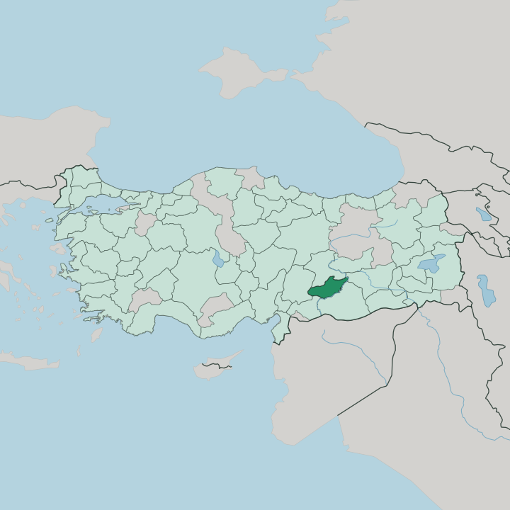


Towns & cities in Adıyaman
Pick a town or city — each links to where to stay.
Start in Adıyaman for a first night. The city holds the museum where the province's Commagene mosaics and statues are gathered, and the rock-cut tombs of Perre sit on its northern edge. For Mount Nemrut, move east to Kâhta, the road town nearest the summit and the Roman and Commagene ruins along the Kâhta stream.
Small pensions at Karadut climb higher still, close enough to walk up for the dawn. Gölbaşı, off toward Malatya, trades ruins for a run of quiet lakes.
About Adıyaman
Mount Nemrut is the reason most travellers come.
What is Adıyaman known for?
On its summit sit the toppled heads of colossal gods and kings, raised by Antiochus I as a tomb-sanctuary for the vanished kingdom of Commagene. The whole province is a museum of that lost realm. Roman engineers left the single-arched Cendere bridge over a gorge near Kâhta, and the Karakuş tumulus still marks a royal Commagene grave.
Below it all runs the Euphrates, dammed into a broad reservoir.
Where is Adıyaman?
Adıyaman lies in the Southeastern Anatolia Region, in the country's south-east. Five provinces ring it. Malatya rises to the north across the Anti-Taurus, while Kahramanmaraş and Gaziantep close off the west, and the land falls away east and south toward Diyarbakır and Şanlıurfa.
The northern third is mountain and high plateau, an outrider of the Taurus, seamed with gorges and summer grazing. Akdağ crowns it, the province's true high point up in the northern range. Mount Nemrut is lower but far more famous, its peak an artificial cone of crushed rock heaped above the tree line.
Southward the ground eases into a broad farming plain. Terraced vineyards and tobacco fields work the warmer lower slopes. The Euphrates does the defining work here.
It sweeps along the southern and eastern edges of the province, and the Atatürk Dam has backed it up into a long reservoir that drowned old Samosata at Samsat. Smaller streams comb down off the highlands to feed it. The Kâhta stream carves the gorge that shelters Arsameia and the Roman Cendere bridge before it reaches the lake.
On the plain between mountain and water sits the provincial capital, ringed by orchards. Water, more than any border post, marks where Adıyaman ends.
What is Adıyaman like?
The province reads as Kurdish more than anything else. Kurmanji is the mother tongue in most of its villages, spoken alongside Turkish, and a large share of the people are Alevi rather than Sunni. That Alevi thread gives Adıyaman a religious life set a little apart from its neighbours, with its own gatherings and music.
Older layers survive underneath. Armenian and Syriac communities lived here for centuries before the upheavals of the last century, and their churches still stand in a few of the mountain villages. Food carries the local pride.
The regional çiğ köfte is kneaded raw, bulgur wheat worked by hand with pepper and spice until it binds, then eaten cold. It belongs to the sıra gecesi, the rotating night gatherings where men take turns hosting music, talk and long tables. Grapes and their molasses, pistachios and flatbread round out a kitchen built on wheat and the vine.
Above the everyday sits Commagene. The kingdom's giants on Mount Nemrut have become the emblem the whole province puts on its festivals and its front pages. A provincial museum in the capital keeps the mosaics and reliefs prised from those ancient towns.
What is the history of Adıyaman?
Layer on layer of empire passes through here. An Iron Age Neo-Hittite kingdom called Kummuh gave the land its first name and, in time, the Greek one of Commagene, whose kings ruled from Samosata until Rome absorbed them. The Arabs built a fortress town they called Hisn-i Mansur, after the commander Mansur, and that name held for a thousand years.
It became Adıyaman only in 1926. The province itself was carved out of Malatya in 1954.
What is the climate of Adıyaman?
Summers here are long, hot and dry. The province sits at the seam of the Mediterranean and the continental interior, so its lowland climate leans hot-summer Mediterranean, with cloudless months baking the plain around Adıyaman and the Euphrates shore. Winters turn cool and wet, and snow settles for weeks on the Anti-Taurus heights and on Mount Nemrut, which stays shut through the cold season.
Spring and autumn are the kind seasons. Then the hills green up before the heat returns.
How do you get to Adıyaman?
Air travel is the usual way into Adıyaman. Adıyaman Airport, on the plain just outside the capital, takes domestic flights from Istanbul and Ankara, and many travellers also fly into Gaziantep or Şanlıurfa and drive the rest. Highways climb in from all three cities.
Long-distance coaches are the workhorse for getting around the region. For Mount Nemrut, the last leg runs from Kâhta by road, up a mountain lane that closes under winter snow.
Good for
Updated July 2026