
Turkey
İstanbul, Turkey — Towns & Travel Guide


İstanbul Province straddles the Bosphorus between the Sea of Marmara and the Black Sea, a Turkish region set across Europe and Asia.
Find your area →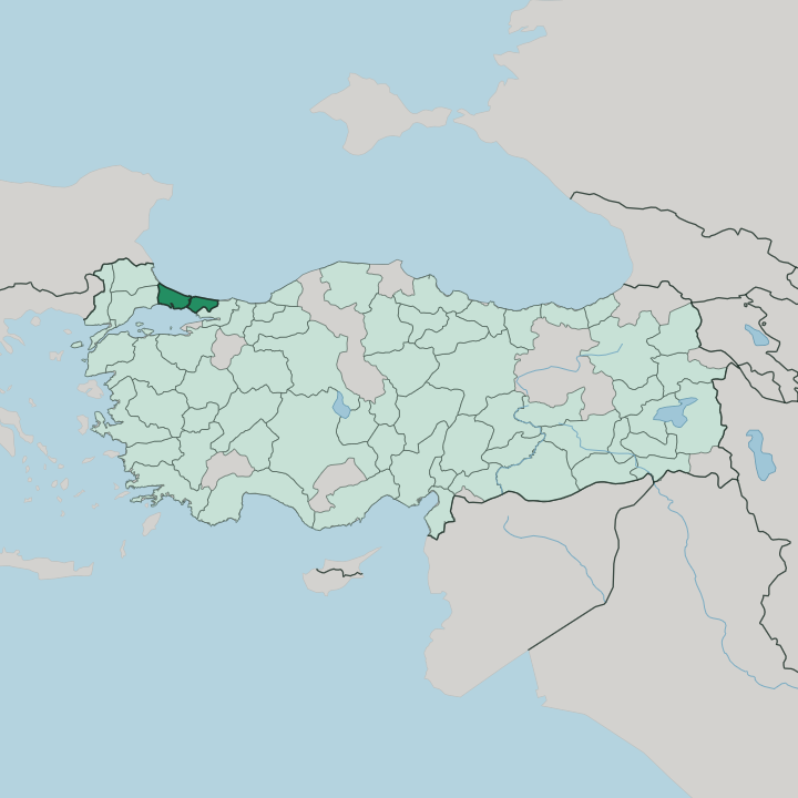


Towns & cities in İstanbul
Pick a town or city — each links to where to stay.
 Turkey
Istanbul
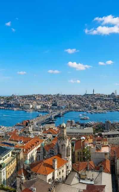
Istanbul stands where the Bosphorus divides Europe from Asia, a Turkish city crowned by Hagia Sophia and the domes of the old imperial quarter.Where to stay →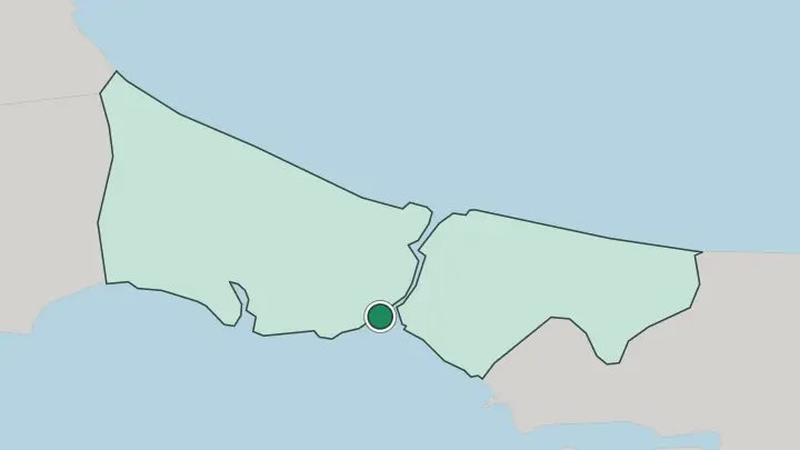
About İstanbul
What is İstanbul known for?
İstanbul Province is known for the Bosphorus, the busy strait that carries ships between the Sea of Marmara and the Black Sea. Two continents meet here. The province holds ground in both Europe and Asia, the only Turkish region to sit astride the divide, and its long shipping channel has shaped settlement on either bank since the days of Byzantium and Constantinople.
Water rules the map.
Where is İstanbul?
İstanbul Province spreads along both banks of the Bosphorus, the narrow strait that joins the Sea of Marmara in the south to the Black Sea in the north. The water divides it in two. On one side the province reaches into Europe, on the other into Asia, making it the single Turkish region to hold land on both continents at once.
Ships fill the channel. The Bosphorus has always been the province's spine, a working seaway lined with quays and landings where the currents run strong between the two seas. Beyond the strait the land climbs into the hills and forests that back the Black Sea shore, while the Sea of Marmara edges the southern lowlands with bays and small islands.
The reach of Anatolia begins here. From the Asian bank the province opens toward the wider tableland of Anatolia, the vast peninsula that carries most of Turkey, so the region stands as the meeting point of a European foreland and an Asian interior. Ferries stitch the two shores together, crossing the Bosphorus and the mouth of the Sea of Marmara in a constant traffic of boats.
Two seas frame the whole.
What is İstanbul like?
Life in İstanbul Province turns on the water and the crossing between two worlds. Turkish is the language of the region. Along both banks of the Bosphorus the culture carries the long memory of a place that was Byzantium and then Constantinople, a seat of empires that drew traders, sailors, and settlers from around the two seas.
The ferries set the daily rhythm. Much of provincial life still follows the shoreline, the markets, and the constant movement between the European and Asian sides. The strait shapes habit as much as geography.
Fishing boats, commuter ferries, and freighters share the Bosphorus, and the shore neighbourhoods keep the mix of faiths and tongues that centuries of trade left behind, from the era of Constantinople to the founding of the Republic of Turkey. That inheritance runs deep. The name Istanbul itself came from a Greek phrase for the city, a small sign of how many peoples have passed along these shores.
Bridges and undersea rail bind the two continents, yet the old habit of crossing by boat still marks the region. The water carries it all.
What is the history of İstanbul?
İstanbul Province holds one of the oldest continuously settled grounds in the region, first known as Byzantium on the European bank of the Bosphorus. Rome renamed it Constantinople. Rebuilt in 324 by the emperor Constantine, the city on the strait became a capital of empires, and the province around it carried that weight through the Byzantine and Ottoman ages until the Republic of Turkey fixed the name Istanbul.
Empires came and went.
What is the climate of İstanbul?
İstanbul Province has a temperate climate held between the Sea of Marmara and the Black Sea, with the water softening both extremes. İstanbul's summers stretch out warm. The seas keep the heat from building too far inland, while winters turn cool and damp along the exposed Black Sea shore, and the Bosphorus channels sharp winds down the strait in the colder months. The sea moderates the year.
How do you get to İstanbul?
İstanbul Province is reached first through the city of Istanbul, the arrival point for almost everyone who comes to the region. Almost everyone reaches İstanbul Province by plane. From the city, ferries fan out across the Bosphorus and the Sea of Marmara to link the European and Asian banks, while road and rail run inland from the shore toward the rest of Anatolia.
The crossings never stop.
Updated July 2026