Ukraine
Sumska Oblast, Ukraine — Towns & Travel Guide


Sumska Oblast is Ukraine's north-eastern forest-steppe frontier, laced by the Psel and Seim rivers and centred on the city of Sumy.
Find your area →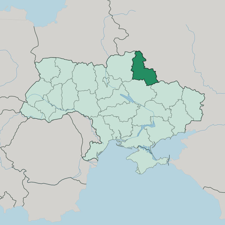
Towns & cities in Sumska Oblast
Pick a town or city — each links to where to stay.
 Ukraine
Sumy
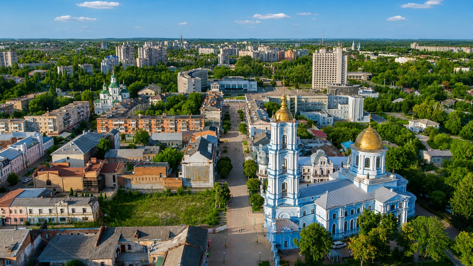
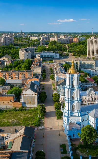
The Psel River winds through Sumy, the seat of Sumy Oblast in northeastern Ukraine, a city founded in 1652 and known for its churches and museums.Where to stay →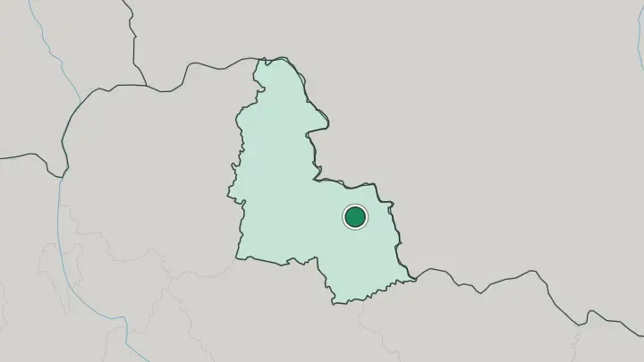
About Sumska Oblast
Woods thin into open steppe here.
What is Sumska Oblast known for?
Sumska Oblast sits in the north-east corner of Ukraine, sharing a long land border with Russia and holding the country's transition from northern forest to southern grassland. The Psel, the Seim and the Vorskla thread across it, all left tributaries feeding the distant Dnieper. Sumy stands on the Psel.
Hlukhiv, further north, once served as the capital of the Cossack Hetmanate, and sugar, film stock and locomotive works built the region's other towns.
Where is Sumska Oblast?
Sumska Oblast occupies the north-eastern corner of Ukraine, the point where the country pushes furthest toward Russia. Its eastern and northern edges are an international border, running against the Russian regions of Bryansk, Kursk and Belgorod for well over five hundred kilometres. Inside Ukraine it meets Chernihiv Oblast to the west, Poltava Oblast to the south and Kharkiv Oblast to the south-east.
The land itself is a hinge. It marks the forest-steppe transition, where the broadleaf woods of the north give way to the open black-earth grassland of the south. Rivers organise the rest.
Seven of them cross the oblast, and nearly all drain westward toward the Dnieper as left tributaries. The Desna is the largest, sweeping across the north. The Seim joins it, the Psel carries Sumy on its banks, and the Vorskla runs south past Okhtyrka toward Poltava.
Ground rises gently eastward from the Dnieper Lowland toward the edge of the Central Russian Upland, so the terrain rolls rather than towers, with woodland thickest in the north and cropland spreading south. It is one of the greener, wetter corners of left-bank Ukraine.
What is Sumska Oblast like?
Two old worlds meet in this oblast. The north belongs to historic Severia, the wooded borderland of early Rus; the south grew out of Sloboda Ukraine, the free-settlement country colonised by Cossacks and peasants through the seventeenth century. Ukrainian is the everyday language across both halves, and that doubled inheritance still shows plainly in the character of the towns.
Hlukhiv carries the most weight. It served as the seat of the Cossack Hetmanate after the older capital was destroyed, and its 18th-century Kyiv Gate still stands from that era. The town's singing school trained church composers for the imperial court, including Dmytro Bortniansky, who was born there.
Elsewhere the texture is different again. Trostianets keeps the Round Court of 1749, a rare fortress-like estate, alongside a chocolate works that still runs. Putyvl guards the wall tied in legend to Yaroslavna's lament from the medieval Tale of Igor's Campaign.
Sumy itself grew rich on sugar in the nineteenth century, and the Kharytonenko family who ran that trade left the city its parks, its cathedral and the little riverside Altanka that has become its emblem. Museums, monasteries and manor gardens are the real draw here, not any single monument.
What is the history of Sumska Oblast?
The land far outdates its borders. Its northern towns belonged to medieval Severia, while the southern half was settled from the mid-1600s as part of Sloboda Ukraine, when Cossacks and peasants moved onto the open frontier. Hlukhiv rose to real prominence in 1708, becoming the capital of the Cossack Hetmanate after Baturyn was razed, and holding that role until the hetman's office was abolished.
The oblast as a single unit is a Soviet creation. It was cut in 1939 from raions taken out of the Kharkiv, Chernihiv and Poltava regions.
What is the climate of Sumska Oblast?
The climate is temperate continental, and it swings hard between the seasons. Winters bite. January settles well below freezing across the region, and snow lies on the fields for weeks at a stretch.
Summers are warm rather than fierce, July hovering pleasantly in the high teens. Rain falls through the year, feeding the Psel, the Seim and the Desna and keeping this one of the wetter, greener parts of left-bank Ukraine. Woodland covers roughly a sixth of the land, thickest in the northern reaches near the Russian border.
Spring and early autumn are the gentlest.
How do you get to Sumska Oblast?
Nearly everyone comes by rail. Konotop is the region's great junction, sitting on the main line out of Kyiv where branches split toward Sumy and the eastern border, so most journeys into the oblast pass through it. Sumy itself has a through station with services from Kyiv and Kharkiv.
There is no significant passenger airport, and the Russian border to the east and north is closed, so the approach is always overland from the Ukrainian side. Roads then fan out from Sumy to Okhtyrka, Trostianets and the smaller river towns.
Common questions
What is the best area to stay in Sumska Oblast?
Sumy: the fullest choice of beds in Sumska Oblast.
Updated July 2026