Armenia
Aragatsotn, Armenia — Towns & Travel Guide


Aragatsotn is Armenia's province around Mount Aragats, the country's highest peak, north-west of Yerevan.
About Aragatsotn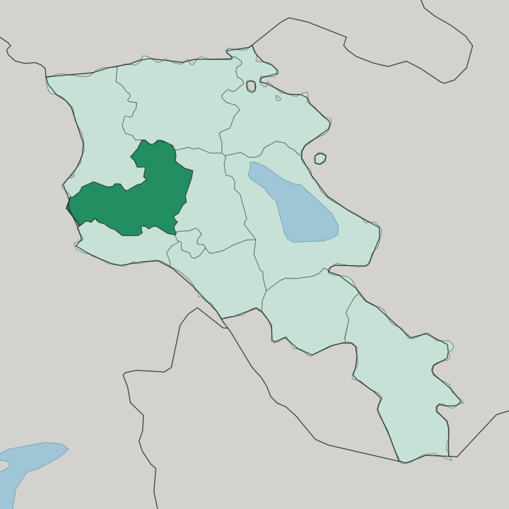
Towns & cities in Aragatsotn
Pick a town or city — each links to where to stay.
Beds sit low. Most cluster near Ashtarak and the Yerevan road, and the province thins out fast as the mountain rises. Ashtarak works as the practical base, a short drive from the capital and close to the Kasagh gorge monasteries.
Higher up, the village of Byurakan sits at the observatory's altitude on the mountain's southern slope, with family guesthouses used by hikers heading for Lake Kari and Amberd. Choose Ashtarak for the monastery circuit and easy access; choose Byurakan when you want to climb Mount Aragats or watch the sky from the observatory village.
About Aragatsotn
One mountain defines the province.
What is Aragatsotn known for?
Mount Aragats rises to 4,090 metres across four separate peaks, the highest ground in Armenia, and the province name means "the foot of Aragats". Its slopes carry the medieval fortress of Amberd and the Byurakan Observatory, the astrophysics centre founded on the mountain in 1946. Down in the Kasagh gorge sit the monasteries of Saghmosavank and Hovhannavank.
Ashtarak, the provincial capital, guards the same river where it cuts below the town.
Where is Aragatsotn?
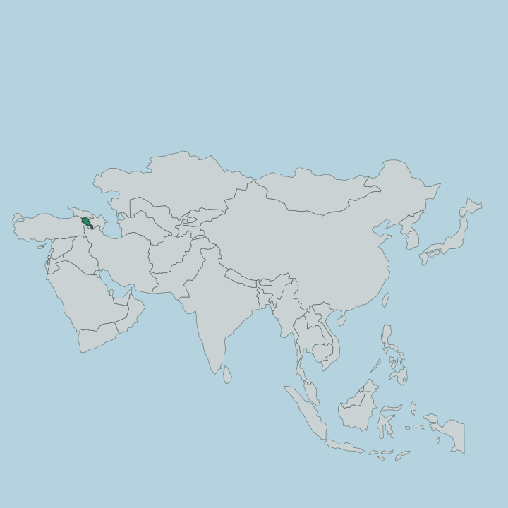
Aragatsotn fills the western part of Armenia, wrapped around the slopes and skirts of Mount Aragats. The mountain is everything here. An extinct volcano with four separate peaks, it lifts the land to 4,090 metres at its northern summit, the highest point in all of Armenia, and the whole province tilts down and away from that cone in every direction.
The Kasagh River drains the eastern side, running south from the high ground and cutting a deep gorge past Ashtarak before it leaves for the Ararat plain. The Akhurian marks the far western edge, and beyond it lies Turkey. Roughly two thousand seven hundred square kilometres belong to the province.
Yerevan sits just off the south-eastern corner, close enough that the capital feeds most of the traffic that comes this way. Shirak lies to the north, Lori to the north-east, Kotayk to the east and Armavir to the south. The floor of the province is farmland and orchard; the ceiling is bare volcanic rock and, high on the massif, the small crater lake of Kari at around 3,250 metres.
Little grows near the top. Between plain and peak the road climbs through village after village, and the elevation gain from valley to summit is what gives the province its scale.
What is Aragatsotn like?
This is a province of stone letters and mountain churches. At Oshakan, the village church holds the tomb of Mesrop Mashtots, the monk who invented the Armenian alphabet in the early fifth century, and pilgrims still come to the grave. A few kilometres up the mountain road stands the Armenian Alphabet Monument, thirty-nine carved letters set out in the open near Artashavan, raised in 2005 for the alphabet's sixteen-hundredth year.
Faith and script sit close together here. The medieval monasteries of Saghmosavank and Hovhannavank, perched on the lip of the Kasagh gorge, were centres of manuscript-copying, and Saghmosavank means "monastery of psalms". Daily life runs to farming and herding on the lower slopes, with dairy, orchards and vineyards on the plain.
The population is mostly Armenian, and Aragatsotn also holds one of the country's larger Yazidi communities, spread across a set of highland villages on the flanks of the mountain. Byurakan gives the province a second identity entirely. Its observatory drew astronomers from across the Soviet Union and beyond, and the mountain village is as known for its telescopes as its neighbours are for their bell-towers.
Old script, old faith, and the night sky all belong to the same short stretch of road.
What is the history of Aragatsotn?
The land is ancient. The border on the map is young. This corner of Armenia was part of the historic Ayrarat region long before the modern marz existed, and its churches and fortresses span more than a thousand years.
Amberd, the "fortress in the clouds", was built on the mountain's southern slope across the tenth to thirteenth centuries. The monasteries in the Kasagh gorge went up in the same medieval span. The province of Aragatsotn itself was drawn on the map only in 1995, when independent Armenia reorganised the country into its present provinces.
What is the climate of Aragatsotn?
Altitude drives the weather here. Down on the plain around Ashtarak summers are warm and dry, with clear skies through June to September, while winters turn cold and the ground freezes. Climb toward the peaks of Mount Aragats and the season shortens sharply: snow lingers on the upper slopes into summer, and the trail to Lake Kari is only open for a few warm months.
The gap between valley heat and summit chill on a single July day can be startling. Spring and autumn on the lower ground are mild but changeable.
How do you get to Aragatsotn?
Yerevan is the doorway. The province touches the capital's north-western edge, so almost everyone arrives by road from Yerevan, half an hour's drive down to Ashtarak on the main highway north. From there one road runs on toward Aparan and the north of the country, while another climbs the mountain toward Byurakan, Amberd and the summit approach at Lake Kari.
There is no passenger airport in the province and no through railway that serves travellers; the car and the marshrutka do the work. Within Aragatsotn everything hangs off that climb from plain to peak.
Good for
Updated July 2026