Armenia
Shirak, Armenia — Towns & Travel Guide


Shirak is the high, cold north-western corner of Armenia, built of black tuff around its second city, Gyumri.
Find your area →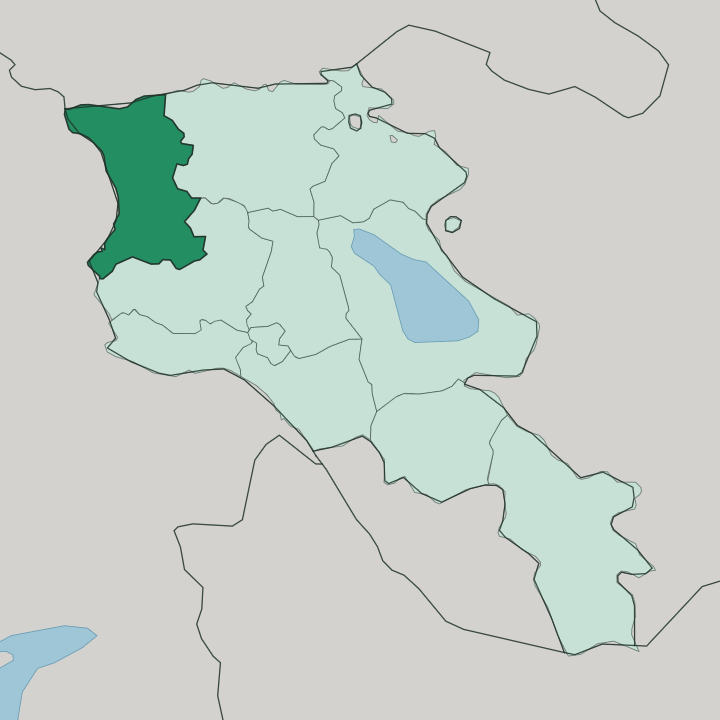
Towns & cities in Shirak
Pick a town or city — each links to where to stay.
 Armenia
Gyumri
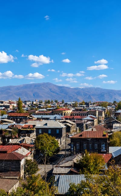
Gyumri, the second-largest city in Armenia, is the cultural centre of Shirak Province in the northwest of the country.Where to stay →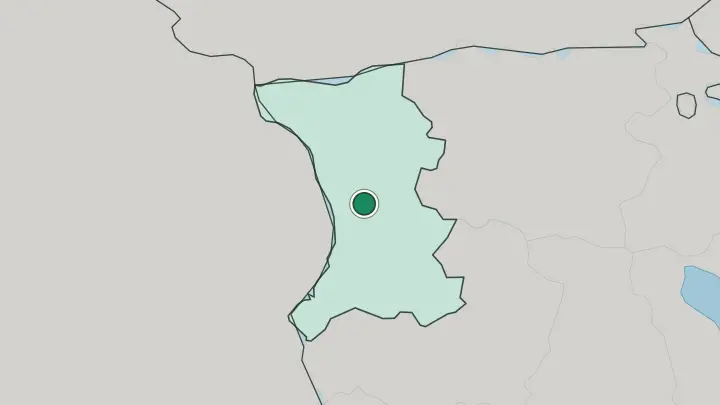
About Shirak
Gyumri anchors the province.
What is Shirak known for?
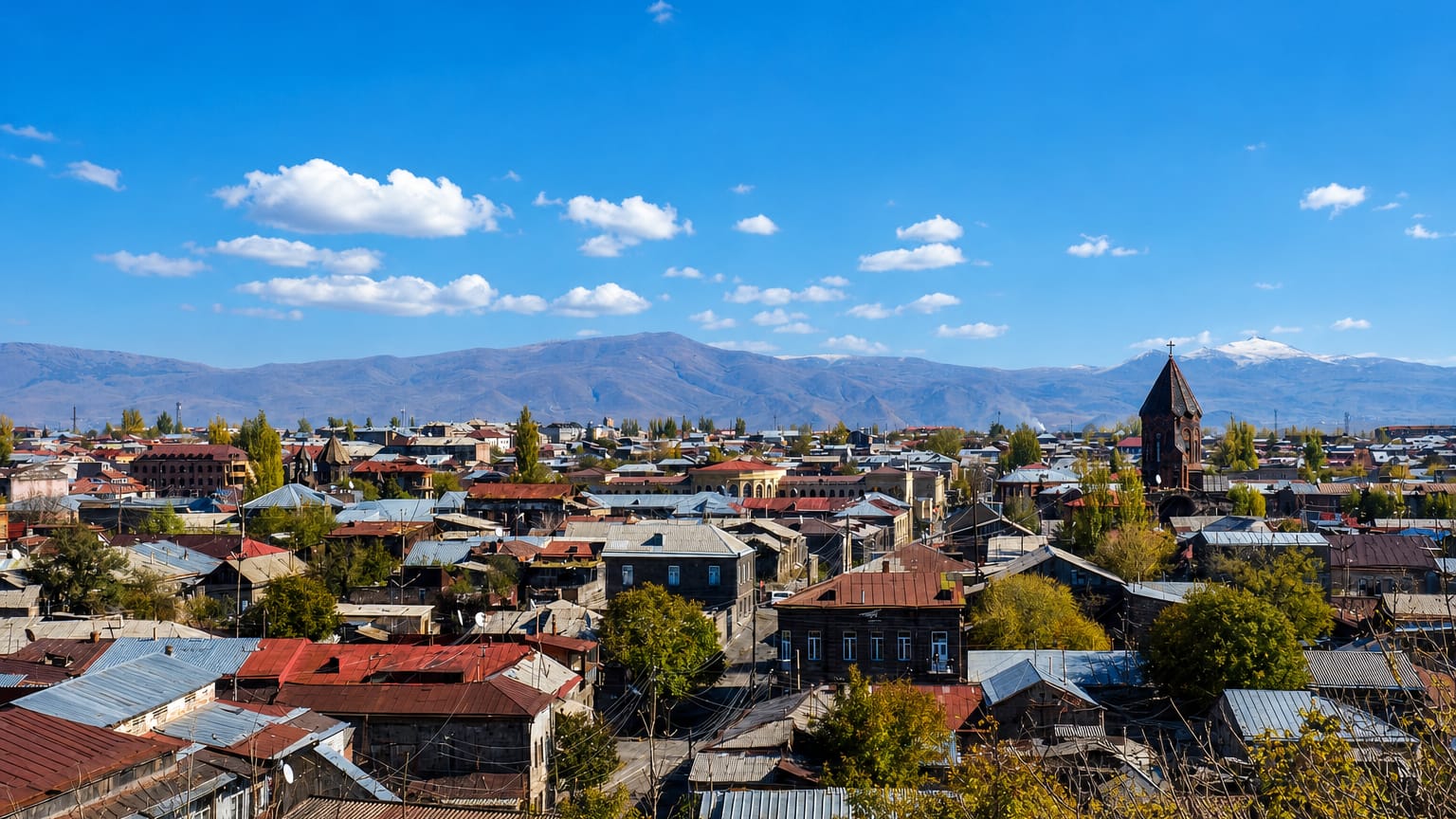
Armenia's second city sits on a treeless plateau, and its old Kumayri quarter is built almost entirely from local black and red volcanic tuff. Shirak is also the coldest province in the country, its northern Ashotsk Plateau running under snow for much of the year. The Akhurian River draws the western edge, the closed border with Turkey.
Medieval monasteries stand along it, chief among them Marmashen, and Mount Aragats rises just beyond the plain to the south.
Where is Shirak?
Shirak fills the north-western corner of Armenia, pressed against two national borders. The Akhurian River runs down its western side and marks the closed frontier with Turkey. To the north lies Georgia, and the neighbouring Armenian provinces of Lori and Aragatsotn wrap the eastern and southern flanks.
Little of this ground is low. The land is a stack of high tablelands: the Ashotsk Plateau in the north rises well above the rest, and the broad Shirak Plain fills the centre and south, both of them sitting higher than most of Europe's inhabited valleys. Mount Aragats, the tallest peak in Armenia at 4,090 metres, closes off the plain to the south, and Gyumri stands on the plateau near the middle of it all.
The Akhurian gathers in the north at Lake Arpi, up on the Ashotsk tableland, then falls south along the Turkish edge toward the Aras. Water is scarce here. Away from that river and its reservoir, the western reaches turn dry and near-treeless, while spring turns the high steppe green before summer scorches it reddish-brown.
This is high and open country, hard to farm, and the altitude governs almost everything about it.
What is Shirak like?
Shirak wears its identity in stone. Gyumri built itself from the black and red volcanic tuff that lies under the plateau, and the Kumayri quarter's carved facades, arched courtyards and worn cornices give the city a texture found nowhere else in Armenia. Craft runs deep.
The province long fed the country its stonecutters and blacksmiths, and Gyumri kept a reputation for humour, music and a stubborn artistic streak through every ruler who passed over it. Faith is older still. Armenia was the first state to adopt Christianity, and Shirak's churches carry that history in their masonry.
The medieval monasteries are the clearest expression of it. Marmashen, raised on the bank of the Akhurian in the tenth and eleventh centuries, ranks among the finest surviving work of the Ani school of Armenian building, its red-tuff churches set against bare hills. Harichavank and the small domed church at Lmbatavank carry the same tradition.
All of it grew from the same volcanic rock underfoot, cut and dressed by hands that had worked it for a thousand years. The stone is the through-line. It is the material of the shrines, the mansions and the ordinary walls alike, and it binds the whole province into one recognisable place.
What is the history of Shirak?
Shirak's story begins in the Bronze Age and enters the record under Urartu, whose King Argishti I left cuneiform inscriptions across the district in the eighth century BC. It later fell to the Bagratid kings of Armenia and their capital at nearby Ani. Russia took the region in the early nineteenth century, and in 1837 the tsar re-founded its main town as Alexandropol; the Soviets renamed it Leninakan before it became Gyumri again.
Then came the catastrophe. The 1988 earthquake levelled much of the city and the towns around it, killing tens of thousands and scarring the province for a generation.
What is the climate of Shirak?
Cold defines Shirak. This is the coldest province in Armenia, and the altitude of the plateau is the reason. Winters on the Ashotsk Plateau run seven or eight months long, with snow that can lie a metre deep and temperatures on record down near -46°C, the lowest ever measured in the country.
Down on the Shirak Plain around Gyumri the winters are milder but still bitter, and summers turn short, dry and warm. Snowmelt and the Akhurian keep the plain watered while the western steppe stays parched.
How do you get to Shirak?
Gyumri is the way in. Its Shirak Airport is the second-busiest in Armenia, and the city lies about 126 kilometres by road and rail north of the national capital, Yerevan. Most visitors reach the province overland on that route.
The western border along the Akhurian with Turkey is closed, so no one crosses there; travellers arriving from abroad come through Yerevan or over the northern boundary with Georgia. From Gyumri, roads fan out to the monasteries and the smaller towns of the plain.
Common questions
What is the best area to stay in Shirak?
Kumayri historic district: sleeping inside Gyumri's tuff-stone Kumayri streets. The Akhurian valley monasteries: day trips to Marmashen and the Akhurian border churches.
Updated July 2026