Where to stay in Isojoki
The right area depends on your trip. Here's who each one suits — pick the place, then the hotel.
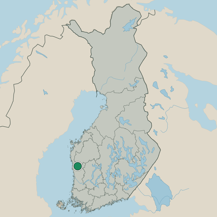
Isojoki holds few rooms. The municipality is rural and quiet, in South Ostrobothnia, and most visitors settle near the village core around Isojoen kirkko, the parish church that gathers what services the place keeps, or out in the river-valley country along the Sarviluoma. Plan ahead in the low season.
The village centre suits travellers who want walking reach of the church and the protected valley landscape of Isojokilaakson kyläasutus ja Isojoen kirkkomaisema. Rooms are few, so booking early matters, and the wider country of South Ostrobothnia offers larger bases for anyone needing more choice. Settle into this quiet river valley in western Finland.
About Isojoki
Isojoki is a river-valley parish.
What is Isojoki known for?
Isojoki is a river-valley parish. The municipality in South Ostrobothnia, western Finland, is known for Isojoen kirkko, the village church whose belltower stands above the valley, and for the protected river-valley landscape of Isojokilaakson kyläasutus ja Isojoen kirkkomaisema. The Sarviluoma watercourse threads the surrounding country.
A small place set along its river.
What are the main landmarks in Isojoki?
The church leads the valley. Isojoen kirkko stands above the village, its separate belltower at Isojoen kirkon tapuli rising beside it, and together they crown the protected setting of Isojokilaakson kyläasutus ja Isojoen kirkkomaisema. The Sarviluoma watercourse winds through the country around Isojoki.
Church, tower, and river in South Ostrobothnia.
What is the history of Isojoki?
Isojoki was chartered in the 19th century. The municipality took form in 1855 as a parish in South Ostrobothnia, in western Finland, with Isojoen kirkko at its heart and the scattered farms of the river valley as its body. Settlement grew along the water that gives the place its name, the river country now protected as Isojokilaakson kyläasutus ja Isojoen kirkkomaisema.
The valley shaped the parish. Life here followed the land and the water. Farms spread along the Sarviluoma and the wider river country, and the separate belfry at Isojoen kirkon tapuli rose beside the church to call the valley together.
The protected church landscape preserves the look of that older rural settlement. Since 1855 the parish has kept its quiet place in South Ostrobothnia.
Where is Isojoki?
A river valley defines Isojoki. The municipality sits in South Ostrobothnia, in western Finland, on the river-valley country where farmland and forest follow the water rather than rising into hills. The village gathers around Isojoen kirkko, with the Sarviluoma watercourse and the broad valley spreading through the surrounding land.
River, field, and forest.
What is the climate of Isojoki?
Inland weather rules Isojoki. Lying away from the coast in South Ostrobothnia, in western Finland, the municipality sees warm light summers and cold, snow-covered winters over its river valley, with little of the sea's softening reach this far inland. Snow lies long along the Sarviluoma and over the fields around Isojoen kirkko.
Four clear seasons in the valley.
How do you get to Isojoki?
The road follows the valley. Isojoki sits inland in South Ostrobothnia, in western Finland, reached along the country roads that trace the river, with the church village around Isojoen kirkko as the place to aim for. No large station serves the parish, so a car carries most visitors the last stretch.
Drive in to the valley.
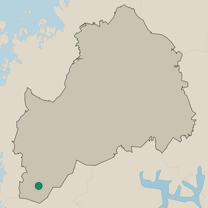
Where Isojoki sits
Boundaries © geoBoundaries (CC BY) & Wikidata (CC0); water & neighbours: Natural Earth.