Kenya
Nakuru, Kenya — Towns & Travel Guide


Nakuru is a county in Kenya's Great Rift Valley, built around flamingo-crowded Lake Nakuru, the Menengai caldera and the road up from Nairobi.
About Nakuru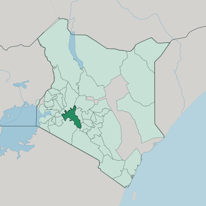


Towns & cities in Nakuru
Pick a town or city — each links to where to stay.
Base yourself beside Nakuru County's lakes. Nakuru city works for the national park, a short drive below Menengai and close to the main gate. The lodges that matter most sit inside Lake Nakuru National Park itself, ranged along the escarpments above the flamingo shallows within the rhino fence.
South toward Nairobi, Naivasha trades soda water for freshwater, with boat rides to Crescent Island and the cliffs of Hell's Gate. Between the two lies Lake Elmenteita, quieter and just as full of birds.
About Nakuru
Flamingos made the county famous.
What is Nakuru known for?
Lake Nakuru draws greater and lesser flamingos to its soda shallows in their thousands, and the national park fenced around it became Kenya's first rhino sanctuary, holding black and white rhino along with Rothschild's giraffe. North of the lake the ground splits open at Menengai, the largest caldera in the country. Two of the three soda lakes in the UNESCO-listed Kenya Lake System, Lake Nakuru and Lake Elmenteita, sit within the county's borders.
The rest is farm country, wheat and dairy on the highlands.
Where is Nakuru?
Nakuru County lies on the floor of the Great Rift Valley, in the middle of Kenya and a couple of hours' drive northwest of Nairobi. The rift walls hem it in on both sides. The Mau Escarpment rises to the west, the Bahati highlands to the northeast, and the old Eburru volcano to the south, so the county sits in a broad trough between them.
Its floor is a chain of lakes with no outlet to the sea. Lake Nakuru and Lake Elmenteita hold soda water that turns the shallows pink with algae and the birds that feed on it, while Lake Naivasha to the south stays fresh. Volcanoes shaped the rest.
Menengai looms just north of Nakuru city, its caldera the largest in Kenya and deep enough to swallow a small town. West and south the land climbs into cool forest and farmland, the Mau forming one of the country's great water towers, feeding rivers that drain down into the rift lakes. Molo and the Kuresoi ridges sit high and wet above the valley.
Down on the floor the ground is dry and dusty, the volcanic soil dark and fertile where the rains reach it. It is a landscape of edges, valley bottom and escarpment within sight of each other.
What is Nakuru like?
Nakuru is one of the most mixed corners of Kenya. The county sits on land the Maasai once grazed, the name comes from their word for a dusty place, and later drew Kikuyu, Kalenjin, Kisii and Luo families onto its farms, first under colonial settlement and then through the resettlement schemes that followed independence. Swahili and English carry across all of it, the shared languages of market and school.
Beneath them, Kikuyu and Kipsigis still fill the shops and matatu stages. Few Kenyan towns mix so thoroughly. Farming is the thread that ties the county together.
Wheat and maize run across the highland plateaus, dairy herds graze the wetter uplands around Molo, and the flower farms along Lake Naivasha grow roses that leave Kenya on night flights for European markets. Pyrethrum, the daisy grown here for its natural insecticide, was long a Rift Valley mainstay. At Njoro the old colonial farm school has grown into Egerton University, still the country's leading school of agriculture.
Weekends turn on church, football and the livestock and produce markets. It is a working landscape more than a scenic one, and the culture reflects the soil.
What is the history of Nakuru?
People have lived here for millennia. Excavations at Hyrax Hill, dug by Mary Leakey in the 1930s, uncovered Neolithic settlement and burials on a ridge above the lake. For centuries afterward it was Maasai grazing land, until the Uganda Railway reached the site around the turn of the twentieth century and a township was proclaimed in 1904.
Colonial settler farms made Nakuru the capital of the white highlands, and it won municipal status in 1929. Devolution created the modern county in 2013, and Nakuru was chartered as Kenya's fourth city in 2021.
What is the climate of Nakuru?
Altitude does the work here. Although the county straddles the equator, the high floor of the Rift keeps days warm rather than hot and nights genuinely cool. Rain comes in two spells, the long rains from March to May and a shorter spell of showers around October and November, with dry months between.
The highlands around Molo and the Mau are cold and wet enough for frost on clear nights. Down on the valley floor at Naivasha it runs warmer and drier, and the soda lakes shrink and swell as the rains dictate.
How do you get to Nakuru?
Nairobi is the way in. International flights land at Jomo Kenyatta International Airport, and from the capital the A104 highway crosses the Rift Valley escarpment and runs northwest through Naivasha to Nakuru, roughly a hundred miles on. The standard-gauge railway carries passengers as far as Naivasha, partway along that road.
Buses and shared matatus cover the route all day. Light aircraft use the airstrip at Lanet, on the edge of the city.
Good for
Updated July 2026