Kenya
Meru, Kenya — Towns & Travel Guide


Meru County climbs the north-eastern slopes of Mount Kenya, homeland of the Ameru and the Born Free plains of Meru National Park.
About Meru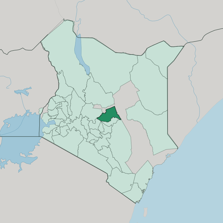


Towns & cities in Meru
Pick a town or city — each links to where to stay.
Meru town holds most of the beds. The county seat sits high on Mount Kenya's eastern shoulder, wrapped in coffee gardens, and makes the natural first base for the highlands. Safari-goers stay lower down, in the tented camps and lodges inside Meru National Park, reached through the Murera gate near Maua.
Elsa's Kopje crowns George Adamson's old camp. Maua anchors miraa country in the Nyambene hills, while the Timau escarpment toward Lewa opens onto cool wheat-and-wildlife plateau above the town.
About Meru
What is Meru known for?
Two things carry Meru's name. One is Meru National Park, the rugged lowland reserve east of Mount Kenya where George and Joy Adamson raised Elsa the lioness of Born Free, and where black rhino, reticulated giraffe and Grevy's zebra still range. The other is miraa.
Grown across the Nyambene hills around Maua, the stimulant leaf known abroad as khat ships from Igembe and Tigania to markets as far as Somalia. Coffee, tea and bananas climb the wet volcanic ridges above the town of Meru, while the equator itself crosses the county.
Where is Meru?
Meru County spreads down the north-eastern flank of Mount Kenya, in the central highlands of Kenya, where the equator runs across the land. Its forested slopes form the county's western wall, and from there the county falls away eastward and northward toward hot, dry plains. Isiolo County lies to the north, Tharaka-Nithi County to the south, Nyeri County to the south-west across the peaks, and Laikipia County to the west.
Height is everything here. Snow and glaciers hold the summit ridges of Mount Kenya, Africa's second-highest peak, while the lowland edge near the Tana River bakes at a fraction of that elevation. The land divides into three steps.
Wet, fertile highlands ring the mountain, thick with coffee, tea and the Meru forest reserve. Below them, a middle belt of farms and market towns like Nkubu and the county town of Meru gives way to the semi-arid rangeland of the north-east. Down on that hot plain sits Meru National Park, its low bush country framed by three rivers, the Tana along the southern boundary, the Ura to the south-west and the Rojewero threading through it.
The Nyambene hills rise apart from the main massif, a volcanic range in the north-east where miraa grows. Water off Mount Kenya feeds all of it.
What is Meru like?
Meru is the country of the Ameru. Nine related subgroups make up the nation, among them the Imenti, Igembe, Tigania, Miutini and Igoji, and most people here speak Kimeru, a Bantu tongue of the Mount Kenya slopes. Authority has long rested with the Njuri Ncheke, the supreme council of elders that sits above the lesser Kiama and Njuri ranks.
Its word settles land disputes. The same elders guard the sacred groves, the salt-licks and the forest, and their sanction still carries weight that no county office quite replaces. Age-sets and initiation once ordered every man's life, and the elders' hierarchy grew straight out of that.
Daily life turns on farming. Coffee, tea, bananas and potatoes come off the wet highland shambas, while the drier north lives by livestock and by miraa. The stimulant twig is more than a cash crop for Igembe and Tigania growers; chewing it knits together weddings, negotiations and long roadside afternoons.
In Meru town, the district office built in 1916 houses the Meru Museum, where the tools, dress and colonial-era relics of the Ameru are kept. Song, proverb and the drum carry much of what is remembered. Custom stays close to the surface here.
What is the history of Meru?
The Ameru remember a crossing. Tradition traces the people to Mbwa, an island of bondage somewhere off the coast, and to a flight across a sea that parted to let them pass toward Mount Kenya. They settled the mountain's slopes in the early eighteenth century.
The Njuri Ncheke and its lesser councils governed clan and land long before colonial rule. Meru County itself dates from 2013, when Kenya's constitution turned the colonial-era district into a devolved county.
What is the climate of Meru?
Altitude, not the calendar, sets Meru's weather. The equator runs through the county, so there is no true summer or winter, and the year splits instead into long rains from March to May and shorter rains from October to December. The mountain highlands stay green and cool, pulling heavy cloud off Mount Kenya.
Drop toward the Tana lowlands and the north-eastern rangeland, though, and the air turns hot and dry, where a poor season can fail the rains outright. Two worlds, one county.
How do you get to Meru?
Most people reach Meru by road from Nairobi. The tarmac climbs north around Mount Kenya through Nyeri and Nanyuki, a run of several hours, then drops east into the county; a second route swings up through Embu on the mountain's southern side. No train line reaches Meru.
For the park, light aircraft from Nairobi's Wilson field land on the Mulika and Kinna airstrips inside Meru National Park, and Nanyuki keeps a busier airstrip on scheduled flights. From there it is a short bush transfer to the lodges.
Good for
Updated July 2026