Kenya
Bungoma, Kenya — Towns & Travel Guide


Bungoma is a county in western Kenya at the foot of Mount Elgon, a rain-fed food basket and the heartland of the Bukusu people.
About Bungoma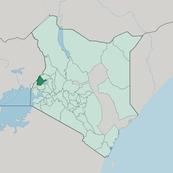


Towns & cities in Bungoma
Pick a town or city — each links to where to stay.
Most visitors base themselves in Bungoma town, the county capital on the railway line to Uganda. Webuye sits east of it, above the falls where the Nzoia River drops toward its old paper mill. Kimilili and Chwele climb toward Mount Elgon.
Choose the town for transport and beds; pick Kimilili or Chwele when you want the forest slopes and the sprawling produce market within reach. Beyond the towns, formal lodging thins fast.
About Bungoma
Two things define Bungoma: Mount Elgon and rain.
What is Bungoma known for?
The county rises from the Lake Victoria plains toward the forested slopes of Kenya's second-highest mountain, and some of the heaviest rain in the country turns its red soils into one of the nation's great food baskets. Maize and sugarcane fill the fields around Webuye and Kimilili. It is Bukusu country.
The circumcision ceremony still empties the schools in even-numbered Augusts, and the open-air market at Chwele draws traders from across the western highlands.
Where is Bungoma?
Bungoma lies in western Kenya, just north of the equator. It fills a corner of the old Western region, hard against the Uganda border. Mount Elgon defines the north.
The extinct shield volcano straddles the frontier with Uganda, and its forested slopes and moorland rise from the county's northern edge to the second-highest summit in Kenya. Volcanic ash off Elgon has left the soils deep and dark. From there the land falls away southward.
Red-soil plains slope toward the flats of the Lake Victoria basin, drained by the Nzoia River and its tributary the Kuywa, while the Sio and Malakisi keep to a separate system of their own. The Nzoia drops over rapids at Webuye, the falls also called Nabuyole. Teremi is another of the county's waterfalls.
Low hills break the plain at Sang'alo, Chetambe and Kabuchai, the highest of them scarred with old caves. Webuye guards the eastern approach; Kimilili and Chwele climb the mountain's foothills to the north. Kakamega County borders the county to the east and south-east, Trans-Nzoia to the north-east. Busia County lies west. Beyond Busia the road runs to Malaba, the busiest crossing on the Kenya-Uganda frontier.
Bungoma town sits near the middle of it, on the plain below the mountain. Rain feeds all of it.
What is Bungoma like?
This is Bukusu country. The Bukusu are the largest of the Luhya subgroups, and their language, Lubukusu, carries the songs, proverbs and clan histories that hold the community together. Every even-numbered August the ceremony returns.
Boys ready for embalu, the initiation into manhood, walk the villages ringing the chinyimba bells and gathering relatives for a night of song and busaa millet beer. Bulls are slaughtered at dawn. The Bukusu trace the custom to the 18th century, when a leader named Mango killed a python that had terrorised the community and earned the rite in return.
Farming shapes daily life as much as ritual does. Bullfighting draws its own crowds. Prize bulls, fed and dressed for the day, lock horns while drums, chikhombi horn trumpets and shrill whistles drive the ring.
The Tachoni share these hills too. Markets like Chwele are the other meeting ground, where produce, livestock and gossip change hands each week. At the Sang'alo cultural centre the dances, drums and initiation songs are kept and taught, so the younger clans learn them off the farm as well as on it.
What is the history of Bungoma?
Bungoma's story turns on resistance and the railway. In 1895 the Bukusu made their last armed stand against British troops at the hilltop forts of Lumboka and Chetambe, where a Hotchkiss gun cut down warriors armed with spears and hide shields. The fort fell.
Colonial rule followed, and the trading centre that grew beside the new Kenya-Uganda railway in the early twentieth century gave the town and later the county their name. Devolution made Bungoma a county in 2013.
What is the climate of Bungoma?
Rain is the county's signature. Bungoma catches some of the heaviest rainfall in Kenya, and the downpours arrive in two seasons: the long rains from March to July, then shorter storms from August into October. April and May are the wettest.
Warm equatorial days hold fairly steady through the year, tempered by altitude, so the plains stay hot while the forested flanks of Mount Elgon turn cold and misty toward the summit. That rain is what fills the granaries.
How do you get to Bungoma?
There is no airport in Bungoma. Travellers fly into Eldoret or Kisumu, then drive west across the highlands on the road toward the Malaba border, a couple of hours out. An old railway threads through too.
That metre-gauge Kenya-Uganda line runs down from Eldoret through Webuye and Bungoma to Malaba, the last Kenyan station before the border, but its passenger trains fell silent long ago. Matatus and buses link the towns.
Good for
Updated July 2026