Kenya
Machakos, Kenya — Towns & Travel Guide


Machakos is a semi-arid county of Kenya southeast of Nairobi, the Kamba heartland where the Athi River drops over the Fourteen Falls.
About Machakos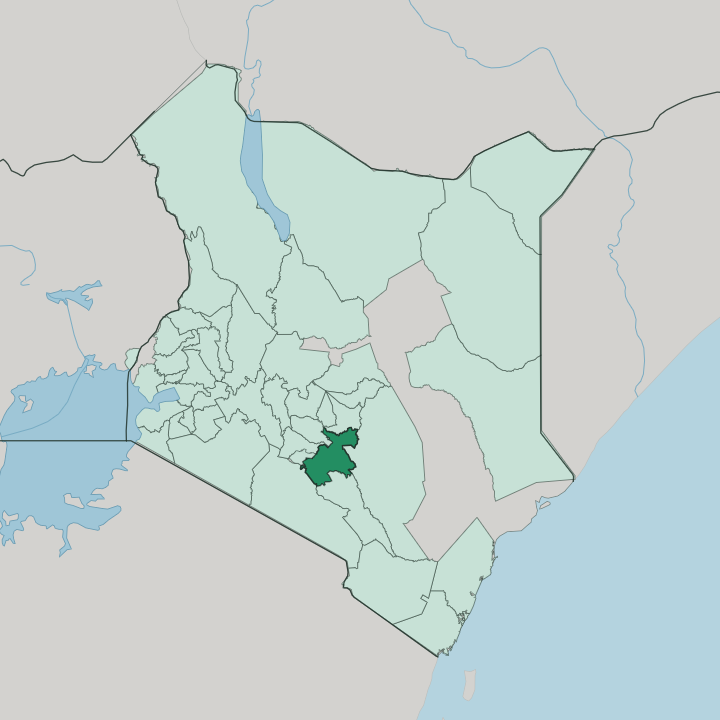


Towns & cities in Machakos
Pick a town or city — each links to where to stay.
Machakos town makes the natural base, a hill settlement wrapped in the Iveti Hills with the green lawns of Machakos People's Park at its centre. Rooms cluster there. Closer to Nairobi, the industrial town of Athi River spreads across the Athi plains, handy for the climbing crags of Lukenya and the game estate at Maanzoni.
For the waterfalls and the mountain, small resorts sit near Ol Donyo Sabuk. Choose the town for comfort; choose the plains if you are arriving straight off the Nairobi road.
About Machakos
Machakos is the home of the Kamba and their carving trade.
What is Machakos known for?
Blackwood and mahogany figures shipped from the workshops of Wamunyu built a craft whose curio stalls now spread across Kenya and far beyond its borders. Wood carving made its name. Northwest of the county the Athi River tumbles over the Fourteen Falls below Ol Donyo Sabuk, a forested mountain crowned by a colonial grave.
Machakos town anchors the highlands, while the planned technology city of Konza rises out on the plains toward Nairobi.
Where is Machakos?
Machakos spreads across the dry highlands southeast of Nairobi, in the Kamba country that Kenyans call Ukambani. It is inland, far from any coast. The county rises and falls between hills and plateaus: the Iveti Hills stand over Machakos town, the Mua Hills and the Kanzalu range break the north, and the land drops away eastward into hot semi-arid plains.
Nairobi and Kiambu press against its western edge, Kajiado lies to the southwest, Makueni to the south, Kitui across the east, and Embu and Murang'a close off the north. One river shapes the county. The Athi River traces the western and southern edges, then curves away to drop over the Fourteen Falls below Ol Donyo Sabuk, the forested mountain Kamba herders called Kilima Mbogo.
Along the eastern side runs the Yatta Plateau, a narrow tongue of ancient lava counted among the longest such flows on Earth. Where the county brushes Nairobi, the plains fill with warehouses and cement works around the town of Athi River and the truck stop at Mlolongo. Elevation does the rest, cool and green in the hills, parched in the lowlands toward Kitui.
What is Machakos like?
This is Kamba country, and Kikamba is the language of the markets and the churches. The Kamba built their name on two things: trade and craft. Long before the British came, Kamba caravans carried ivory and goods between the coast at Mombasa and the far interior, and that trading instinct never left.
Carving grew out of it. At Wamunyu, on the old road toward Kitui, a returning porter named Mutisya Munge began shaping blackwood into animals and figures, and the craft spread through cooperatives until Kamba curios reached shops around the world. Sound carries the rest of the culture.
Kamba drumming drives the kilumi, a dance once beaten out to call down rain, and sisal kiondo baskets come off the same hands that carve. The land is hard, so farmers plant maize alongside drought crops like sorghum, millet and cowpeas, and hillside mangoes and citrus ripen for the Nairobi markets. Faith runs to the churches, which crowd every ridge and town.
On weekends Machakos town fills its People's Park, and Kikamba benga and gospel spill from the matatus heading home.
What is the history of Machakos?
The town takes its name from Masaku, a Kamba leader whose settlement the British mispronounced when they arrived. In 1889 the Imperial British East Africa Company planted a fort here, one of the first inland stations on the road up from the coast, and for a few years Machakos was the interior's main colonial post. Then the railway went elsewhere.
When the Uganda Railway swung north through the swamp that became Nairobi, the administration followed, and Machakos slipped back into a quiet district town. Devolution revived it: the county was drawn up in 2013 with Machakos town as its seat.
What is the climate of Machakos?
Machakos runs dry. Rain comes in two short seasons, the long rains around March to May and the short rains near November, and in between the semi-arid air bakes the plains. Drought is a familiar visitor.
The hills around Machakos town and the Iveti ridge catch more cloud and stay cooler and greener than the low country falling east toward Kitui, where the heat is fierce and the wells run shallow. Height, not the sea, sets the weather here.
How do you get to Machakos?
Machakos County holds no airport within its borders. The flights land at Jomo Kenyatta International in Nairobi, whose runway sits almost on the county's western edge, and from there it is a short drive southeast. Traffic does the deciding.
Matatus and buses stream out along the Nairobi-Mombasa highway through Mlolongo and the town of Athi River, then branch off at the Machakos turnoff for the climb into the hills. The railway to the coast stops at Athi River too.
Good for
Updated July 2026