Kenya
Narok, Kenya — Towns & Travel Guide


Narok is the Kenyan county that holds the Maasai Mara, where the wildebeest migration crosses the Mara River each year.
About Narok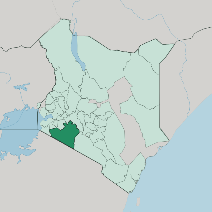


Towns & cities in Narok
Pick a town or city — each links to where to stay.
Most sleep inside the Maasai Mara itself. Camps and lodges line the Mara and Talek rivers, close to the crossing points where the migration fords the water. The Mara Triangle, the reserve's western sector beneath the Oloololo Escarpment, keeps its game drives quieter than the eastern plains.
Narok town sits halfway from Nairobi, the last place to fuel and stock up before the gates, and it works as an overnight staging stop rather than a destination. Kilgoris anchors the greener Trans-Mara hills in the county's west. Choose the reserve for the wildlife; choose the town if you are breaking the drive.
About Narok
One name carries the county.
What is Narok known for?
It is the Maasai Mara, a reserve that fills Narok's southern plains and runs into the Serengeti National Park across the Tanzanian border to form a single unbroken grassland. Every year the wildebeest migration pours north over the Mara River after fresh grazing, and the river crossings draw travellers from around the world. The Maasai give the county its other face, herding cattle across the open range their families have held for generations.
Wheat farms and the Mau Forest cover the cooler highlands north of the plains.
Where is Narok?
Narok fills the southern floor of Kenya's Great Rift Valley, southwest of Nairobi and running down to the Tanzanian border. Six Kenyan counties ring its inland edges, among them Nakuru to the north and Kajiado to the east, while Tanzania lies across the plains to the south. The land tilts from cool forested highlands down to hot open savannah.
In the north the Mau Escarpment rises above the valley floor, carrying the Mau Forest, the largest indigenous montane forest in East Africa. Southward the ground falls away into the wide grass plains that hold the Maasai Mara. Water ties the two halves together.
The Mara River gathers in the Mau highlands, then winds south and west across the plains before crossing into Tanzania and emptying, far downstream, into Lake Victoria. Along the western edge of the reserve the Oloololo Escarpment climbs in a sheer wall above the grass, marking the rim of the Mara Triangle. Beyond the southern boundary the plains continue unbroken into the Serengeti National Park, so the county's wildlife shares one range with Tanzania.
Distances here are long. Narok town, the county seat, stands roughly halfway between Nairobi and the reserve gates.
What is Narok like?
Narok is Maasai country, and cattle stand at the centre of life here. Wealth is counted in herds, not acres, and boys still grow up driving livestock across the open range. Homesteads of low mud-and-dung houses ring their cattle inside thorn enclosures called enkang.
Red catches the eye first. Men and women wrap themselves in the bright shuka cloth, layered with beadwork whose colours carry meaning, and the tall jumping dance of the young warriors is a fixture of ceremonies. Two tongues run side by side.
Maa, the Maasai language, is spoken at home, while Swahili and English serve the market and the school. Narok town is the seam between the herding world and the cash economy, its streets busy with traders, matatus and safari vehicles bound for the reserve. Up in the Mau highlands the culture shifts toward the plough, where Kenyan wheat and barley farmers work land that was grazing within living memory.
Tourism threads through all of it, since the Maasai Mara draws a steady stream of visitors whose lodges employ guides, trackers and dancers from the surrounding group ranches.
What is the history of Narok?
The Maasai reached these grasslands generations before any border was drawn, herding down from the north along the Rift. Colonial rule pushed them south. Treaties signed in 1904 moved Maasai communities off the central highlands and into reserves that included the Narok plains.
The Maasai Mara was set aside as a wildlife area in 1961, first as a small game reserve and later enlarged across the southern county. Devolution redrew the map again in 2013, when Narok became a self-governing county and took charge of the reserve, while the Mara Conservancy kept day-to-day control of the western Mara Triangle.
What is the climate of Narok?
Across Narok, elevation dictates the climate. The Mau highlands in the north stay cool and green, wrapped in mist and heavy rain, while the Mara plains to the south are warmer and drier. Rain comes in two spells: the long rains around April and May, then shorter showers late in the year.
Between them the dry months from June onward turn the grass gold and thin the cover, which is when the herds gather and the river crossings run. Storms build fast over the escarpment. Nights on the open plains can turn surprisingly cold.
How do you get to Narok?
Most trips start in Nairobi. The classic route runs southwest on the B3, dropping down the Rift Valley escarpment through Mai Mahiu before reaching Narok town, roughly a three-hour drive. From Narok the tarmac gives way to rougher murram roads that climb the last stretch to the reserve gates.
Fliers skip the whole drive. Light aircraft leave Wilson Airport in Nairobi for the Mara's bush airstrips, among them Keekorok and Ol Kiombo, a hop of under an hour. Either way, Narok town is the hinge the whole county turns on.
Good for
Updated July 2026