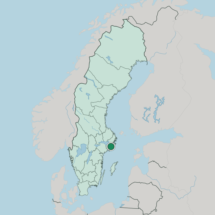
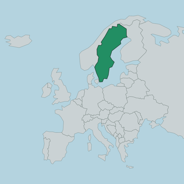
Sweden · Stockholm County
Where to Stay in Haninge, Stockholm County


Haninge is a municipality in Stockholm County on southern Södertörn, the mainland threshold to Stockholm's southern archipelago.
Find your area →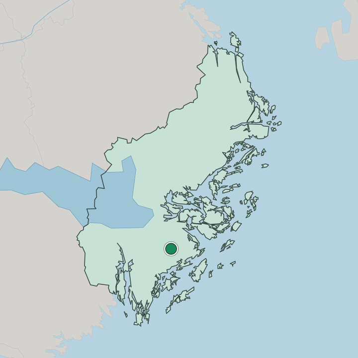
Where to stay in Haninge
Each area has its own feel; here's who each one suits.
Where you stay in Haninge depends on what you came for. Handen, the main town, sits on the commuter line and gathers the everyday hotels, shops, and services; it is the obvious base for anyone here on business or using the municipality as a foothold near the city. It is practical rather than scenic.
The coast tells a different story. Dalarö, an old customs and bathing village out on a point, is the place to stay for the archipelago itself, with wooden houses, jetties, and boats leaving for the outer islands; it suits travellers who want sea air and slow days rather than transport links. Årsta havsbad nearby carries the same seaside character in a former holiday-cottage settlement. For a true island stay, you can press on by boat to Utö or Ornö, where small guesthouses sit among the rocks and pines.
Beds thin out fast on the islands. If you want the archipelago, book early and base on the coast or an island; if you want convenience and trains, stay in Handen and visit the water by day.
Things to do in Haninge
Ranked by global recognition; descriptions from Wikidata (CC0).
Museums & Galleries
2- Handens museum och smedja
- Svartbäckens skolmuseum
Churches & Religious Sites
2- Sankt Eskils kyrka Heritage
- Jordbro kyrka Heritage
Stadiums & Sports
1- Torvalla IP
worth knowingacross 3 categories in Haninge
About Haninge
Haninge is known as the way into the southern archipelago.
What is Haninge known for?
From quays such as Dalarö and Årsta havsbad, boats run out to islands like Utö and Ornö, so the municipality functions as the mainland staging post for a whole stretch of skerries and sounds. Inland the picture changes. The town of Handen forms the busy commercial and administrative core, and the old wilderness of Tyresta, with its national park, reaches into the northern edge, pairing suburban centre with deep forest and open sea.
What are the main landmarks in Haninge?
Haninge keeps its set pieces spread between town and shore. In Handen the modern Sankt Eskils kyrka serves the parish, and local sport gathers at Torvalla IP. The older landmarks lie out toward the water: the wooden grid of Dalarö with its eighteenth-century church and customs past, the bathing places along the coast, and the primeval forest of Tyresta, where one of the country's national parks protects old-growth pine.
The pull is outward, toward the islands.
What is the history of Haninge?
Haninge's past is really the past of several places drawn together. The coast was settled and sailed for centuries, and Dalarö grew into a customs station and naval anchorage guarding the southern approaches to Stockholm, a role that left it a tight village of wooden houses and a notable church. Out on the islands, Utö was mined for iron from the Middle Ages, one of the oldest ironworking sites in the region.
Inland the story is more recent. Farming parishes lay scattered across southern Södertörn until the railway and then the postwar expansion of the capital reached them. The town of Handen was built up as a modern centre in the twentieth century, and in the early 1970s the surrounding parishes were joined into the single municipality of Haninge.
That fusion explains the place as it stands: an administrative town of recent date set among far older coastal villages and mining islands, with deep forest preserved at Tyresta between them.
Where is Haninge?
Haninge lies in the southern part of Stockholm County, on the seaward side of the Södertörn peninsula in eastern Sweden. Its mainland is forest and lakes; its coastline breaks into a maze of bays, points, and islands. The archipelago dominates the east.
Beyond the shore the skerries run out toward the open Baltic, with larger islands such as Utö and Ornö lying offshore, while inland the protected woods of Tyresta rise along the northern boundary in a band of old forest.
What is the climate of Haninge?
Open to the sea, Haninge has a humid continental climate softened along the coast by the Baltic. Winters are cold but maritime, with the outer water slow to freeze while sheltered inlets and inland lakes ice over earlier. Summers draw people to the shore.
Long light, sea breezes, and warm water in the sounds make the bathing places busy through the season, and the forests stay cool, before wet and windy weather closes in across the islands in autumn.
How do you get to Haninge?
Haninge rides on Stockholm's southern arteries. Commuter trains on the main line stop at Handen and the other town stations, tying the municipality to the central city, while the Nynäsvägen road, route 73, runs down through it toward the coast. The sea is the other route.
Archipelago boats leave from quays such as Dalarö and Årsta brygga for the outer islands, and from there small ferries link the scattered communities that the roads and rails never reach.
Good for
More cities in Stockholm County
Updated July 2026