Turkey
Aksaray, Turkey — Towns & Travel Guide


Aksaray is a province of Central Anatolia, spread across the high plateau between Ankara and Cappadocia below the volcano Hasan Dağı.
About Aksaray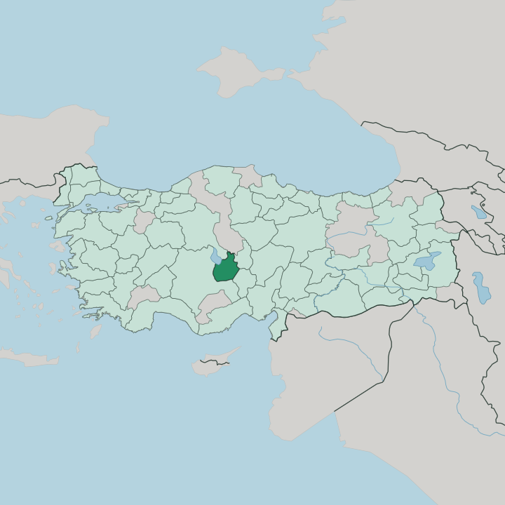


Towns & cities in Aksaray
Pick a town or city — each links to where to stay.
Aksaray city is the practical base, sat on the Ankara-Cappadocia road with the leaning Eğri Minare at its centre. Sleep there before an early start. For the valleys, push south to Güzelyurt, the old Greek town beside the Ihlara gorge, where cave rooms and stone Greek mansions have been turned into small hotels.
Out west, the caravan town of Sultanhanı puts you at the gate of the Sultan Han and within reach of Lake Tuz. Pick the city for convenience, Güzelyurt for the rock churches, Sultanhanı for the salt road.
About Aksaray
What is Aksaray known for?
Two landmarks carry the province's name. The Sultan Han caravanserai stands beside the old caravan road at Sultanhanı, the largest medieval way-station the Seljuks ever built in Anatolia, and travellers still stop under its carved stone gate. West of the city the flat white pan of Lake Tuz supplies much of the country's table salt.
The Ihlara Valley cuts a green gorge into the plateau. Add the Malaklı guard dog and the volcano Hasan Dağı, and the shortlist is set.
Where is Aksaray?
Aksaray lies on the Central Anatolian plateau, the high dry tableland at the centre of Anatolia. Ankara is about 240 km to the northwest, and the tuff country of Cappadocia begins some 50 km east, so the province sits on the road between the capital and that volcanic landscape. The land is open steppe, grain fields and grazing pasture running to the horizon.
It rests high above the sea. Konya borders it to the west, Niğde to the south, and Nevşehir to the east across the Cappadocian tableland. Two natural features dominate.
Hasan Dağı, a dormant volcano, rises above three thousand metres on the southern boundary with Niğde, and the ash it once threw out laid down the soft tuff that gives western Cappadocia its shapes. Along the northwestern edge lies Lake Tuz, a shallow salt pan that is the second-largest lake in the country. In summer much of it dries to a hard white crust of salt.
The Melendiz River carves the other landmark, the Ihlara Valley, a green gorge sunk into the plateau between Selime and the village of Ihlara. Water is scarce up here, so those rivers and springs mattered.
What is Aksaray like?
Aksaray keeps the rhythm of a farming province. The plateau is grain and pasture country, one of the granaries of Central Anatolia, and shepherding still shapes daily life. Out among the flocks works the Malaklı, the giant Aksaray guard dog bred to face down wolves.
Locals call it the Anatolian Lion. A single pair can hold a herd of hundreds against a pack, and the breed has become a point of provincial pride carried well beyond Turkey. The other inheritance is carved in stone.
Long before the Turks arrived, Byzantine Christians hollowed churches, refectories and whole underground towns out of the soft tuff. Their frescoes still colour the rock chapels along the Ihlara Valley. The old Greek village of Güzelyurt, once called Gelveri, keeps dozens of these churches and a network of tunnelled homes.
Beneath it lie carved underground cities where farmers once sheltered from raiders. At the table the province leans on soup, pastry and pulses, and the thick, peppery Arabaşı is the dish people name first. Wool, grain and the herding calendar still order much of village life.
Turkish is the everyday language throughout.
What is the history of Aksaray?
The city grew up on an old Anatolian crossroads, known in antiquity as Archelais. After the Seljuk Turks took Anatolia at Manzikert in 1071, Aksaray grew into a Seljuk town whose name, white palace, recalls a palace of Sultan Kılıç Arslan II. Their masons raised the Sultan Han on the Konya road in 1229.
Ottoman rule came in 1470, and when İshak Pasha moved townspeople to Istanbul, they gave their name to a whole quarter of the city. That quarter still carries it.
What is the climate of Aksaray?
Aksaray has the dry continental climate of the Anatolian steppe. Winters are cold and often white, with snow settling on the plateau and lingering on Hasan Dağı well into spring. Summers turn hot and parched.
Rain is thin and falls mostly in winter and spring, which is why the fields lean on the Melendiz River and the snowmelt off the mountains. Days and nights swing far apart under the clear inland sky. Bring layers whatever the season.
How do you get to Aksaray?
Most people reach Aksaray by road. The province straddles the main highway from Ankara to Cappadocia, so buses run in from the capital, from Konya to the west and from Istanbul, pulling into the central otogar. It is a drive of roughly 240 km up from Ankara.
The nearest runway is Nevşehir Kapadokya Airport, about an hour east, with shuttle vans linking it to the city. From Aksaray a single road climbs south to Güzelyurt and the mouth of the Ihlara Valley. Come by bus or car.
Good for
Updated July 2026