Turkey
Niğde, Turkey — Towns & Travel Guide


Niğde is a province of south-central Turkey, a high Anatolian plateau walled by the Aladağlar peaks of the Taurus Mountains.
About Niğde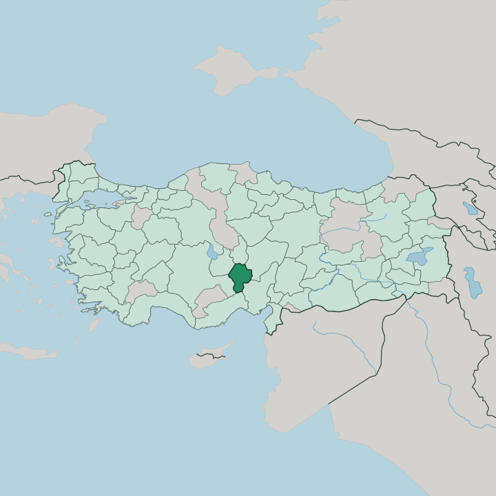


Towns & cities in Niğde
Pick a town or city — each links to where to stay.
Niğde town is the easy base. It gathers below its castle mound and the Alaeddin Mosque, with the province's bus and rail links on the doorstep. Climbers and walkers push southeast to Çamardı, where Demirkazık and Çukurbağ sit right at the foot of the Aladağlar.
West of the town lie Bor and Kemerhisar, beside the Roman aqueduct at Tyana. Choose the town for comfort, buses, and the railway; move out to Çamardı and Demirkazık when the high walls of the Aladağlar are the whole reason you came.
About Niğde
Niğde is mountain country.
What is Niğde known for?
The Aladağlar, the highest and wildest reach of the Taurus Mountains, rise along its eastern edge, and Demirkazık draws climbers to what many call the birthplace of Turkish mountaineering. Down on the plateau the province grows more potatoes than anywhere else in Turkey, its cellars and cold stores dug into the volcanic ground. History runs just as deep.
The Neo-Hittite city of Tyana and the rock-cut Gümüşler Monastery mark the land west of the town.
Where is Niğde?
Niğde lies in the south of Turkey's Central Anatolia region, part of the high inland plateau rather than the coast. The land sits well above a thousand metres, and mountains close it in on three sides. The Aladağlar, the tallest block of the Taurus Mountains, wall off the east and southeast; Demirkazık, their highest peak, rises above the village of the same name near Çamardı.
To the south the Bolkar Mountains carry the plateau down toward Mersin and the old pass of the Cilician Gates. Northwest stands the volcano Mount Hasan, and between it and the town run the Melendiz mountains. It is a landscape of rock and open tableland.
The province borders six others. Kayseri and Nevşehir lie to the north and northeast, Aksaray to the northwest, Konya to the west, and Adana and Mersin over the Taurus wall to the south. The old region of Cappadocia reaches into this northern edge, its tuff and cones continuing across the Nevşehir line. Water is scarcer than rock here.
The Melendiz river drains the western basins, and the brackish Lake Nar sits in a crater on the Aksaray border. Streams off the Aladağlar feed the Bor plain, the province's most productive ground. Everything drains inward, toward the plateau, not the sea.
What is Niğde like?
Niğde is a working provincial town, not a resort. Its life turns on the land and the mountains around it. Potato cellars and apple orchards fill the plateau; trout come from the cold streams off the Aladağlar, and the weekly markets still draw farmers down from the villages.
Much of the country's table potatoes are lifted from this ground. An old saying catches the rhythm of trade here: once the market at Bor is over, the donkey carries on to Niğde. Turkish is what you'll hear in Niğde's streets and markets.
The pace is slow, the winters long, and the food plain and filling. Its monuments come mostly from the Seljuk and the centuries just after. The Alaeddin Mosque, raised in 1223 inside the castle walls, anchors the old town, and the domed tomb of Hüdavent Hatun and the carved doorway of the Ak Medrese stand nearby.
Out at Gümüşler, a Byzantine monastery cut straight into the rock keeps frescoes of the Cappadocian church fathers and a rare smiling Virgin. Stone does the remembering here. The overall effect is austere, upland, and old, closer to Kayseri than to the coast.
What is the history of Niğde?
People have farmed this plateau since the Neolithic. The Hittites held the land for centuries, and their successors built the kingdom of Tuwana around the city later known to Rome as Tyana, at modern Kemerhisar. Seljuk Turks took the region in the twelfth century and made Niğde a walled provincial capital, raising its mosque in 1223.
The Karamanids and then the Ottomans followed, the latter absorbing the province in 1471. Its name descends, through Nakida, from the goddess Anahita.
What is the climate of Niğde?
The climate is dry and continental. Winters bite, with hard frost and snow lying over the plateau for weeks, while summers turn hot and parched under a high, cloudless sky. Rain is sparse, and most of it comes in spring.
The dryness keeps the land as steppe, not forest. Snow holds on the Aladağlar and the Bolkar Mountains long into summer, enough to feed the ski runs above Demirkazık.
How do you get to Niğde?
No airport serves Niğde directly. Most travellers fly into Kayseri or the Cappadocia airport at Nevşehir, then drive or bus down in under two hours. The D750 trunk road threads the province north to south, carrying traffic from Ankara and Aksaray toward Adana and the Mediterranean through the historic pass of the Cilician Gates.
Trains stop at Niğde on the line between Kayseri and Adana. Long-distance coaches run in from Ankara, Konya, and the coast.
Good for
Updated July 2026