South Africa
Eastern Cape, South Africa — Towns & Travel Guide


The Eastern Cape stretches along South Africa's Indian Ocean shore, from the dry Karoo inland to the untamed Wild Coast.
Find your area →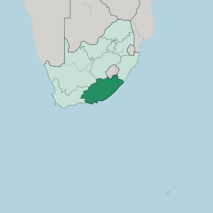
Towns & cities in Eastern Cape
Pick a town or city — each links to where to stay.
 South Africa
Gqeberha
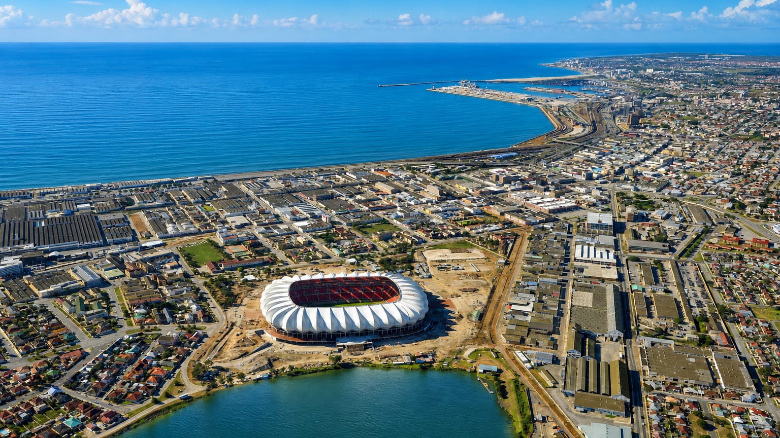
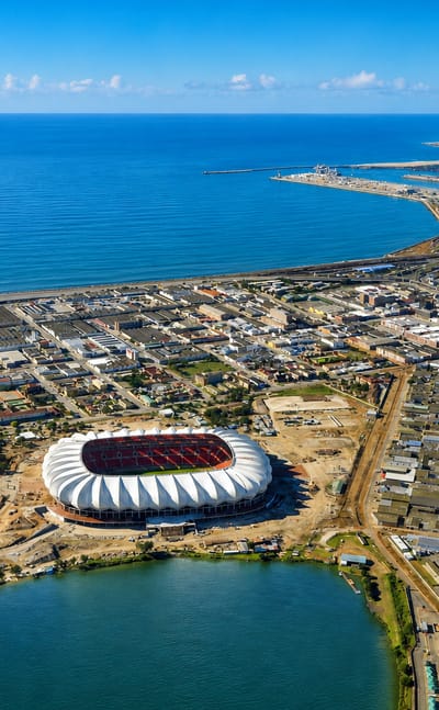
Gqeberha stands on the Indian Ocean coast of the Eastern Cape in South Africa, a windswept seaport known for the Donkin Memorial and its wide bay.Where to stay →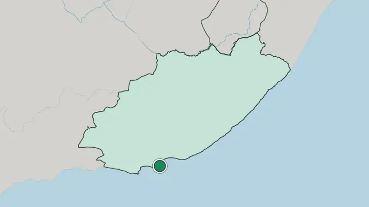
About Eastern Cape
This is the home of legends.
What is Eastern Cape known for?
Nelson Mandela grew up in the village of Qunu near Mthatha, and Steve Biko was raised near Qonce, so the province carries much of South Africa's anti-apartheid story. Wildlife is the other draw. Addo Elephant National Park, half an hour from Gqeberha, shelters more than 600 elephants and is malaria-free, which makes it an easy first safari.
Beyond it lie the surf breaks of Jeffreys Bay and the cliffs, lagoons, and Xhosa villages of the Wild Coast.
Where is Eastern Cape?
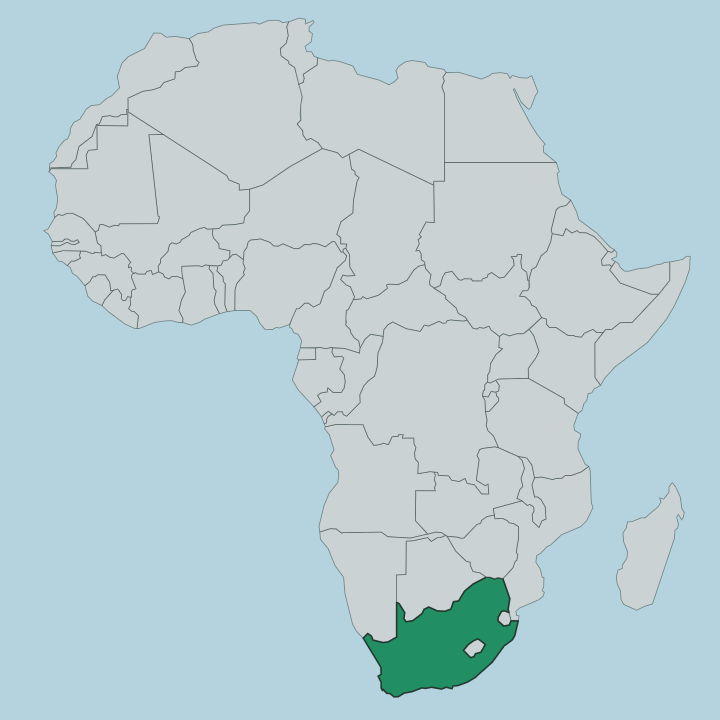
The Eastern Cape fills the south-eastern corner of South Africa. It runs along the Indian Ocean between the Western Cape to the west and KwaZulu-Natal to the north-east, and it is the second-largest of the country's nine provinces. Its coastline curves for roughly 800 km, from the surf town of Jeffreys Bay in the west past Gqeberha and East London to the wild river mouths of the north-east.
The land climbs as you leave the sea. Behind the coast the ground rises through green hills toward the Great Escarpment, and the forested Amathole Mountains near Qonce lift above 1,800 metres before the plateau flattens out. Inland the province turns dry and open.
The north-west runs into the Great Karoo, a semi-arid tableland of flat-topped hills and thin scrub around towns like Graaff-Reinet. Big rivers cut across all of it. The Great Fish River runs 644 km from the hills east of Graaff-Reinet down to the ocean, and for a century it marked the frontier of the old Cape Colony.
Further east, past the Great Kei River, lie the deep gorges and rolling grassland of the former Transkei, the heart of the Wild Coast. That mix of dry interior, high escarpment, and rugged shore is what gives the province its range.
What is Eastern Cape like?
The Eastern Cape is the Xhosa heartland. The central and eastern districts, the old Transkei and Ciskei, are where most of South Africa's Xhosa people live, and the language you hear on the Wild Coast and around Mthatha is isiXhosa, full of its distinctive clicks. Beadwork carries meaning here.
Colours and patterns mark a person's age and status, and initiation and coming-of-age rites are still kept in the villages. On the table you will meet umngqusho, the samp-and-beans dish of crushed maize that was said to be Mandela's favourite. This is also a province of struggle memory.
It gave South Africa Nelson Mandela, Oliver Tambo, Robert Sobukwe, and Steve Biko, and locals call it the Home of Legends for good reason. That history is not hidden away. You can visit Mandela's boyhood village at Qunu and the Steve Biko sites around Qonce, where the anti-apartheid story is told on the ground it happened on.
Alongside the Xhosa world runs an older settler layer: the Victorian streets of Graaff-Reinet, the 1820 Settler heritage around Makhanda, and the mission towns of the interior. The two threads sit side by side across the whole province.
What is the history of Eastern Cape?
The province is young. It was drawn up in 1994, when the sprawling Cape Province was broken apart and the two Xhosa homelands of Transkei and Ciskei were folded back into a single new province with Bhisho as its capital. The frontier here is far older.
Long before that, the Great Fish River was the fought-over edge of the Cape Colony, where Xhosa chiefdoms and colonial settlers clashed through a run of frontier wars across the 1800s. That long collision, and the anti-apartheid resistance that followed it, shaped the province more than any other event.
What is the climate of Eastern Cape?
The coast stays mild. Gqeberha and the shore towns run warm summers and gentle winters, cooled by the Indian Ocean and often breezy enough that the port earned the nickname the Windy City. Head inland and the swing widens sharply, because the Karoo bakes under hot, dry summer days and can drop close to freezing on clear winter nights.
Rain is thin in the semi-arid west and heavier along the eastern hills and the Wild Coast, where summer storms feed the green grassland. The high Drakensberg country in the far north even sees winter snow.
How do you get to Eastern Cape?
Most travellers fly into Gqeberha. Chief Dawid Stuurman International Airport sits minutes from the city and links to Johannesburg, Cape Town, and Durban, which makes it the usual door to Addo Elephant National Park and the western coast. East London has the second airport and a river port, and it is the common starting point for the drive onto the Wild Coast.
The long Garden Route also runs in along the shore from the Western Cape. Once you arrive, a hired car is close to essential, because the parks, the Karoo towns, and the Transkei villages sit far apart on the road.
Common questions
What is the best area to stay in Eastern Cape?
Gqeberha: a first base near Addo's elephants.
Good for
Updated July 2026