South Africa
Mpumalanga, South Africa — Towns & Travel Guide


Mpumalanga fills the north-east of South Africa, where the Highveld drops down an escarpment into the Lowveld and Kruger.
About Mpumalanga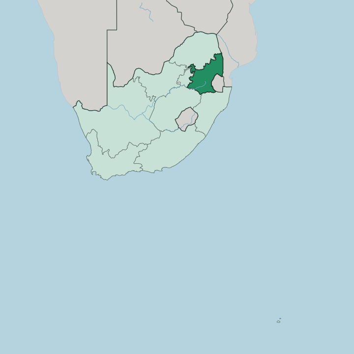
Towns & cities in Mpumalanga
Pick a town or city — each links to where to stay.
Nights split between rim and bush. Graskop and Sabie sit high on the escarpment among pine plantations and waterfalls, the natural bases for driving the Panorama Route and looking down into the Blyde River Canyon. Hazyview drops lower toward the Lowveld, close to the western gates of the Kruger National Park, so many people sleep there the night before a game drive.
Mbombela, the provincial capital on the Crocodile River, is the practical hub, holding the airport and the shops. Pick the rim for the canyon; pick Hazyview when the safari comes first.
About Mpumalanga
What is Mpumalanga known for?
The name means "the place where the sun rises". Its draw is the edge where the land falls. The Drakensberg escarpment splits the province, and along that rim the Panorama Route strings together the Blyde River Canyon, God's Window and Bourke's Luck Potholes.
Below the escarpment the Lowveld runs east into the Kruger National Park, South Africa's flagship safari ground and the single biggest reason travellers point their cars at Mpumalanga. Gold made it first. The 1873 rush at Pilgrim's Rest, the country's earliest, still shows in the tin-roofed diggers' village kept as a museum.
Where is Mpumalanga?
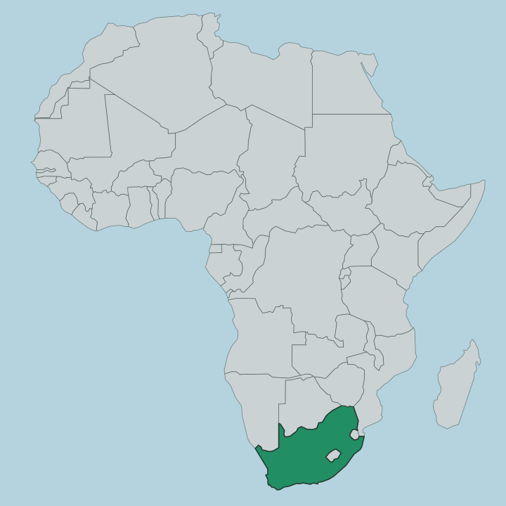
Mpumalanga lies in the north-east of South Africa, one of the country's smaller provinces by area but among its busiest for visitors. Its eastern edge is an international one. Eswatini presses against the south-east and Mozambique runs along the east, so the province ends where South Africa itself ends. Inland it shares borders with four sister provinces: Limpopo to the north, Gauteng to the west, the Free State to the south-west and KwaZulu-Natal to the south.
Yet the line that matters most is not political at all. The Drakensberg escarpment cuts across the province from north to south and divides it in two. West of that wall the land sits high, a cool plateau of grassland called the Highveld, rolling between about 1,700 and 2,300 metres.
East of it the ground collapses down the escarpment into the Lowveld, a hot and low subtropical belt of savanna that carries on into the Kruger National Park and across the border. The drop is steep and sudden. Mbombela, the capital, sits in that lower country on the Crocodile River, which winds east past the city and eventually joins the Komati on its way toward Mozambique.
Water and altitude decide almost everything here.
What is Mpumalanga like?
This is a Swazi and Zulu heartland first, a province whose very name is a Nguni word. Swazi is the language most homes speak, ahead of Zulu, with Tsonga strong toward the Mozambique border in the east. The culture bends across those borders as much as within them, since the Swazi world does not stop at the line with Eswatini and the Tsonga one carries on into Mozambique.
Farming and forestry set the daily rhythm. The high escarpment around Sabie is planted thick with pine and eucalyptus, feeding the timber mills, while the warm Lowveld grows citrus, subtropical fruit and sugar. Gold-rush memory sits on top of all this.
Pilgrim's Rest, kept whole as a heritage village, preserves the corrugated-iron world of the 1870s diggers, and the old mining towns of the rim still trade partly on that past. Then there is the bush. For many South Africans and foreign visitors alike, Mpumalanga simply means the Kruger National Park, and the safari lodge and the game drive shape a whole hospitality economy along the Lowveld gates.
Grassland above, savanna below, and a border-crossing mix of peoples between them.
What is the history of Mpumalanga?
Gold wrote the modern story. In 1873 prospectors panning Pilgrim's Creek struck payable gold, and Pilgrim's Rest was proclaimed a goldfield that September, the first true gold rush in the country. Diggers poured in.
When the easy alluvial gold thinned, many moved south to fresh strikes around Barberton, and the pattern of boom towns spread along the escarpment. The province itself is young as a unit, drawn up in 1994 out of the old Transvaal when democratic South Africa redrew its map and gave the region its Nguni name, Mpumalanga, and its capital at Mbombela.
What is the climate of Mpumalanga?
Altitude splits the weather as sharply as it splits the land. The high Highveld in the west is cool and dry, sitting well above 1,700 metres, with cold, crisp winter nights and thunderstorms rolling through the summer afternoons. Drop down the Drakensberg escarpment and everything warms.
The Lowveld in the east is subtropical, hot and humid in summer and mild in winter, which is exactly why the dry winter months draw travellers to the Kruger National Park, when thin bush and thirsty animals make game easy to spot. Rain falls mostly in summer. Two climates, one short drive apart.
How do you get to Mpumalanga?
Most visitors come from Johannesburg, to the west. The drive east on the N4 highway runs roughly 330 kilometres to Mbombela and takes about four hours, climbing over the Highveld before dropping toward the Lowveld. Flying is quicker: the Kruger Mpumalanga International Airport outside Mbombela is under an hour from Johannesburg by air and puts you within reach of both the Panorama Route and the Kruger National Park gates.
From there it is road to everything. The escarpment towns and the park sit within a couple of hours of the capital.
Good for
Updated July 2026