South Africa
Free State, South Africa — Towns & Travel Guide


Free State is South Africa's grassland heartland, a Highveld farming province curled around the mountain kingdom of Lesotho.
Find your area →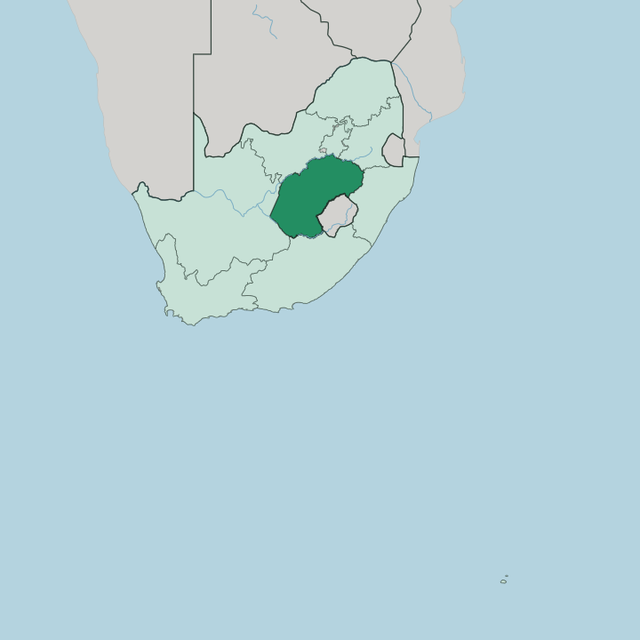
Towns & cities in Free State
Pick a town or city — each links to where to stay.
 South Africa
Bloemfontein
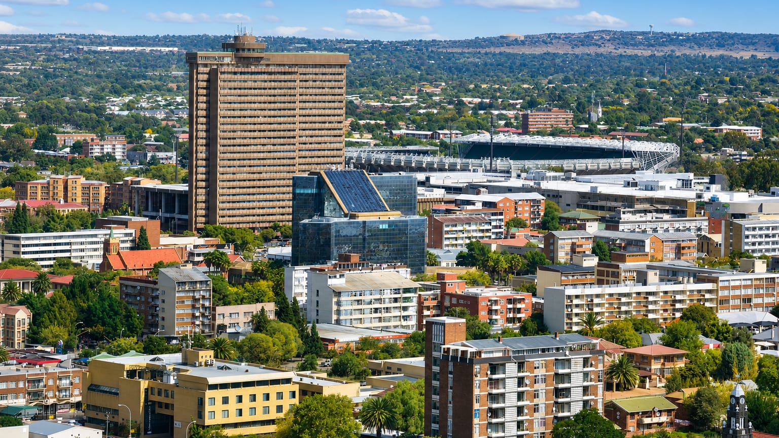
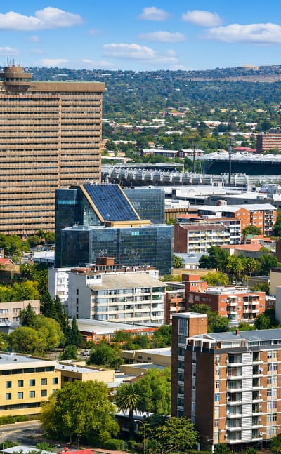
Bloemfontein is the capital of the Free State in South Africa, the rose-festival city known for the National Women's Monument and the Fourth Raadsaal.Where to stay →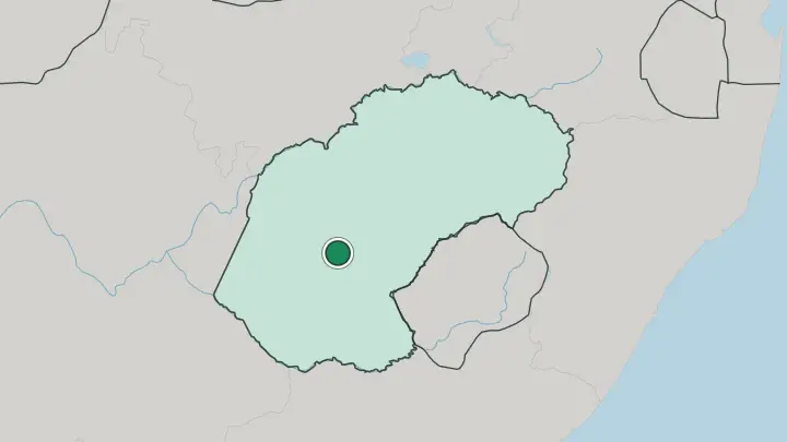
About Free State
This is the breadbasket.
What is Free State known for?
Free State grows a large share of South Africa's maize, with wheat and sorghum filling the rest of its rolling farmland on the Highveld plateau. Bloemfontein anchors it, the provincial capital and one of the country's three national capitals, where the highest appeal court sits. The eastern edge turns dramatic as the flat grain country climbs into the sandstone highlands and the foothills of the Maloti Mountains along the border with Lesotho.
Golden Gate Highlands National Park guards that corner. Grain in the west, cliffs and cherry orchards in the east.
Where is Free State?
Free State fills the centre of South Africa, a broad plateau of grassland on the Highveld. The Vaal River draws its northern edge, dividing it from Gauteng and the mining provinces beyond. Along the south-west the Orange River curls away toward the Northern Cape.
Flat, rolling farmland lies between those two rivers, and the whole plateau tilts gently downward as it runs toward the drier west. Grain fields cover most of it. The east is another country entirely.
There the plateau rises abruptly into sandstone hills and the foothills of the Maloti Mountains, which climb toward the border with the Kingdom of Lesotho. Lesotho sits in the hollow of the province's curved shape. This independent mountain state is almost surrounded by Free State along its northern and western sides, a small kingdom cupped inside a larger province.
Golden Gate Highlands National Park guards the wildest reach of that eastern rampart, where black wildebeest and eland graze beneath cliffs that burn gold at dusk. Grain in the west, mountains in the east.
What is Free State like?
Free State is the one province in South Africa where Sesotho speakers form the majority. Nearly three-quarters of the population give Sotho as their first language, the same tongue spoken across the border in Lesotho, and Afrikaans runs a strong second among the province's farming towns. This is Sotho country.
At the Basotho Cultural Village in the Golden Gate highlands, visitors meet the mural art the Basotho call litema, geometric patterns pressed and painted onto the walls of homesteads. Clarens has grown into the province's arts town, its old sandstone square lined with galleries, studios and restaurants that draw painters and weekenders from far off. Bloemfontein carries the other strand of the story.
The capital keeps its Boer War monuments, its art galleries and a museum given over to rugby, the game the province follows with a settled passion. Farm life sets the rhythm. Grain, cattle and cherry orchards mark the calendar as surely as any festival, and the harvest gatherings of the eastern towns pull the two farming worlds together.
What is the history of Free State?
The province began as a Boer republic. Voortrekkers of the Great Trek pushed north across the Orange River in the 1830s and 1840s, and in 1854 the Bloemfontein Convention recognised their independent Orange Free State between the Orange and the Vaal. That republic ran its own affairs for almost fifty years, until the Second Boer War ended its independence at the Treaty of Vereeniging in 1902 and folded it into British South Africa.
The word Orange was dropped in 1995, and the modern province took the shorter name it carries now.
What is the climate of Free State?
The Highveld sets the weather here. Summers are hot on the open plains, and the rain arrives late in the day as short, dramatic thunderstorms that break the heat over Bloemfontein and the grain country. Winters flip the pattern completely: dry, dusty and cold, with hard frost settling on the plateau most clear mornings between June and August.
Snow is rare on the plains. It falls more readily on the eastern sandstone highlands near Clarens, where the ground climbs toward the Maloti Mountains.
How do you get to Free State?
The road is how most visitors arrive in Free State. The N1 highway runs straight through the province between Johannesburg and Cape Town, passing Bloemfontein, and the capital's airport handles the domestic flights that link it to the coast. Bloemfontein is the natural gateway.
From there the eastern towns of Clarens, Ficksburg and the Golden Gate country lie a few hours' drive along the sandstone route toward the Maloti Mountains and the border with Lesotho. Rail lines cross the grain plains too, a legacy of the old republic.
Common questions
What is the best area to stay in Free State?
Bloemfontein: the capital, courts and museums.
Good for
Updated July 2026