South Africa
KwaZulu-Natal, South Africa — Towns & Travel Guide


KwaZulu-Natal is South Africa's subtropical east coast, running from Indian Ocean beaches up to the Drakensberg wall.
Find your area →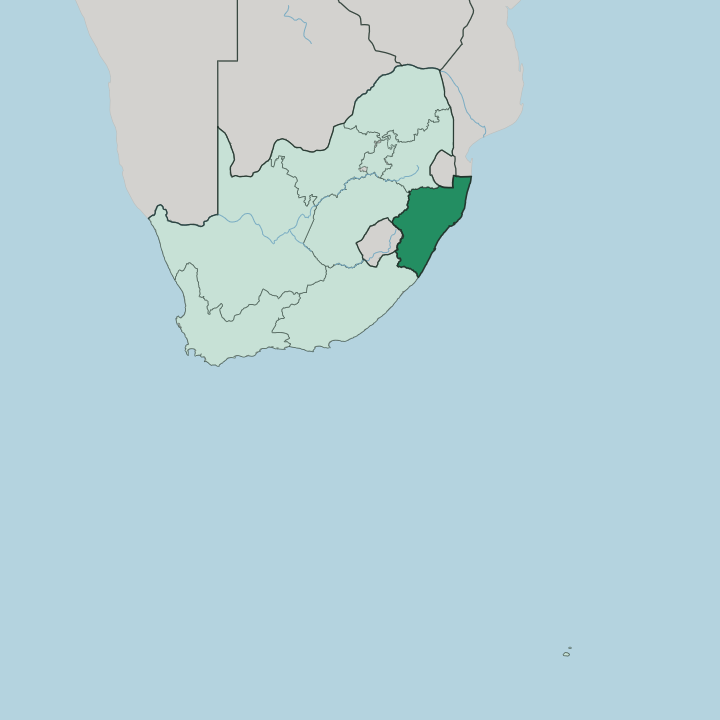
Towns & cities in KwaZulu-Natal
Pick a town or city — each links to where to stay.
 South Africa
Durban
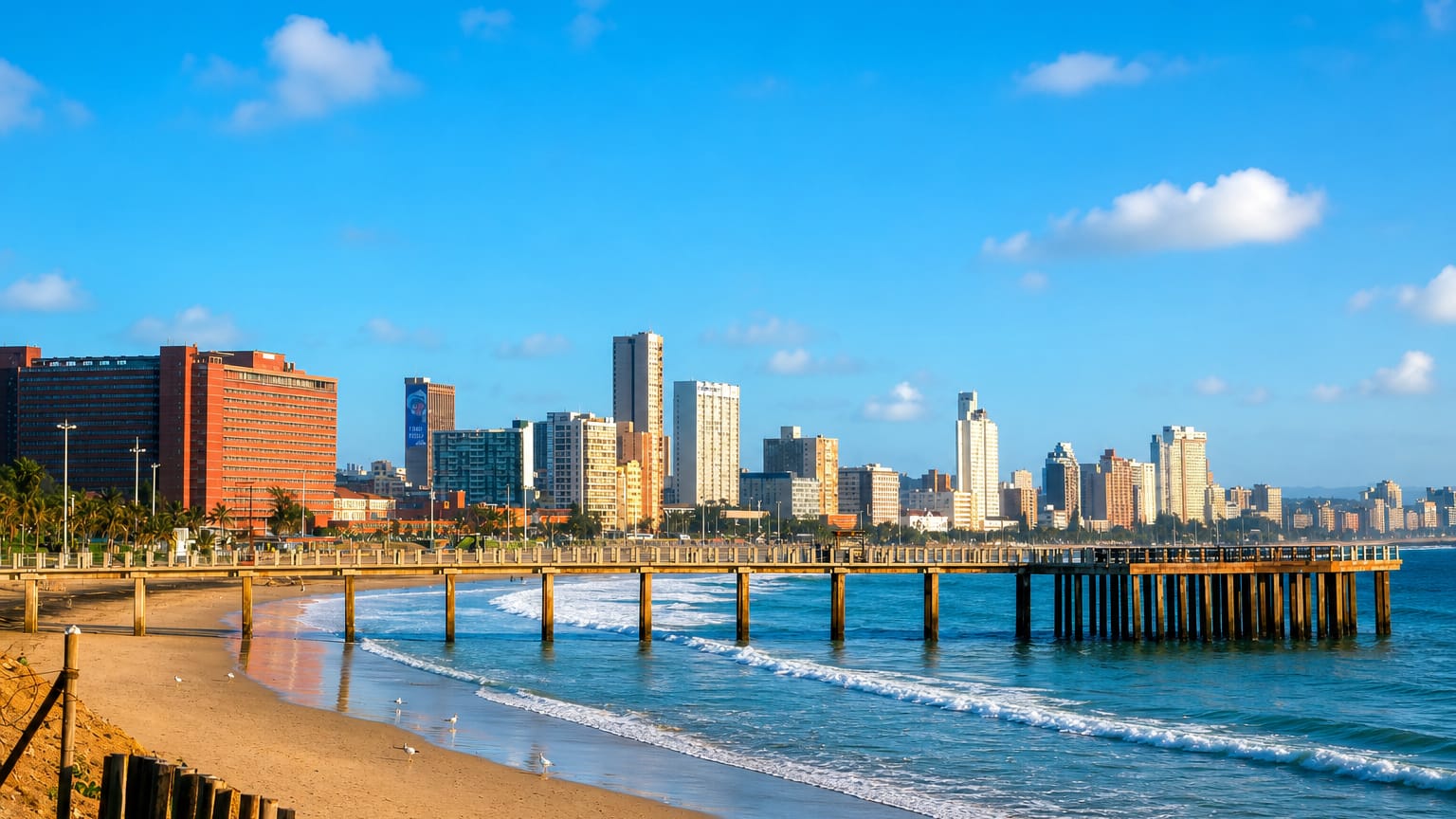
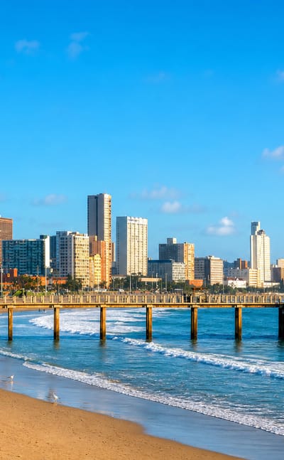
Warm surf breaks along the shore at Durban, a port city on the Natal Bay of the Indian Ocean in KwaZulu-Natal, known for uShaka Marine World and the Berea.Where to stay →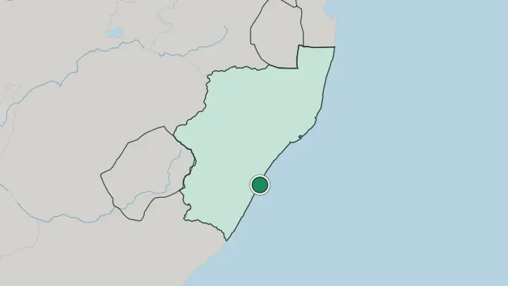
About KwaZulu-Natal
This is Zulu country.
What is KwaZulu-Natal known for?
The province takes half its name from the Zulu Kingdom that Shaka forged here in the 1810s, and isiZulu is still the mother tongue of most people who live along this stretch of coast. Durban anchors the shore, its harbour the largest and busiest in sub-Saharan Africa, backed by a warm-water beachfront the city calls the Golden Mile. Inland the land climbs to the basalt cliffs of the Drakensberg, and the battlefields of the 1879 Anglo-Zulu War lie scattered across the northern grasslands.
Two UNESCO sites bookend the province.
Where is KwaZulu-Natal?
KwaZulu-Natal fills the south-eastern corner of South Africa, its whole eastern edge a shoreline on the Indian Ocean that runs well over 500 kilometres from the Eastern Cape border up toward Mozambique. The province falls into three bands that follow the land as it rises from the sea. First comes the coast.
A warm subtropical lowland runs the length of the shore, holding Durban and its port midway along. Behind it the ground lifts into the rolling Natal Midlands, a plateau of green farmland and forestry around the capital at Pietermaritzburg. Then the land climbs hard to the west, where the Drakensberg throws up a basalt wall more than 3,000 metres high along the border with Lesotho.
The far north tells a different story. There the low Lebombo range runs in parallel ridges down from Eswatini, and the coast flattens into the lakes and dune forests of iSimangaliso around St Lucia. Rivers drain the whole province eastward off the high ground toward the sea.
The Thukela is the largest, gathering in the Drakensberg foothills and cutting some 560 kilometres east across the Midlands before it reaches the Indian Ocean. Mozambique closes the province off to the north, Eswatini and Lesotho press in from the interior, and the ocean holds the rest.
What is KwaZulu-Natal like?
The Zulu presence shapes the province more than any other single thing. isiZulu is the first language of most people here, and the province name joins kwaZulu, the place of the Zulu, to the old colonial Natal. The Zulu Kingdom that Shaka built in the 1810s still supplies the province its monarchy, its praise-poetry and the reed dances held at the royal residences in the north. That heritage is lived, not staged.
Durban layers a second culture over the first. The city holds one of the largest populations of Indian descent outside India, brought as indentured labour to the sugar plantations from the 1860s, and their kitchens gave South Africa its bunny chow, a hollowed loaf packed with curry. Mosques, Hindu temples and Zulu markets share the same streets.
The coast keeps an easy surf-town rhythm along the warm water, while the Midlands run to arts studios, trout farms and country hotels between Pietermaritzburg and the mountains. English threads through all of it as the shared working language. The mix here is genuinely its own.
What is the history of KwaZulu-Natal?
Shaka welded scattered clans into the Zulu Kingdom here in the 1810s, a power that held the coast between the Thukela and the grasslands of the north. Settlers pressed in behind him. The reckoning came in 1879, when a British army invaded Zululand and was destroyed at Isandlwana before the war turned and the kingdom finally fell.
Britain ruled the coast as the Colony of Natal, later a province of South Africa from 1910. Apartheid then split off a Zulu homeland called KwaZulu. The two were stitched back together as one province, KwaZulu-Natal, only in 1994.
What is the climate of KwaZulu-Natal?
The coast is warm and humid. Durban and the shore sit in a subtropical band where the Indian Ocean keeps winters mild and summers hot and wet, with most rain arriving in the summer months as afternoon storms. The weather cools steadily as the land rises inland toward the Midlands.
Up on the Drakensberg the pattern flips hard, and the high basalt peaks along the Lesotho border take heavy snow in winter and can catch a dusting even in summer. Sea and mountain make two climates in one province.
How do you get to KwaZulu-Natal?
Most fly in. King Shaka International serves Durban from the coast just north of the city, and it is the arrival point for nearly every trip into the province. Overland, the N3 freeway climbs inland from Durban's port up to Johannesburg, carrying most of the freight that moves through the harbour.
The province meets Mozambique in the far north, so some visitors cross by road from the Elephant Coast. Coastal roads then thread the shore, while mountain passes work up into the Drakensberg from the Midlands.
Common questions
What is the best area to stay in KwaZulu-Natal?
Durban: a beach-and-city base on the KwaZulu-Natal coast.
Good for
Updated July 2026