South Africa
Limpopo, South Africa — Towns & Travel Guide


Limpopo is the northernmost province of South Africa, bushveld country named for the river along its border with Zimbabwe.
About Limpopo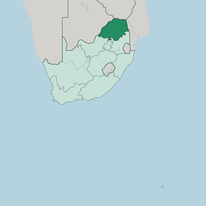
Towns & cities in Limpopo
Pick a town or city — each links to where to stay.
The choice is town or bush. Polokwane, the capital, sits on the N1 in the province's centre and makes the natural arrival point and supply stop. For wildlife, the Waterberg holds malaria-free game reserves within a few hours of Gauteng, while lodges along the Kruger National Park's northern gate at Phalaborwa put you at the edge of big-game country.
Tzaneen anchors the wetter, forested slopes below the Magoebaskloof escarpment in the east. Choose Polokwane if you want a city and a road hub; choose the Waterberg or the Kruger fringe when the animals are the point.
About Limpopo
Limpopo is safari country.
What is Limpopo known for?
The northern reach of the Kruger National Park runs down its eastern flank, and private game reserves fill the Waterberg to the south-west. Bushveld savanna covers most of the province, broken by the Soutpansberg range across the north. Its western and northern edge follows the Limpopo River, which also carries the province's name.
At the river's far north-western corner sits Mapungubwe, the stone hilltop capital of southern Africa's first indigenous kingdom.
Where is Limpopo?
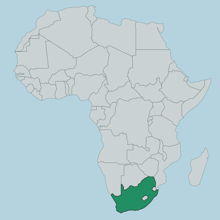
Limpopo is the last province before South Africa runs out of country. It occupies the far north, wrapped along two borders by the river it is named for. The Limpopo River forms the western and northern edge, and across that water lie Botswana to the north-west, Zimbabwe due north, and Mozambique off to the east.
Inside those borders the land is mostly bushveld, a dry savanna of thorn trees and open grass that shades into hotter lowveld toward the Kruger National Park in the east. Relief breaks the plain. The Soutpansberg runs in an east-west wall across the north, named for the salt pans in its western foothills, and the Waterberg rises to the south-west as a worn massif of the Bushveld Igneous Complex.
Polokwane sits near the centre on the high plateau, astride the N1 that threads the province from south to north. Neighbouring Gauteng, Mpumalanga and North West provinces close off the southern side. Where the Limpopo meets the Shashe at the province's north-western tip stands Mapungubwe, a sandstone hill above the confluence.
That corner is the driest, hottest ground in the province.
What is Limpopo like?
Limpopo is one of South Africa's most rural and most multilingual provinces, and three African languages divide it geographically. Northern Sotho, also called Sepedi, is spoken by more than half the province and dominates the plateau around Polokwane. Tshivenda belongs to the Venda people of the far north, in the country tucked against the Soutpansberg, and Xitsonga is the tongue of the Tsonga toward the eastern lowveld.
Each carries its own music, its own crafts, its own foods. Daily life leans agricultural. This is the country's fruit basket.
Orchards of mango and avocado, of banana, macadamia and citrus, blanket the warmer eastern districts around Tzaneen, and cattle graze the drier bushveld further west. The deep past is present too. Mapungubwe, in the north-west, was a gold-trading kingdom that dealt with Arabia, China and India through the ports of the Indian Ocean seven centuries ago, and its golden rhinoceros is among South Africa's best-known archaeological finds.
Craft markets, roadside fruit stalls and sacred sites like Lake Fundudzi in the Venda hills sit alongside the game lodges that most visitors come for.
What is the history of Limpopo?
The oldest chapter is written in stone. Above the meeting of the Limpopo and Shashe rivers, the hilltop kingdom of Mapungubwe traded gold and ivory with the Indian Ocean world between roughly 900 and 1300, then faded as power shifted north to Great Zimbabwe. Centuries later this ground became the northern reach of the Transvaal, and its homelands of Lebowa, Gazankulu and Venda were carved out under apartheid.
The modern province was drawn in 1994 from that northern Transvaal, first as Northern Province and then renamed Limpopo. Its legislature sits at Lebowakgomo, the capital at Polokwane.
What is the climate of Limpopo?
Heat and dryness define the Limpopo climate. It has a subtropical bushveld climate with rain falling in the summer half of the year, from about October to March, as afternoon thunderstorms build over the plateau. Winters are dry, sunny and mild by day but cold at night on the high ground around Polokwane.
The eastern lowveld toward the Kruger National Park is hotter and more humid still, and the far north-western corner along the Limpopo River bakes in the heat. Come in the dry winter for game viewing, when thin bush and shrinking waterholes pull the animals into the open.
How do you get to Limpopo?
Most visitors drive up from Gauteng. The N1, South Africa's main north-south route, climbs out of Pretoria and runs the length of the province through Bela-Bela and Polokwane toward the Zimbabwe border at Musina. It is a long haul.
Polokwane has its own airport just north of the city on that same road, with flights down to Johannesburg. Many safari-goers instead fly into a lowveld strip near the Kruger National Park and skip the drive entirely.
Good for
Updated July 2026