Algeria
Wilaya de Sidi Bel Abbès, Algeria — Towns & Travel Guide


Sidi Bel Abbès is an inland wilaya of northwestern Algeria, its grid-planned capital set on the Oued Mekerra amid wheat plains and dry steppe.
About Wilaya de Sidi Bel Abbès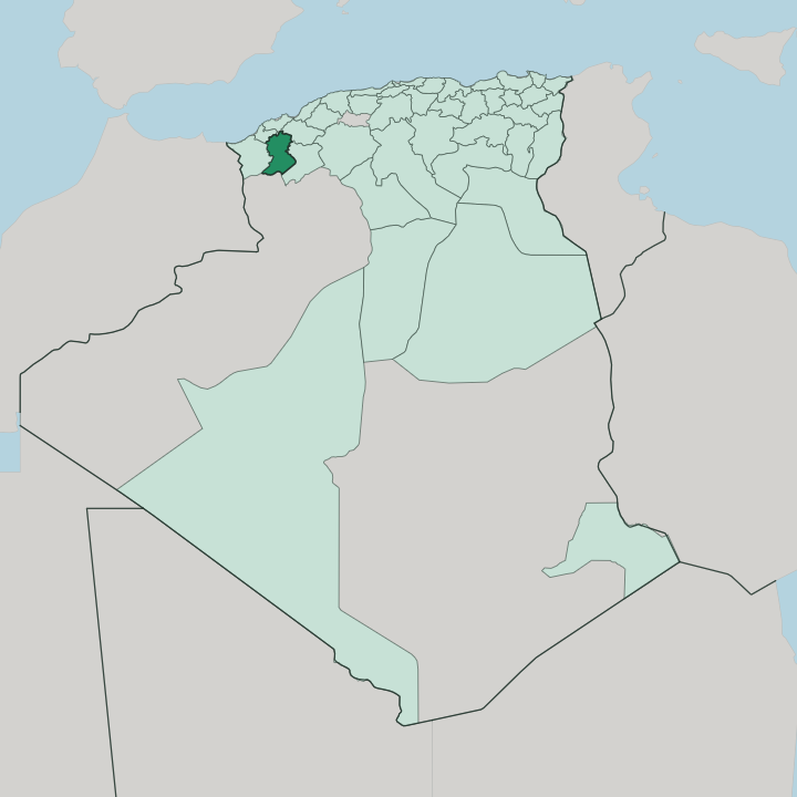


Towns & cities in Wilaya de Sidi Bel Abbès
Pick a town or city — each links to where to stay.
Beds concentrate in the capital. Sidi Bel Abbès holds nearly every hotel in the wilaya, ranged along the wide colonial boulevards of its gridded centre within a short walk of the Oued Mekerra. Elsewhere the province is farm country and steppe, thin on rooms.
Télagh, the main town of the dry south, makes a rough staging post toward the High Plateaus. Most travellers who want comfort keep to the capital and drive out to the vineyards, the wheat plains and the wooded lake at Sidi Mohamed Benali by day.
About Wilaya de Sidi Bel Abbès
Two things fix Sidi Bel Abbès.
What is Wilaya de Sidi Bel Abbès known for?
The first is the French Foreign Legion, which kept its home depot and 1st Foreign Regiment here until Algerian independence in 1962, when the corps decamped to Aubagne. The second is the town plan itself, a strict colonial grid of wide boulevards and arcaded squares that earned the nickname Little Paris. Around it spread the wheat and the vines.
The Oued Mekerra threads the plain, and Oran and its coast lie a short way north.
Where is Wilaya de Sidi Bel Abbès?
Sidi Bel Abbès sits inland in northwestern Algeria, on the high plains behind the coast. The Mediterranean lies about 75 kilometres to the north, screened off by ridges. Its capital stands near the middle of the wilaya, roughly 470 metres up, in a broad plain that the Oued Mekerra crosses from south to north.
The Monts du Tessala wall the plain to the north, a limb of the Tell Atlas that separates the province from Oran and the sea beyond. To the south the ground climbs and dries into steppe, tilting toward the High Plateaus. Tlemcen lies west, Oran north, and the port there is the region's outlet.
Three landscapes share the wilaya. Steppe covers roughly two-fifths of it, grassy and bare, spreading south across the high rangeland. Plains and cultivated valley floors take the centre, where the Mekerra and its canals water wheat, barley and vineyards.
The hills take the rest. The Mekerra runs shallow and fitful for most of the year, then floods hard after winter storms, and the town has drowned more than once when the oued burst its banks. Just northwest of the city a canal bleeds off some of that floodwater into the wooded reservoir of Lac Sidi Mohamed Benali.
Télagh anchors the far south, out where the fields give way to open range.
What is Wilaya de Sidi Bel Abbès like?
The French left their mark on the stone. When the army pulled down the old ramparts, wide boulevards and arcaded frontages went up in their place, and the grid earned Sidi Bel Abbès the tag Little Paris. For more than a century the French Foreign Legion made the town its home, drilling recruits and burying its dead here, until 1962 took the corps, its monuments and its museum away to Aubagne in Provence.
What stayed was the architecture and the street plan. The centre still reads as a settler town, right down to the boulevards that face the Oued Mekerra. Underneath the colonial shell, the town is Algerian and agricultural.
It trades in wheat, wine and market produce, and its weeks turn on the university named for Djillali Liabès and on the business of the surrounding farms. Music runs strong. Sidi Bel Abbès sits in the Oranie, the western country that gave Algeria raï, with Oran the genre's capital just up the road.
Arabic is the everyday language, in the broad western dialect of the Oran plains, though French still surfaces in the older streets and the paperwork. Life is unhurried and provincial, closer to the fields than to the capital.
What is the history of Wilaya de Sidi Bel Abbès?
The name honours Sidi Bel Abbès, a Muslim holy man whose tomb stood by the Oued Mekerra long before any town. The French raised a fortified camp on the spot in 1843 and laid out a planned farming colony around it in 1849. Under their rule it grew into a garrison and grain market.
The modern wilaya is younger. It was carved from the old Oran department in 1974, and a decade later, in 1984, its western communes were split off to form Aïn Témouchent.
What is the climate of Wilaya de Sidi Bel Abbès?
A cold, semi-arid climate rules this corner of Algeria. Summers are long, hot and cloudless, baking the wheat plains a pale gold. Winters turn cool and damp.
Most of the year's rain falls between autumn and early spring, and it is these winter storms that swell the Oued Mekerra and, at times, flood the streets of Sidi Bel Abbès. The plain sits well back from the sea, so it swings hot by day and sharply cold at night, and frost is not unusual in the small hours of winter.
How do you get to Wilaya de Sidi Bel Abbès?
Most travellers reach Sidi Bel Abbès through Oran. The nearest large airport is Oran's Ahmed Ben Bella International, about 70 kilometres north, and from there a road and a rail line run down to the city across the Tessala hills. The East-West Highway, the motorway spanning northern Algeria, passes close to the province and carries most of the long-distance traffic.
Trains still call at the old station. Within the town a modern tramway threads the centre, but for the plains and the southern steppe around Télagh a car is the honest answer.
Updated July 2026